Lünersee
| Lünersee | ||
|---|---|---|

|
||
| Geographical location | Vorarlberg / Bludenz district / Vandans municipality | |
| Drain | Alvier (before construction of the dam) | |
| Location close to the shore | Bludenz | |
| Data | ||
| Coordinates | 47 ° 3 '9 " N , 9 ° 45' 11" E | |
|
|
||
| Altitude above sea level | 1970 m above sea level A. | |
| surface | approx. 112 ha | |
| volume | approx. 0.156 km³ | |
| Maximum depth | approx. 139 m | |
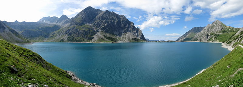
The Lünersee is one of the largest lakes in the Austrian state of Vorarlberg in the municipality of Vandans .
Its water level is at a height of 1970 m above sea level when it is fully flooded . A. at the foot of the Schesaplana . After the state of Vorarlberg began sealing work on the lake bed as early as 1920, Vorarlberger Illwerke AG increased the storage volume of the lake in 1959 with a dam.
The water is used by illwerke vkw AG to generate electricity in the Lünerseewerk . Since the natural tributaries need more than five years to fill the usable volume of the lake, the Lünerseewerk was built as a pumped storage power plant. The lake is also fed by the meltwater from the Brandner Glacier through an artificially created tunnel . The processed water from the Lünersee is temporarily stored in the Latschau reservoir and from there forwarded to the Rodund I and II power plants or pumped back into it.
The Rellswerk , another pumped storage power plant, has been in operation since 2017 . This is connected to the Lünersee – Lünerseewerk pressurized water system and increases the inflow to the Lünersee by around 17 million m³ / a
The useful volume of the Lünersee is 78.3 million m³ (water surface with full damming 1.55 km²). This corresponds to around 262 million kWh of stored energy. The usable volume of the lake would last for almost 33 days with the Lünerseewerk working at full capacity in turbine operation (flow rate 27.5 m³ / s). The plant's pumps would be able to replenish the usable volume, which the natural inflow takes over five years, in a good 40 days.
The water depth is 139 meters when the water is fully blocked.
The area around the lake forms the end of the Brandnertal valley , which can only be reached via narrow trails or the Lünerseebahn from the Schattenlagant area . Therefore, the area around the Lünersee (also the Totalp), although geographically it belongs to the Brandnertal, is in the municipality of Vandans. The alpine areas on the lake have always been pushed from the Rellstal, as the partly rocky slopes from the Brandnertal to the Lünersee are practically impassable for large cattle.
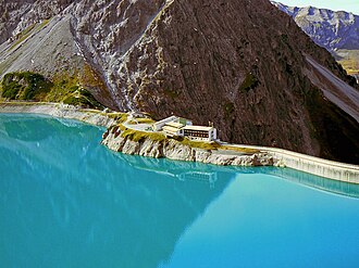
The Douglasshütte is located directly at the mountain station on the dam, which , among other things, serves as a snack and overnight accommodation option for hikers. It is a replacement building, completed in 1960, for a previous building from 1870, whose place on the peninsula at 1969 m above sea level was flooded when the first full damming occurred.
|
Power plant group Obere Ill-Lünersee |
|||||||||||||||||||||||||||||||||||||||||||||||||||||||||||||||||||||||||||||||||||||||||||||||||||||||||||||||||||||||||||||||||||||||||||||||||||||||||||||||||||||||||||||||||||||||
|---|---|---|---|---|---|---|---|---|---|---|---|---|---|---|---|---|---|---|---|---|---|---|---|---|---|---|---|---|---|---|---|---|---|---|---|---|---|---|---|---|---|---|---|---|---|---|---|---|---|---|---|---|---|---|---|---|---|---|---|---|---|---|---|---|---|---|---|---|---|---|---|---|---|---|---|---|---|---|---|---|---|---|---|---|---|---|---|---|---|---|---|---|---|---|---|---|---|---|---|---|---|---|---|---|---|---|---|---|---|---|---|---|---|---|---|---|---|---|---|---|---|---|---|---|---|---|---|---|---|---|---|---|---|---|---|---|---|---|---|---|---|---|---|---|---|---|---|---|---|---|---|---|---|---|---|---|---|---|---|---|---|---|---|---|---|---|---|---|---|---|---|---|---|---|---|---|---|---|---|---|---|---|---|
|
|||||||||||||||||||||||||||||||||||||||||||||||||||||||||||||||||||||||||||||||||||||||||||||||||||||||||||||||||||||||||||||||||||||||||||||||||||||||||||||||||||||||||||||||||||||||
In 2013 the technical facilities of the dam on the Lünersee and the connecting lines to the Lünersee works were renovated.
Technical data for power plant operation
- Usable volume of the Lünersee reservoir: 78.3 million m³
- Energy content of the Lünersee reservoir: 262.16 million kWh
- Congestion destination 1970.47 m above sea level A. (L 1006)
- Operational focus 1947.47 m above sea level A.
- Storage center 1939.30 m above sea level A.
- Lowering target 1897.47 m above sea level A.
- inflow
- natural inflow on average: 15.1 million m 3 / year
- Inflow from upstream of the Rodund works: 63.2 million m 3 / year
- first full stowage 1959
literature
- Manfred Hunziker: Ringelspitz / Arosa / Rätikon , Alpine Touren / Bündner Alpen , Verlag des SAC 2010, ISBN 978-3-85902-313-0 , p. 522
Trivia
The Lünersee was chosen as the most beautiful place in Austria in the ORF program “ 9 Places - 9 Treasures ” in October 2019.
Web links
Individual evidence
- ↑ Explanatory board from Vorarlberger Illwerke AG at the mountain station of the Lünerseebahn, 2018
- ^ Rellswerk. Retrieved May 30, 2018 (Austrian German).
- ↑ Illwerke Magazin, Issue 27, October 2013, p. 10
- ↑ "Schauraum" - exhibition and information rooms at the machine hall of the Lünerseewerk in Tschagguns - Latschau
- ^ Austrian map 1:25 000, sheet NL 32-02-30 West Bludenz, edition 2016, publisher: Federal Office for Metrology and Surveying, Vienna
- ↑ cited from http://cdn2.vol.at/2010/02/Rellswerk_UVP.pdf ENVIRONMENTAL COMPATIBILITY TEST Rellswerk Vorarlberger Illwerke AG, p. 15
- ↑ According to ENVIRONMENTAL COMPATIBILITY TEST Rellswerk Vorarlberger Illwerke AG , p. 72


