Lake Laberge
| Lake Laberge (Tàa'an Mann) | ||
|---|---|---|

|
||
| Lake Laberge | ||
| Geographical location | Yukon (Canada) | |
| Tributaries | Yukon River | |
| Drain | Yukon River | |
| Location close to the shore | Whitehorse | |
| Data | ||
| Coordinates | 61 ° 10 ′ N , 135 ° 10 ′ W | |
|
|
||
| Altitude above sea level | 627 m | |
| length | 50 km | |
| Maximum depth | 140 m | |
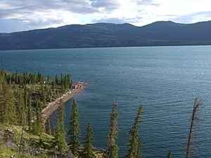
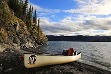
The Lake Laberge , in the local Indian language Tàa'an Mens , is a lake in the Territory Yukon in Canada . It is more of a widening of the Yukon River. The lake is around 50 km long.
The lake formed the core of the traditional area of the Ta'an Kwach'an First Nation, an Indian group belonging to the Southern Tutchone .
Ecological peculiarities
In the lake there is a species of burbot (burbot) that is disdained by most Canadian anglers, but not by the Scandinavians and Indians. Their liver in particular is considered a delicacy, in spite of the increased toxin concentrations. Parks Canada even warned against consuming them because the concentration of toxaphene was highest in the fish of Lake Laberge. The increased accumulation of this species seems to be related to the fact that they are the only group of their kind to dig large holes in the lake bed in which these substances, which have been banned for years, have accumulated.
Dall sheep , wolves , grizzly bears , foxes and coyotes live in the vicinity of the lake , the latter only arriving in the region around 1900.
history
Early history
Lake Laberge forms the core of the traditional residential area of the Ta'an Kwach'an First Nation, from which it derives its name. There were also villages on the Takhini River and at the southern end of Fox Lake (since at least 1000 AD), which is west of Laberge Lake. The tribe's territory ranged from Hootalinqua , the confluence of the Yukon and Teslin Rivers , to the M'Clintock Valley and Marsh Lake .
The area was opened up by numerous paths. Along Laurier Creek and Thomas Creek one reached the caribou hunting areas in the Big Salmon Mountains as well as fishing spots at Mason's Landing and Boswell Creek at the Teslin River. This one crossed at Winter Crossing and thus reached the Livingstone Creek Trail, which extends northeast to the Ross River . To the west a path leads to Fox Lake , from there on to Braeburn and Carmacks . From Shallow Bay a path leads to the Takhini River and Takhini Hot Springs , and northwards one goes to 52 Mile Lake , where an important camp was located. Sheep and gophers , small rodents, were hunted in the southern Golden Horn Mountain (Simà) . A path leads north to the Thirty Mile River , where beavers were also hunted, from there to Hootalinqua. From upper Laberge south to the Yukon River, a path leads to Swan Lake, as well as salmon grounds and a village on Marsh Lake.
The trade took place in red agate from Miller's Ridge west of Carmacks and goes back more than a millennium. With the Champagne and Aishihik there was a trade in obsidian , volcanic glass from the St. Elias Mountains .
At Lake Laberge there were villages on Deep Creek and Jackfish Bay, the former trading in rare tuff as far as the Mackenzie area in the Northwest Territories . One of the main fishing spots for whitefish was on Horse Creek, where people gathered in October and November. Here one met with the Chilkat from the coast, who once a year climbed the Chilkat Pass and drove down the Kusawa Lake to exchange goods. Estimates of the age of these places range up to 4000 years. The path can be found on a map drawn by Klukwan chief Koh-Klux in 1852. Young men were deployed at Naalen or Lookout Mountain and signaled the arrival of the Chilkat dealers, whose copper was particularly popular, by means of light signals.
The closest relationships were with the Tagish Kwän, but there were also relationships with other groups in the area. They can even be traced back to a Tagish and a Hutshi ancestor, or to the Taku in Alaska.
Most of the villages were at the confluence of the Little River and Takhini River, below the Whitehorse Rapids , then around Hootalinqua and at the mouth of the M'Clintock River . The village on Takhini was the most important salmon fishing ground and at the same time the main trading place with the Tlingit from the coast, at Shallow Bay, white fish were mainly caught .
The oldest find is likely to come from the Ibex River , because it is 5000 to 8000 years old. The Laberge Lake and its tributaries were abundant in fish, such as salmon and burbot, but also small game and caribou , and moose were occasionally hunted.
Gold rush, reservation, Chief Jim Boss
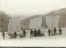
In 1882 the German explorer Aurel Krause registered that the Tlingit people called the lake "Tahini-wud". In 1883 Frederick Schwatka noted the name "Kluk-tas-si". William Dall, leader of the Western Union Telegraph Expedition , named the lake after Michael Laberge from Chateauguay in Québec . He had roamed the area for the Western Union on the way from Fort Yukon to Fort Selkirk in 1867 - looking for a route for Collins Overland Telegraph from New York through Russia to Paris .
The Yukon played an important role in transporting the prospectors and their equipment to Dawson during the Klondike Gold Rush . In the beginning, Mundessa was the chief of the Indians there. His son was Kashxóot from the Wolf Clan, better known as Chief Jim Boss . He was married three times and had 7 children. Many of today's Indians at Lake Laberge are traced back to Mundessa and his descendants.
The Ta'an Kwäch'än were the first to receive a tiny reservation there after Jim Boss sent a petition to the Canadian government in 1900 . The place was first known as "Russian Town". Boss hired a Whitehorse lawyer named TW Jackson to enforce his legal claims. Chief Jim Boss, together with his brother-in-law Henry Broeren, built a roadhouse for shipping on Lake Laberge at Horse Creek . Soon the place was called "Jim Boss Town" or "Upper Laberge". He was also involved in the supply of wood and fish to Whitehorse. Some Indians also took part in the gold prospecting.
After the gold rush ended, most whites left the area. A few collapsed huts and a few graves testify to the presence of the gold diggers. Some of them were only forced to give up their huts after the Takhini Fire , a devastating forest fire in 1958. Upper Laberge, Lower Laberge and 31 Mile were built in traditional Ta'an Kwäch'än area and set up as villages. Upper Laberge stands today at camp at Joe Creek on the east side of the lake. Maggie Boss and her husband Henry Broeren lived here. He was one of the first - together with Amy Laberge, the daughter of Laberge Billy and Jenny Laberge, and her husband William Cletheroe - to dig for minerals at Livingstone Creek . In 31 Mile, Angus and Kitty McLeod, as well as other Ta'an, ran a fox and mink breed in the 1920s . Finally, there was an important commercial salmon fishing site near Whitehorse before it was destroyed by dams, especially on Marsh Lake.
Alaska Highway, abandoned villages, self-employment
In 1942 the construction of the Alaska Highway began , which was considered important for the Pacific War . The army practiced in two places in the Yukon, namely at Watson Lake and Lake Laberge. Countless projectiles and bombs are still lying at the bottom of the lakes, which in 1978 meant that an investigation was carried out for the first time. A 500-pound bomb was found in Watson Lake and had to be blown up. The Deep Creek region was hardest hit at Lake Laberge. The same goes for Richtofen Island , the southern end of which had been heavily bombarded and where at least one bomb was found in the late 1990s.
The way of life of the Indians changed drastically from the 1940s onwards. Many moved from Lake Laberge to the construction sites on the Alaska Highway, or looked for work in the vicinity. Many also moved to Whitehorse.
In 1956 the Canadian government forced the amalgamation of several Indian tribes to form the Whitehorse Indian Band , now the Kwanlin Dun First Nation , in and around Whitehorse. It was not until 1987 that the Ta'an Kwäch'än broke away from this association. In 2002 they signed a contract with the government that gave them a self-governed reservation around Lake Laberge.
In 1995 the Lake Laberge Archeology Project began , a joint excavation project of the Ta'an Kwäch'än First Nation Council and the Yukon Heritage Branch , a cooperation between the local First Nation and archaeologists .
In 2009 a sunk steamer in the lake is also to be examined.
literature
- Dirk J. Templeman-Kluit: Laberge and Carmacks, Yukon Territory , Geological Survey of Canada, 1984
Web links
Remarks
- ↑ environmentyukon.ca ( Memento of the original from October 16, 2013 in the Internet Archive ) Info: The archive link was inserted automatically and has not yet been checked. Please check the original and archive link according to the instructions and then remove this notice.
- ↑ Sarah Locke: Burrowing burbots of Lake Laberge , May 5, 2000 ( Memento of the original from April 11, 2009 in the Internet Archive ) Info: The archive link was inserted automatically and has not yet been checked. Please check the original and archive link according to the instructions and then remove this notice.
- ↑ Lake Laberge, Yukon Nuggets
- ^ D. Davidge: A Report on a Preliminary Underwater Survey of Lake Laberge in the Vicinity of Deep Creek, Yukon , 2000
- ↑ [1] ( Page no longer available , search in web archives ) Info: The link was automatically marked as defective. Please check the link according to the instructions and then remove this notice. > (PDF)
- ↑ Yukon Gold Rush Steamer Survey - Canada ( Memento of the original from April 11, 2009 in the Internet Archive ) Info: The archive link was automatically inserted and not yet checked. Please check the original and archive link according to the instructions and then remove this notice.


