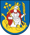
Lamač
| Lamač | |
|---|---|
| coat of arms | map |

|

|
| Basic data | |
| State : | Slovakia |
| Kraj : | Bratislavský kraj |
| Okres : | Bratislava IV |
| Region : | Bratislava |
| Area : | 6.54 km² |
| Residents : | 7,313 (Dec. 31, 2019) |
| Population density : | 1,118 inhabitants per km² |
| Height : | 220 m nm |
| Postal code : | 841 03 |
| Telephone code : | + 421-2 |
| Geographic location : | 48 ° 11 ' N , 17 ° 3' E |
| License plate : | BA, BL, BT |
| Kód obce : | 529419 |
| structure | |
| Community type : | district |
| Administration (as of November 2018) | |
| Mayor : | Lukáš Baňacký |
| Address: | Miestny úrad Bratislava-Lamač Heyrovského 2 84103 Bratislava |
| Website: | www.lamac.sk |
| Statistics information on statistics.sk | |
Lamač (German Blumenau or Lamatsch , Hungarian Lamacs - older also Lamács ) is a district in the north of the Slovak city of Bratislava at the foot of the Little Carpathians .
Description and history
In the area of the current part of the city there are 4 localities, the oldest was mentioned in a document in 1240, two places with the names Plumnou (Blumenau) and Sellendorf were mentioned in documents in 1279 and 1288 respectively. North of the aforementioned Blumenau, the place Lamač was created in the 16th century by the immigration of Croats to this area (first mentioned in a document as Krabatendorff ).
On July 22nd, 1866, on the last day of the German War, the battle near Blumenau took place in the immediate vicinity of the town , in which the town was severely destroyed.
The municipality was independent until 1946, but on April 1, 1946 it became part of the city of Bratislava as a district.
District structure
The district is divided into the following further (unofficial) quarters:
- Podháj (Hay, Raagers Hauffen)
- Rázsochy

