
Vajnory
| Vajnory | |
|---|---|
| coat of arms | map |

|

|
| Basic data | |
| State : | Slovakia |
| Kraj : | Bratislavský kraj |
| Okres : | Bratislava III |
| Region : | Bratislava |
| Area : | 13.53 km² |
| Residents : | 5,957 (Dec 31, 2019) |
| Population density : | 440 inhabitants per km² |
| Height : | 130 m nm |
| Postal code : | 831 07 |
| Telephone code : | + 421-2 |
| Geographic location : | 48 ° 12 ' N , 17 ° 12' E |
| License plate : | BA, BL, BT |
| Kód obce : | 529362 |
| structure | |
| Community type : | district |
| Administration (as of November 2018) | |
| Mayor : | Michal Vlček |
| Address: | Miestny úrad Bratislava-Vajnory Roľnícka 109 83107 Bratislava |
| Website: | www.vajnory.sk |
| Statistics information on statistics.sk | |
Vajnory (German Weinern , Hungarian Pozsonyszőllős (until 1907 Szőllős )) is a district in northeast Bratislava , at the foot of the Little Carpathians .
Description and history
The Slovak name is derived from the German name. Under the Slavic name Prača or Pračany , which is also reflected in its earlier Hungarian name Prácsa , the place was mentioned for the first time in 1237. Like the neighboring Rača , it was a wine-growing community for centuries. This was independent from 1851 until it finally became a district of Bratislava in 1946.
Until 2007 an airfield was operated in the area of Vajnorys .
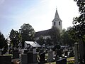
Church and cemetery in Vajnory

one of the two primary schools with a kindergarten in the street of freedom


Sons and daughters
- Titus Zeman (1915–1969), Roman Catholic clergyman and martyr
Web links
Commons : Vajnory - collection of pictures, videos and audio files
- vajnory.sk (Slovak)

Districts of Bratislava