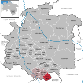
Landwehr (Freden (Leine))
|
Landwehr
Municipality of Freden (Leine)
|
||
|---|---|---|
| Coordinates: 51 ° 54 ′ 59 ″ N , 9 ° 57 ′ 40 ″ E | ||
| Height : | 208 m above sea level NHN | |
| Area : | 12.97 km² | |
| Residents : | 544 (December 31, 2017) | |
| Population density : | 42 inhabitants / km² | |
| Incorporation : | November 1, 2016 | |
| Postal code : | 31084 | |
| Area code : | 05184 | |
|
Location of Landwehr in Lower Saxony |
||
|
Landwehr in the Hildesheim district
|
||
Landwehr is a district of the municipality of Freden (Leine) in the district of Hildesheim in Lower Saxony .
geography
Geographical location
The Landwehr locations are the southernmost point of the Hildesheim district, north of Bad Gandersheim between the Sackwald and Helleberg mountains .
Local division
The district of Landwehr is made up of:
history
The villages were created as outposts of the Winzenburg . The villages blocked the historic roads from Gandersheim in Braunschweig to Winzenburg (Eyershausen) and Freden (Wetteborn), as well as the valley in which the "new" country road to Winzenburg and Freden (Ohlenrode) was built at the end of the 19th century. The oldest structures are today's church towers, which were defensive towers when they were built, which can be seen above all in what is probably the oldest, the Wetteborn church tower.
On March 1, 1974, the communities of Eyershausen, Ohlenrode and Wetteborn were merged to form the new community of Landwehr. This in turn was incorporated into Freden (Leine) on November 1, 2016, the integrated community of Freden (Leine) was dissolved.
politics
Local council
The Landwehr local council consists of three councilors and two councilors from the following parties:
(Status: local election September 11, 2016)
Local mayor
The local mayor of Landwehr is Ines Hoffmann (SPD). Your deputy is Kevin Wetteborn (SPD).
coat of arms
| Blazon : "A silver palisade fence in red , above three silver watchtowers with gable roofs ." | |
| Founding of the coat of arms: In 1974 the municipality of Landwehr emerged from a merger of the places Eyershausen, Ohlenrode and Wetteborn. Since all three communities had a special mark in their coat of arms - the palisade - this was taken over into the new coat of arms of the Landwehr community. Instead of the previous medieval weapons, three watchtowers with gable roofs were used to represent the three places. |
traffic
Landwehr is connected to the road network via Bundesstraße 64 , which runs south through Bad Gandersheim.
Web links
Individual evidence
- ^ Area information and population of Landwehr. In: www.meinestadt.de. Retrieved June 28, 2017 .
- ^ Official population of Landwehr. In: Website of the municipality of Freden (Leine). December 31, 2017, accessed March 9, 2019 .
- ^ Federal Statistical Office (ed.): Historical municipality directory for the Federal Republic of Germany. Name, border and key number changes in municipalities, counties and administrative districts from May 27, 1970 to December 31, 1982 . W. Kohlhammer, Stuttgart / Mainz 1983, ISBN 3-17-003263-1 , p. 205 .
- ↑ Lower Saxony State Chancellery (ed.): Law on the new formation of the community Freden (Leine), district Hildesheim . Lower Saxony Law and Ordinance Gazette (Nds. GVBl.). No. 22/2015 . Hanover December 15, 2015, p. 401 ( digitized version ( memento of May 13, 2019 in the Internet Archive ) [PDF; 278 kB ; accessed on July 1, 2019] p. 19).
- ↑ a b The local council of Landwehr. In: Website of the municipality of Freden. Retrieved June 28, 2017 .
- ^ Main statutes of the Landwehr community at that time. (PDF; 26 kB) (No longer available online.) In: Website of the municipality of Freden. November 13, 2001, archived from the original on August 27, 2017 ; accessed on February 20, 2019 .


