Helleberg
| Helleberg | |
|---|---|
|
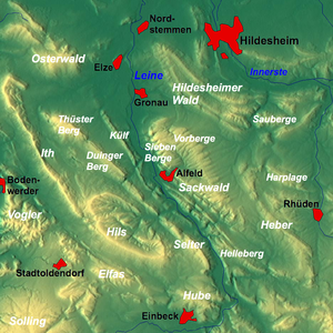
Overview map: The Helleberg ridge at the bottom right |
|
| Highest peak | Schildhorst ( 297.5 m above sea level ) |
| location | Lower Saxony |
| Lower Saxony highlands | Leinebergland |
| Coordinates | 51 ° 54 '29 " N , 9 ° 57' 1" E |
| rock | Sandstone , siltstone , mudstone , limestone , marl |
| Age of the rock | Red sandstone , shell limestone |
The Helleberg is up to 297.5 m above sea level. NN high ridge of the Lower Saxony mountains in the districts of Hildesheim and Northeim in Lower Saxony ( Germany ).
geography
Geographical location
The Helleberg is located in the eastern part of the Leinebergland , a northern part of the Lower Saxony mountains. It extends for about 8.5 km in the triangle of the villages of Freden , Bad Gandersheim and Kreiensen . It lies between Schildhorst in the north-west, Wetteborn , Landwehr and Dankelsheim in the east, Clus and Bad Gandersheim in the south-east, Orxhausen in the south, Heckenbeck and Hilprechtshausen in the south-west and the Leinetal and domain Haus Freden settlement in the west.
To the north of the Helleberg lies the Sackwald , to the north-east of the Heber and on the other side of the Leine that passes the ridge, to the south-west, the Hube and west of the Selter . To the south, the Gande flows roughly in an east-west direction into the Leine, which flows past the ridge in the west in a south-north direction.
To the south, the B 3 leads past the Helleberg. In the Hoheroth, an elevation of the Selters, the 1,641 m long Helleberg tunnel is located as part of the high-speed line Hanover – Würzburg in a north-south direction . The Hannöversche Südbahn (main line Hanover - Göttingen ) with nearby train stations in Kreiensen and Freden runs west past the ridge in the Leinetal in a north-south direction . The lower basin of the Erzhausen pumped storage plant lies in this river valley .
Surveys
The elevations of the Helleberg include - sorted by height in meters above sea level (NN)
|
|
hike
Numerous forest paths and paths lead over the Helleberg, among other things you can walk on a hiking trail along its ridge in a north-west-south-east direction from Schildhorst and Bad Gandersheim. The European long-distance hiking trail E11 leads over the mountain range in the section between these villages , where there are barrows with an information board.
