
Laufener hut
| Laufener hut DAV self-catering hut category I |
||
|---|---|---|
.JPG) |
||
| location | Tennalm , eastern edge of the Tennengebirge; Abtenau / Tennengau / State of Salzburg ; Valley location: Abtenau, Lungötz | |
| Mountain range | Tennengebirge | |
| Regions | Lammertal – Dachstein West | |
| Geographical location: | 47 ° 31 '13.4 " N , 13 ° 20' 11.2" E | |
| Altitude | 1726 m above sea level A. | |
|
||
| owner | DAV - Section running | |
| Built | 1925 | |
| Construction type | Self-catering hut | |
| Usual opening times | Pentecost to early October | |
| accommodation | 19 beds, 45 camps | |
| Winter room | 8 beds | |
| Web link | Running section | |
| Hut directory | ÖAV DAV | |

The Laufener Hütte is located at 1726 m in the Tennengebirge at the foot of the Fritzerkogel in the Salzburg region . It is run as a self-catering hut and is an important base for numerous climbing routes, circular tours and crossings, as well as for hikes on the high plateau of the Tennengebirge and ski tours.
History and technical facilities
The Laufener Hütte was built in 1925 and 1926 by the German and Austrian Alpine Club. It was expanded for the first time from 1952 to 1955. It got its present appearance between 1997 and 2000, during which time the hut was extensively renovated, added on and converted. In addition, the hut's energy supply has been brought up to date:
- Solar hot water system with an area of 10.8 m² and a storage volume of 800 liters
- Photovoltaic system with a total output of 1760 W, voltage 24 V, inverter 230 V, nominal capacity 800 Ah
- Combined heat and power plant, operated with vegetable oil, electrical output 10 kVA, thermal output 21 kW, efficiency approx. 87%
Accesses
- From Abtenau ( 715 m ) on the Hüttenweg via the Wandalm in a walking time of 3½ hours.
- From the Karalm ( 1000 m ) on the Hüttenweg via the Wandalm in a walking time of 2½ hours.
- From Spießhof , Sankt Martin-Lammertal , near Lungötz , ( 965 m ) over the Scharfen Steig in a walking time of 3½ hours.
Transitions
- Dr.-Heinrich-Hackel-Hütte ( 1530 m ) over Tennkessel, Bleikogel and Tauernscharte in a walking time of 5 hours.
- Edelweißerhütte ( 2350 m ) via Tennkessel, Bleikogel and Wengerscharte in a walking time of 6 hours.
- Leopold-Happisch-Haus ( 1925 m ) via Tennkessel , Bleikogel and Wengerscharte in a walking time of 7 hours.
- Gsengalmhütte ( 1450 m ) over Tagweide and Firstsattel in a walking time of 3½ hours.
- Gwechenberghütte ( 1365 m ) over Tagweide and Firstsattel in a walking time of 3½ hours.
Mountaineering
- Day pasture ( 2128 m ), medium, walking time: 1½ hours
- Hochkarfelderkopf ( 2219 m ) over Edelweißscharte , easy, walking time: 2 hours
- Hochkarfelderkopf ( 2219 m ) over day pasture , difficult, walking time: 2½ hours
- Edelweißkogel ( 2030 m ) over Edelweißscharte , easy, walking time: 1 hour
-
Fritzerkogel ( 2360 m )
- over east ridge , medium, walking time: 2 hours
- via Tennkessel , medium, walking time: 2½ hours
- Bleikogel ( 2412 m ) over Tennkessel and west flank, walking time: 3 hours
Climbing garden
There is a climbing garden near the Laufener Hütte . There are currently three sectors with 22 routes from the lower 3rd to the lower 7th level of difficulty according to UIAA .
Views
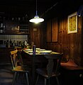
kitchen

Hut by the waterhole

Entry page

Signpost near the hut

Signpost near the hut
.JPG)


literature
- Josef Balzar: The Laufener Hut in the Tennengebirge. German Alpine Club, Running Section, 1983.
- A. Precht: Alpine Club Guide Tennengebirge. Bergverlag Rother , Ottobrunn, ISBN 978-3-7633-1246-7 .
Web links

Cadastral communities: Abtenau Dorf | Abtenau market | Fischbach | Leitenhaus | Rigaus | Chimney | Sea rats | Seidegg | Unterberg
Locations: Abtenau | Au | Döllerhof | Erlfeld | Fischbach | Gseng | Hall sides | Kehlhof | Leitenhaus | Lindenthal | Möselberg | Pichl | Rigaus | Salfelden | Chimney | Schratten | Sea rats | Seydegg | Stocker | Unterberg | Wagner | Waldhof | Wegscheid
Market place:
Abtenau •
Villages:
Voglau •
Hamlet:
Käfer |
Edt |
Fichtlhof |
Haarpoint |
Emperor |
Kurzhof |
Lacquers |
Loifried |
Oberdöllerhof |
Poschenhof |
Reisenau |
Thorhof •
Rotten:
Auwinkl |
Döllerhof |
Fischbach |
Grossenhof |
Haimhof |
Hörndl |
Kirchegg |
Lammerer |
Meingast |
Mollerzhof |
Cyclist host |
More beautiful |
Schöpp |
Schörghof |
Schwarzenbach |
Spiesshof |
Stable yard |
Thalger |
Voglau |
Wasenegg |
Winterer |
Wötzlhof |
Zicken •
Settlements:
Heimhofsiedlung |
Kehlhof •
Scattered houses:
Au |
Erlfeld |
Großlienbachalm |
Gseng |
Hall sides |
Leitenhaus |
Lindenthal |
Möselberg |
Pichl |
Rigaus |
Salfelden |
Chimney |
Schratten |
Sea rats |
Seydegg |
Stocker |
Unterberg |
Wagner |
Waldhof |
Wegscheid •
Other locations:
Astein |
Erlbachhütte |
Gypsum mine |
Laufener Hut |
Postalm |
Saddle
Counting district: Abtenau-Zentrum | Abtenau-Süd | Abtenau-North