Leerstetten
|
Leerstetten
Schwanstetten market
Coordinates: 49 ° 19 ′ 32 ″ N , 11 ° 7 ′ 21 ″ E
|
|
|---|---|
| Height : | 350 m above sea level NHN |
| Residents : | 3471 |
| Incorporation : | May 1, 1978 |
| Postal code : | 90596 |
| Area code : | 09170 |
|
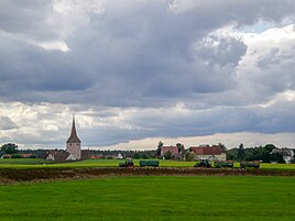
View of Leerstetten from the east
|
|

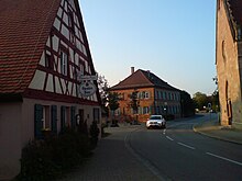
Leerstetten is a district of the Schwanstetten market in the Roth district in Central Franconia .
Geographical location
The parish village is about 15 kilometers south of Nuremberg and is largely surrounded by forest areas.
history
Leerstetten was first mentioned as Larenstetten in 1194.
The Bavarian original cadastre shows Leerstetten in the 1810s as a church village with 36 hearths and two divine cells .
Until its dissolution in 1972, Leerstetten belonged to the district of Schwabach and subsequently to the district of Roth. Before the municipal reform , Leerstetten was an independent municipality with the districts Furth , Hagershof , Harm , Holzgut and Mittelhembach . On May 1, 1978, Leerstetten and the neighboring community of Schwand were merged to form the Schwanstetten market.
- See also
traffic
The district road RH 1 leads to Großschwarzenlohe (towards Nuremberg) and Schwand. The district road RH 2 branches off in the direction of Schwabach- Penzendorf .
literature
- Johann Kaspar Bundschuh : Leerstetten . In: Geographical Statistical-Topographical Lexicon of Franconia . tape 3 : I-Ne . Verlag der Stettinische Buchhandlung, Ulm 1801, DNB 790364301 , OCLC 833753092 , Sp. 309 ( digitized version ).
- Johann Kaspar Bundschuh : Lehrstetten . In: Geographical Statistical-Topographical Lexicon of Franconia . tape 3 : I-Ne . Verlag der Stettinische Buchhandlung, Ulm 1801, DNB 790364301 , OCLC 833753092 , Sp. 315 ( digitized version ).
- Friedrich Eigler : Schwabach (= Historical Atlas of Bavaria, part of Franconia . I, 28). Michael Laßleben, Kallmünz 1990, ISBN 3-7696-9941-6 , p. 403, 476 .
- Karl Gröber, Felix Mader : City and district of Schwabach (= The art monuments of Bavaria . Middle Franconia 7). R. Oldenburg, Munich 1939, DNB 366496239 , p. 245-247 .
- Gottfried Stieber: Leerstetten . In: Historical and topographical news from the Principality of Brandenburg-Onolzbach . Johann Jacob Enderes, Schwabach 1761, p. 550 ( digitized version ).
- Willi Ulsamer (Ed.): 100 Years of the Schwabach District (1862–1962). A home book . Schwabach 1964, DNB 984880232 , p. 372-382 .
Web links
- Leerstetten in the location database of the Bayerische Landesbibliothek Online . Bayerische Staatsbibliothek, accessed on September 23, 2019.
- Leerstetten in the Topographia Franconiae of the University of Würzburg , accessed on September 23, 2019.
- Leerstetten in the historical local directory of the Verein für Computergenealogie , accessed on September 23, 2019
- Information about Leerstetten at the Museum Association Schwanstetten eV
Individual evidence
- ↑ Leerstetten in the Bavaria Atlas
- ↑ 800 Years of Leerstetten - A Historical Review, Markt Schwanstetten, Schwanstetten 1994
- ↑ Leerstetten on BayernAtlas Klassik
- ^ Federal Statistical Office (ed.): Historical municipality directory for the Federal Republic of Germany. Name, border and key number changes in municipalities, counties and administrative districts from May 27, 1970 to December 31, 1982 . W. Kohlhammer, Stuttgart / Mainz 1983, ISBN 3-17-003263-1 , p. 733 .

