Faadhippolhu Atoll
| Faadhippolhu Atoll (Lhaviyani) |
||
|---|---|---|
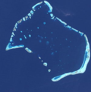
| NASA satellite image of Faadhippolhu Atoll | ||
| Waters |
Lakkadive Sea (Indian Ocean) |
|
| archipelago | Maldives | |
| Geographical location | 5 ° 20 ′ N , 73 ° 30 ′ E | |
|
|
||
| Number of islands | 52 | |
| Main island | Naifaru | |
| length | 36 km | |
| width | 24 km | |
| Land area | 7.2 km² | |
| total area | 701.46 km² | |
| Residents | 9190 (2006) | |
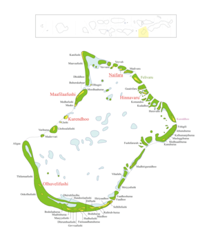
| Map of the Faadhippolhu Atoll | ||
The Faadhippolhu Atoll (also Fadiffolu , Dhivehi ފާދިއްޕޮޅު) is an atoll in the Maldives . It lies north of the North Malé Atoll and is congruent with the area of the Administrative Atoll Lhaviyani (ޅ). With a total area of 701.46 km², Faadhippolhu Atoll is the twelfth largest atoll in the Maldives. In contrast, the aggregate land area of the islands is only 7.20 km² or about one percent of the total area.
geography
Of the 52 islands in Faadhippolhu Atoll, five are inhabited. These are Hinnavaru , Kurendhoo , Maafilaafushi , Naifaru and Olhuvelifushi .
Individual evidence
- ↑ Statistical Yearbook of the Maldives 2011 , statisticsmaldives.gov.mv
- ^ National Adaptation Program of Action (NAPA) . (PDF; 6.2 MB) Ministry of Environment, Energy and Water


