List of cultural monuments in Thale
The list of cultural monuments in Thale lists all the cultural monuments of the municipality of Thale (Harz district) and its districts. The basis is the monument register of the state of Saxony-Anhalt, which was created on the basis of the Monument Protection Act of October 21, 1991 (as of December 31, 2018).
Cultural monuments according to districts
Allrode
| location | designation | description |
Registration |
Identification type | image |
|---|---|---|---|---|---|
| Kirchplatz and Blankenstrasse (map) |
War memorial | Dedicated to the fallen of the First World War 1914–1918. | 094 25298 | monument |

|
| Kirchplatz (map) |
church | Petruskirche | 094 45041 | monument |

|
| Lange Strasse 9, 9a (map) |
Residential building | 094 25299 | monument |

|
|
| Lange Strasse 31 (map) |
Farmhouse | 094 45043 | monument |

|
|
| Mühlweg 136 (map) |
Forsthof | 094 98640 | monument |

|
Altenbrak
| location | designation | description |
Registration |
Identification type | image |
|---|---|---|---|---|---|
| Hüttengraben - location (map) |
Mühlengraben | Mühlgraben / Hüttengraben, fed by the Bode. | 094 25420 | monument |

|
| on the meadows opposite the bathing establishment (map) |
barn | 094 00903 | monument |

|
|
| Below the church (map) |
War memorial | 094 00343 | monument |

|
|
| Alte Straße, hillside location on the left (map) |
monument | 094 25271 | monument |

|
|
| An der Bode 1 (map) |
Residential building | 094 00342 | monument |

|
|
| An der Bode 2 (map) |
Residential building | 094 00533 | monument | ||
| An der Bode 3 (map) |
Residential building | Shepherd's house | 094 00905 | monument | |
| Altenbraker Bergstrasse 1 (map) |
church | 094 00344 | monument |

|
|
| Hütteplatz 1 (map) |
Residential building | 094 00339 | monument |

|
|
| Hütteplatz 12 (map) |
Forester's house | 094 00571 | monument |

|
|
| Hütteplatz 13, 13a, 13b (map) |
Metallurgical plant | Altenbrak ironworks | 094 25025 | monument |

|
| Hütteplatz 13 (map) |
Metallurgical plant | 094 25418 | monument | ||
| Ludwigshütte, entrance to the village / Bode above (map) |
bridge | Viaduct bridge (water bridge) + turbine ditch | 094 25024 | monument |

|
| Ludwigshütte 1b (map) |
factory | 094 25419 | monument |

|
|
| Saint Knight 14 (card) |
Mill | 094 00574 | monument |

|
|
| Sankt Ritter 26 a (card) |
sanatorium | former sanatorium, today guesthouse "Zum Harzer Jodlermeister" | 094 00584 | monument |

|
| Saint Knight 29 (card) |
pension | 094 00578 | monument |

|
|
| Saint Knight 32 (card) |
Residential building | 094 00345 | monument |

|
|
| Sankt Ritter 34 (card) |
Residential building | 094 00573 | monument |

|
|
| Schlossweg (map) |
Hunting lodge | Hunting lodge Windenhütte | 094 01749 |
monument |

|
| Todtenrode (map) |
Forsthaus Todtenrode | Forsthaus Todtenrode, Jagdhof | 094 00583 | monument |

|
| Unterdorf 2 (map) |
Residential building | 094 00572 | monument |

|
|
| Unterdorf 3 (map) |
Residential building | 094 1750 | monument |

|
|
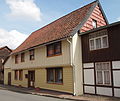
| Unterdorf 4 (map) |
Residential building | 094 00340 | monument |
|
|
| Unterdorf 9 (map) |
Residential building | 094 00341 | monument |

|
Friedrichsbrunn
| location | designation | description |
Registration |
Identification type | image |
|---|---|---|---|---|---|
| Hauptstrasse 3 (map) |
villa | "White Villa" | 094 21140 | monument |

|
| Hauptstrasse 36 (map) |
Bonhoeffer Church | Church, village church Friedrichsbrunn with a war memorial from 1924 in front of it. Behind the mourning hall from 1902 and the local cemetery. The church was built in 1880 after the previous building was demolished. Since 1996 it has been called the Bonhoeffer Church . | 094 21099 | monument |

|
| Hauptstrasse 136 (map) |
Residential building | 094 45159 | monument | ||
| Hauptstrasse 141 (map) |
villa | 094 45062 | monument |

|
|
| Hauptstrasse 147 (map) |
Residential building | 094 21097 | monument |

|
|
| Hauptstrasse 151 (map) |
Forester's house | Ramberg forester's house | 094 46647 | monument |

|
| Klobenberg 3 (map) |
Forester's house | Klobenberg forester's lodge with ancillary room | 094 46648 | monument |

|
| Waldstrasse 7 (map) |
Residential building |
Brick Bonhoeffer house, acquired in 1913 as a holiday home by Paula and Karl Bonhoeffer .
The house was declared a monument on March 16, 2015 |
monument |

|
Neinstedt
| location | designation | description |
Registration |
Identification type | image |
|---|---|---|---|---|---|
| Alexanderstraße 5 (map) |
farm | 094 50540 | monument |

|
|
| An der Schwedenlinde, cemetery (map) |
chapel | 094 45075 | monument |

|
|
| Alte Gartenstrasse 3 (map) |
Farmhouse | 094 45071 | monument |

|
|
| Georgshöhstrasse 12 (map) |
Residential building | 094 50581 | monument |

|
|
| Neinstedter Hauptstrasse 20 (map) |
Farm buildings | 094 50579 | monument |

|
|
| On the Kirchberg 4 (map) |
Sexton's house | 094 45069 | monument |

|
|
| On the Kirchberg (map) |
church | Church of St. Katharinen Neinstedt | 094 45442 | monument |

|
| Kramerringstrasse 1 (map) |
Residential building | 094 45070 | monument |

|
|
| Kramerringstrasse 30 (map) |
Mühlenhof | Brothers house Maranatha | 094 45072 | monument |

|
| Lindenstrasse 1/3 (map) |
Nursing home | Nostedter institutions, Lindenhof | 094 21101 | monument |

|
| Lindenstrasse 15 (map) |
villa | Villa Nathusius | 094 45237 | monument |

|
| Lindenstrasse 1, 3, 15, 17, 18, 19, 20, 22, Quedlinburger Strasse 1, Suderöder Strasse 2, 4, 5, 6, 12, 19 (map) |
Nursing home | Neinstedter Anstalten, entire facility (Elisabethstift has already been demolished) | 094 45076 | Monument area |

|
| Lindenstrasse 17, 18, 19, 20, 22, Suderöder Strasse 2, 4, 5, 6, 12, 19 (map) |
Nursing home | Nostedter institutions, Johannenhof | 094 21102 | monument |

|
| Lindenstrasse (map) |
park | small park with the resting place of Marie and Philipp Nathusius | 094 45073 | monument |

|
| Alte Quedlinburger Strasse 2–6, 24–26 (map) |
Street train | 094 50539 | monument |

|
|
| Alte Quedlinburger Strasse 24 (map) |
Farmhouse | 094 45235 | monument |

|
|
| Alte Quedlinburger Strasse 25 (map) |
farm | 094 50538 | monument |

|
|
| Quedlinburger Strasse (map) |
bridge | So-called Peace Bridge | 094 45236 | monument |

|
| Stecklenberger Strasse 1 (map) |
Farm buildings | 094 50580 | monument |

|
|
| Steuerstraße 26 (map) |
Rectory | 094 45074 | monument |

|
|
| Alte Thalenser Straße 1 (map) |
Residential building | 094 21 100 | monument |

|
|
| Ziegeleistraße 4 (map) |
Residential building | 094 50576 | monument |

|
Stecklenberg
| location | designation | description |
Registration |
Identification type | image |
|---|---|---|---|---|---|
| on the Stecklenberg, district Stecklenberg, corridor 3, parcel 53 (map) |
Stecklenburg Castle | 094 21134 | monument |

|
|
| above the Mecklenburg on a foothill of the Ramberg massif, district Stecklenberg, hall 3, parcels 52, 53 (map) |
Lauenburg Castle | 094 45242 | monument |

|
|
| Stecklenberger Hauptstrasse 25 (map) |
chapel | 094 45103 | monument |

|
|
| Stecklenberger Hauptstrasse 86 (map) |
villa | Villa von der Busche ("Stecklenberg Castle") | 094 45104 | monument |

|
| Stecklenberger Hauptstrasse 18, 19, 20, 20a, 21, 22, 23 (map) |
Street line | 094 45105 | Monument area |

|
|
| Stecklenberger Hauptstrasse 25a (map) |
Brewery | Old brewery | 094 45107 | monument |

|
| Stecklenberger Wurmtal 26 (map) |
Parish hall | 094 21091 | monument |

|
|
| Stecklenberger Wurmtal 52 (map) |
Farmhouse | 094 21092 | monument |

|
Thale
| location | designation | description |
Registration |
Identification type | image |
|---|---|---|---|---|---|
| Ahornallee 4 (map) |
villa | 094 50574 | monument |

|
|
| Alfredstrasse 16a – b (map) |
Residential building | 094 45245 | monument |

|
|
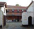
| Old Pot 5 (card) |
Mühlenhof | 094 50621 | monument |
|
|
| Bahnhofstrasse 1 (map) |
railway station | Central station, Thale railway operations building | 094 45246 | monument |

|
| Bahnhofstrasse 1 (map) |
Workshop building | Workshop building on the other side of the track next to Villa Bahnhofstrasse 2 | 094 21176 | monument | |
| Bahnhofstrasse 2 (map) |
villa | Villa in the Heimat style from around 1910 | 094 50600 | monument |

|
| Bahnhofstrasse 5 (map) |
movie theater | Central-Theater, a cinema from around 1910, opened in 1911 | 094 45247 | monument |

|
| Baldurweg 1–3, Obersteigerweg 12–15, Wotanstraße 20, 22, 24 (map) |
Group of houses | Closed residential building in the design of a courtyard. | 094 45300 | Monument area |

|
| Bergstrasse 19 (map) |
Spa pension | 094 45250 | monument |

|
|
| Birkenstrasse 13/14 (map) |
Residential building | 094 45255 | monument |

|
|
| Birkenstrasse 21/22 (map) |
Residential building | 094 45257 | monument |

|
|
| Blankenburger Strasse 26a (map) |
graveyard | Cemetery with several artistically and historically valuable graves. The graves of the Oswald, Martius and Brennecke families, the grave of Theodor Nolte and a stele with a dove are listed as historical monuments . | 094 45258 | monument |

|
| Bodetal (map) |
hotel | Youth hostel on the terraced south bank of the Bode below the Homburg | 094 45270 | monument |

|
| Width way 6 (map) |
Residential building | 094 21139 | monument |

|
|
| Width way 15a (map) |
Residential building | 094 45356 | monument |

|
|
| Brückenstrasse 29 (map) |
Residential and commercial building | 094 50588 | monument |

|
|
| Dambachhaus (map) |
Dambachhaus | Jagdschloss, possibly double entry with 094 46653 | 094 45367 | monument | |
| Dambachhaus 1 (map) |
Chief Forester | Forsthaus Dambachhaus, possibly double entry for 094 45367 | 094 46653 | monument | |
| Eisenbahnstrasse 2 (map) |
Residential building | 094 45260 | monument |

|
|
| Eisenbahnstrasse 3 (map) |
Residential building | 094 45261 | monument |

|
|
| Eisenbahnstrasse 6 (map) |
Residential building | 094 45262 | monument |

|
|
| Eisenbahnstrasse 23 (map) |
villa | 094 45439 | monument |

|
|
| Eisenbahnstrasse 24 (map) |
Residential building | 094 45440 | monument |

|
|
| Friedrichsbrunner Chaussee 1/2 (map) |
Residential building | 094 45263 | monument |

|
|
| Georgshöhe 1 (map) |
Hunting lodge | 094 45368 | monument | ||
| Heimburgstrasse 4 (map) |
Residential building | 094 45264 | monument |

|
|
| Heimburgstrasse 26 (map) |
Spa pension | 094 45265 | monument |

|
|
| Heimburgstrasse 28/29 (map) |
Residential building | 094 45266 | monument |

|
|
| Heimburgstrasse 30 (map) |
Residential building | 094 45267 | monument |

|
|
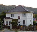
| Heimburgstrasse 31 (map) |
Residential building | 094 45268 | monument |
|
|
| Hexentanzplatz (map) |
Hexentanzplatz | Hexentanzplatz with Walpurgis hall | 094 45369 | monument |

|
| Hubertusstrasse 1 (map) |
Water tower | Water tower converted into a residential building. | 094 45271 | monument |

|
| Hubertusstrasse 2 (map) |
church | Saint Peter's Church | 094 45272 | monument |

|
| Hubertusstrasse 3 (map) |
villa | Villa Rosenburg | 094 45355 | monument |

|
| Hubertusstrasse 9 (map) |
pension | Villa Hubertus | 094 45275 | monument |

|
| Hubertusstrasse 12 (map) |
villa | ev. parish office St. Petri, sold to private in 2016. | 094 45276 | monument |

|
| Hubertusstrasse 19 (map) |
Residential and commercial building | 094 21165 | monument |

|
|
| Hubertusstrasse (map) |
park | Kurpark, Friedenspark between Hubertusstraße, Parkstraße, Bahnhofstraße and Theodor-Nolte-Straße | 094 45316 | monument | |
| Jägerstrasse 3/4 (map) |
Residential building | 094 45277 | monument |

|
|
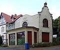
| Jägerstrasse 4a (map) |
Residential building | Former museum | 094 45278 | monument |
|
| Jägerstrasse 5 (map) |
Residential building | 094 45279 | monument |

|
|
| Jägerstrasse 6/7 (map) |
Residential building | 094 45280 | monument |

|
|
| Kahlenbergstrasse 26 (map) |
Residential building | 094 45282 | monument |

|
|
| Karl-Marx-Strasse 4 (map) |
Residential building | House from around 1900/1910 | 094 45283 | monument |

|
| Karl-Marx-Strasse 14 (map) |
Residential and commercial building | Residential and commercial building in Art Nouveau forms from around 1905 | 094 45284 | monument |

|
| Karl-Marx-Strasse 17 (map) |
Residential and commercial building | Residential and commercial building from around 1910, remarkable half-timbered facade | 094 45285 | monument |

|
| Karl-Marx-Strasse 19 (map) |
Residential and commercial building | Residential and commercial building in the style of historicism | 094 45286 | monument |

|
| Karl-Marx-Strasse 22 (map) |
Residential and commercial building | three-storey residential and commercial building in the style of historicism and neo-Gothic | 094 45287 | monument |

|
| Karl-Marx-Strasse 24 (map) |
Residential and commercial building | 094 45288 | monument |

|
|
| Karl-Marx-Strasse 26 (map) |
Residential and commercial building | three-storey residential and commercial building from around 1900 | 094 45289 | monument |

|
| Karl-Marx-Strasse 28 (map) |
Residential and commercial building | 094 45290 | monument |

|
|
| Karl-Marx-Strasse 55 (map) |
villa | 094 50590 | monument |

|
|
| Karl-Marx-Strasse 57 (map) |
Residential and commercial building | Red ox | 094 45292 | monument |

|
| Karl-Marx-Straße, on the north side of the street at a bend in the street (next to the former Volksbad) (map) |
graveyard | Soviet war cemetery. The bones were reburied in the cemetery on Blankenburger Strasse in 1996. | 094 45293 | monument |

|
| Karl-Marx-Strasse 59 (map) |
Bathing establishment | Former public bathing establishment, now residential building Palais Picard . | 094 45294 | monument |

|
| Karl-Marx-Strasse 61 (map) |
Residential building | 094 45295 | monument |

|
|
| Karl-Marx-Strasse 65 (map) |
Residential building | 094 45296 | monument |

|
|
| Karl-Marx-Strasse 72 (map) |
villa | Villa Toscana | 094 50591 | monument |

|
| Karl-Marx-Strasse 80 (map) |
Residential building | 094 45297 | monument |

|
|
| Kirchstrasse 2 (map) |
Saint Andrew's Church | Church of St. Andreas at Wendhusen Monastery | 094 45357 | monument |

|
| Kirchstrasse 8 (map) |
Sheep farm | 094 50603 | monument |

|
|
| Lindenbergsweg 36 (map) |
villa | 094 50593 | monument |

|
|
| Margarethenstrasse 6 (map) |
villa | 094 50594 | monument |

|
|
| Margarethenstrasse 7 (map) |
Residential and commercial building | 094 45298 | monument |

|
|
| Marktstrasse 3 (map) |
Farmhouse | 094 45358 | monument |

|
|
| Mühlenstraße 2, east of the former Wendhusen ad Bode or Bode-Mühlgraben monastery (map) |
Mill | 094 50082 | monument |

|
|
| Musestieg 3 (map) |
villa | 094 21164 | monument |

|
|
| Musestieg 4 (map) |
villa | 094 50630 | monument |

|
|
| Neinstedter Strasse 6 (map) |
Poor house | 094 50596 | monument |

|
|
| Neinstedter Strasse 23 (map) |
Mill | Rock mill | 094 45420 | monument |

|
| Neinstedter Strasse 1 / 1a (map) |
Nursing home | Nursing home Kreuzhilfe | 094 45299 | monument |

|
| Obersteiger Weg 26/27, 28, 29a, 29b, 29c 29d, 30 (map) |
Group of houses | Four houses | 094 45301 | Monument area |

|
| Parkstrasse 1 (map) |
factory | From the former Eisenhüttenwerk Thale (EHW) factory, the following have been preserved: The large administration building that is to be converted into a hotel, Hall No. 7 with the steam engine from 1911 and a workshop. | 094 45304 | monument |

|
| Parkstrasse 2 (map) |
Residential building | 094 45305 | monument |

|
|
| Parkstrasse 3 (map) |
villa | villa | 094 45306 | monument |

|
| Parkstrasse 6/7 (map) |
Settlement house | 094 50597 | monument |

|
|
| Pfingstanger 5 (map) |
gym | 094 50592 | monument |

|
|
| Poststrasse 1 (map) |
Post office | 094 45307 | monument |

|
|
| Poststrasse 3a (map) |
Residential and commercial building | 094 45308 | monument |

|
|
| Poststrasse 5 (map) |
Residential and commercial building | 094 45309 | monument |

|
|
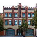
| Poststrasse 5a (map) |
Residential and commercial building | 094 45310 | monument |
|
|
| Poststrasse 6 (map) |
Residential building | 094 21138 | monument |

|
|
| Poststrasse 7 (map) |
hotel | Hubertus-Eck on the corner of Stecklenberger Allee | 094 45311 | monument |

|
| Poststrasse 9 (map) |
Spa pension | 094 45312 | monument |

|
|
| Poststrasse 11 (map) |
Residential building | 094 45313 | monument |

|
|
| Poststrasse 12 (map) |
pension | 094 45314 | monument |

|
|
| Poststrasse 13 (map) |
pension | 094 45315 | monument |

|
|
| Horse bustard (map) |
Castle | Winzenburg | 094 45370 | monument |

|
| Horse bustard (map) |
Berghotel Rosstrappe | Inn and hotel, essentially dating back to 1849 | 094 50648 | monument |

|
| Roßtrappenstrasse 1 (map) |
Brauner Hirsch inn | Gasthaus Brauner Hirsch , vacant, acquired by the city of Thale in 2018 and threatened with demolition. | 094 45359 | monument |

|
| Roßtrappenstrasse 102 (map) |
Residential building | Birthplace of Bertha Behrens ( Wilhelmine Heimburg ) | 094 21145 | monument |

|
| Rudolf-Breitscheid-Strasse 1 (map) |
Residential building | 094 45319 | monument |

|
|
| Rudolf-Breitscheid-Strasse 2 (map) |
Residential building | 094 45320 | monument |

|
|
| Rudolf-Breitscheid-Strasse 5 (map) |
Residential building | 094 45321 | monument |

|
|
| Rudolf-Breitscheid-Strasse 7 (map) |
Residential building | 094 45322 | monument |

|
|
| Rudolf-Breitscheid-Strasse 10 (map) |
Residential building | 094 45323 | monument |

|
|
| Rudolf-Breitscheid-Strasse 12 (map) |
Residential building | 094 45324 | monument |

|
|
| Rudolf-Breitscheid-Strasse 13 (map) |
Residential building | 094 45325 | monument |

|
|
| Rudolf-Breitscheid-Strasse 14 (map) |
Residential building | Villa Bournville | 094 45326 | monument |

|
| Rudolf-Breitscheid-Strasse 16 (map) |
Residential building | 094 46644 | monument |

|
|
| Rudolf-Breitscheid-Strasse 18 (map) |
Residential building | 094 45328 | monument |

|
|
| Rudolf-Breitscheid-Strasse 19 (map) |
Residential and commercial building | 094 45329 | monument |

|
|
| Rudolf-Breitscheid-Strasse 20 (map) |
Spa pension | 094 45330 | monument |

|
|
| Rudolf-Breitscheid-Strasse 23 (map) |
villa | 094 50598 | monument |

|
|
| Rudolf-Breitscheid-Strasse 25 (map) |
Spa pension | Swiss house | 094 45331 | monument |

|
| Rudolf-Breitscheid-Strasse 27 (map) |
Spa pension | 094 45332 | monument |

|
|
| Rudolf-Breitscheid-Strasse 28 (map) |
Spa pension | 094 45333 | monument |

|
|
| Schänkeplatz 6 (map) |
Rectory | Parish office of St. Andreas | 094 45360 | monument |

|
| Schillerstraße 6 (map) |
Residential building | 094 45334 | monument |

|
|
| Schillerstraße 19 (map) |
Residential building | 094 45335 | monument |

|
|
| Schleifenbachstrasse (map) |
bridge | Iron pedestrian bridge over the Silberbach. | 094 50599 | monument |

|
| Schmiedestrasse 3/4 (map) |
grange | Manor Thale I | 094 45361 | monument |

|
| Stecklenberger Allee 21 (map) |
Spa pension | 094 45336 | monument |

|
|
| Stecklenberger Allee 36 (map) |
Residential building | Presumably, this refers to the house at Alfredstrasse 36 on Stecklenberger Allee. | 094 45337 | monument |

|
| Steinbachstrasse 4 (map) |
school | Former vocational school, now a residential building. | 094 45339 | monument |

|
| Theodor-Nolte-Strasse 1 (map) |
town hall | former hotel ten pounds | 094 45317 | monument |

|
| Unter der Linde 4 (map) |
Agricultural bourgeoisie | 094 45362 | monument |

|
|
| Walpurgisstrasse 4–9 (map) |
Street line | 094 45340 | Monument area |

|
|
| Walpurgisstrasse 25 (map) |
Residential building | 094 45341 | monument |

|
|
| Walpurgisstrasse 26 (map) |
Villa Alice | Villa Alice , used as a hotel. | 094 45342 | monument |

|
| Walpurgisstrasse 28 (map) |
Residential building | 094 45343 | monument |

|
|
| Walpurgisstrasse 29 (map) |
Residential building | 094 45344 | monument |

|
|
| Walpurgisstrasse 31 (map) |
Residential building | 094 45346 | monument |

|
|
| Walpurgisstrasse 34 (map) |
Residential building | Original description in the list of monuments was originally Kurhaus , but that was in number 37. | 094 45347 | monument |

|
| Walpurgisstrasse 35 (map) |
Residential building | 094 45348 | monument |

|
|
| Walpurgisstrasse 35c (map) |
Residential building | 094 45349 | monument |

|
|
| Walpurgisstrasse 35g (map) |
Residential building | 094 45350 | monument |

|
|
| Walpurgisstrasse 36 (map) |
Forestry Office | Revierförsterei, forester's house Hexentanzplatz. (Assigned twice with ID 094 45351, once as a residential building and once as a forest ranger) | 094 46652 | monument |

|
| Walpurgisstrasse 37 (map) |
hotel | Kurhaus Thale from 1907, in the GDR conversion to the culture house of the EHW Thale, now Klubhaus Thale . Structurally changed significantly after fire restoration. | 094 50601 | monument |

|
| Walpurgisstrasse 39-45, 47 (map) |
Street line | 094 45352 | Monument area |

|
|
| Walter-Rathenau-Strasse 1 (map) |
Hut chapel | Presumably built as a hut chapel in 1856, today used as a museum gallery | 094 45303 | monument |

|
| Walter-Rathenau-Strasse 2 (map) |
Catholic Church | 094 45353 | monument |

|
|
| Walter-Rathenau-Strasse 2 (map) |
Rectory | 094 45302 | monument |

|
|
| Walter-Rathenau-Strasse 3 (map) |
railway station | Bodetal train station | 094 21166 | monument |

|
| Wendhusenstrasse 7, 7a (map) |
monastery | Wendhusen Monastery | 094 45365 | monument |

|
| Wendhusenstrasse 8 (map) |
Residential building | Half-timbered house from around 1700 | 094 45366 | monument |

|
| Diagon Alley 8 (map) |
Farmhouse | 094 45441 | monument |

|
|
| Worth 1 (card) |
farm | 094 50602 | monument |

|
|
| Thale-Treseburg and Dambachhaus-Friedrichsbrunn crossroads (map) |
monument | Arrow monument near Dambachhaus | 094 45407 | monument |

|
| 500 meters northwest of the entrance to the village (map) |
Landmark | Landmark No. 207 from 1844, set between the Duchy of Braunschweig and Prussia. | 094 50650 | Small monument |

|
| approx. 500 m northwest of the city, on the road to Blankenburg (map) |
Atonement Cross | "Warnstedter Murder Cross". It is intended to commemorate Siegfried I, Count Palatine of the Rhine , who was wounded here on February 21, 1113 at the Battle of Warnstedt by supporters of the Imperial Field Marshal Hoyer von Mansfeld and died on March 9, 1113. The stone is said to have been erected in the 15th century. | 094 50649 | Small monument |

|
Treseburg
| location | designation | description |
Registration |
Identification type | image |
|---|---|---|---|---|---|
| Stockpile 1 (map) |
Hotel Bodeblick | Hotel on the Bode, built in the 1890s | 094 25276 | monument |

|
| Stockpile 2 (map) |
hotel | hotel | 094 25277 | monument |

|
| Stockpile 3 (map) |
pension | pension | 094 25278 | monument |

|
| Am Berg, Friedhof (map) |
Cemetery chapel | chapel | 094 00537 | monument |

|
| Ortsstrasse 2 (map) |
Pension Wildstein | pension | 094 00536 | monument |

|
| Ortsstrasse 4 (map) |
Residential building | Residential building | 094 00533 | monument |

|
| Ortsstrasse 7 (map) |
Residential building | Residential building | 094 00532 | monument |

|
| Ortsstrasse 22 (map) |
Inn | Inn | 094 00539 | monument |

|
| Ortsstrasse 23, 24, 25 (map) |
Group of houses | Group of houses | 094 00534 | Monument area |

|
| Ortsstrasse 25 (map) |
school | Schoolhouse with chapel from 1877 | 094 25279 | monument |

|
| Ortsstrasse 26 (map) |
Pension Luppbode | Inn | 094 00535 | monument |

|
| Ortsstrasse 28 (map) |
hotel | Essentially a hotel dating back to the 18th century | 094 00540 | monument |

|
| Ortsstrasse 30 (map) |
Pension Bodetal | pension | 094 00541 | monument | |
| Rock ridge over Bodeschleife (map) |
Castle ruins | Treseburg castle ruins | 094 25275 | monument |

|
Warnstedt
| location | designation | description |
Registration |
Identification type | image |
|---|---|---|---|---|---|
| Warnstedter Hauptstrasse 22 (map) |
Farm buildings | 094 50639 | monument |

|
|
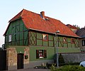
| Warnstedter Hauptstrasse 74 (map) |
Farmhouse | 094 45143 | monument |
|
|
| Kirchberg (map) |
church | St. Georg Church Warnstedt | 094 45372 | monument |

|
| Kirchberg 79 (map) |
Rectory | 094 45144 | monument |

|
|
| Sackstrasse 15 (map) |
Farmhouse | 094 45142 | monument |

|
|
| Warnstedter Plan 72 (map) |
farm | 094 50640 | monument |

|
|
| Wedderslebener Weg (map) |
Mill | 094 45145 | monument |

|
Wendefurth
| location | designation | description |
Registration |
Identification type | image |
|---|---|---|---|---|---|
| Alte Blankenburger Strasse 3 (map) |
Forsthof | 094 25273 | monument |

|
|
| Alte Blankenburger Strasse 4 (map) |
Residential building | Swiss house | 094 25274 | monument |

|
| Alte Blankenburger Strasse 5 (map) |
Residential building | 094 00581 | monument |

|
Weddersleben
| location | designation | description |
Registration |
Identification type | image |
|---|---|---|---|---|---|
| Wedderslebener Bergstrasse 10 (map) |
Farmhouse | 094 45373 | monument |

|
|
| Wedderslebener Bergstrasse 11 (map) |
Farmhouse | 094 45374 | monument |

|
|
| Bodeberg 3 (map) |
grange | 094 45375 | monument |

|
|
| Friedensstrasse 6 (map) |
Farmhouse | 094 45133 | monument |

|
|
| Friedensstrasse 31 (map) |
Residential building | 094 45449 | monument |

|
|
| Friedensstrasse 34 (map) |
farm | 094 50573 | monument |

|
|
| Friedensstrasse 37 (map) |
Inn | Gasthof Weißer Schwan with hall from 1904 | 094 45377 | monument |

|
| Friedensstrasse 38 (map) |
Farmhouse | 094 45450 | monument |

|
|
| Wedderslebener Kirchstrasse 8 (map) |
Rectory | 094 50571 | monument |

|
|
| Wedderslebener Kirchstrasse 10 (map) |
church | St. Michael Church | 094 45409 | monument |

|
| Quedlinburger Strasse 1 (map) |
Mühlenhof | Old Maasmühle | 094 45429 | monument |

|
| Quedlinburger Strasse 1a (map) |
Mill | New Maasmühle from 1909 | 094 45136 | monument |

|
| Quedlinburger Strasse 13 (map) |
Residential building | 094 45139 | monument |

|
|
| Quedlinburger Strasse 15 (map) |
farm | 094 45380 | monument |

|
|
| Quedlinburger Strasse 17 (map) |
Mühlenhof | 094 45378 | monument |

|
|
| New Warnstedter Strasse (map) |
Celebration hall | Weddersleben cemetery | 094 45141 | monument |

|
Westerhausen
| location | designation | description |
Registration |
Identification type | image |
|---|---|---|---|---|---|
| Feldstrasse 528 (map) |
sanatorium | 094 45120 | monument |

|
|
| Friedhofstrasse (map) |
graveyard | Westerhausen cemetery | 094 45382 | monument |

|
| Halberstädter Strasse 239 (map) |
Mill | Untermühle (Fischer's Mill) | 094 45122 | monument |

|
| Halberstädter Strasse 536 (map) |
Clubhouse | Rifle house | 094 45123 | monument |

|
| Behind the office 28 (map) |
Office building | Administrator's House "The Temple" | 094 50636 | monument |

|
| Behind the office 40 (card) |
Farmhouse | 094 50637 | monument |

|
|
| Oberdorf 8 (map) |
farm | Flemish farm 16th century | 094 45124 | monument |

|
| Oberdorf 9 (map) |
Farmhouse | Flemish farm 17th century | 094 50635 | monument |

|
| Oberdorf 12 (map) |
farm | Flemish farm 17th century | 094 45125 | monument |

|
| Oberdorf 13 (map) |
farm | Flemish farm 17th century | 094 45126 | monument |

|
| Planstrasse 90 (map) |
Rectory | 094 50638 | monument |

|
|
| Planstrasse 105 (map) |
Farmhouse | 094 50633 | monument |

|
|
| Sankt-Stephan-Strasse 449 (map) |
Fisherman's house | 094 45130 | monument |

|
|
| Schulstrasse 68 (map) |
Craftsman House | 094 45127 | monument |

|
|
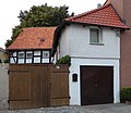
| Schulstrasse 70 (map) |
Farmhouse | 094 45128 | monument |
|
|
| Schulstrasse 77 (map) |
church | St. Stephen's Church | 094 45410 | monument |

|
| Schulstrasse 88 (map) |
Inn | Gasthof "Zum Würfel" | 094 45129 | monument |

|
| Road of Peace 265 (map) |
farm | 094 50647 | monument |

|
|
| In front of Junkerhof 488 (map) |
Syringe house | 094 45131 | monument |

|
|
| In front of Junkerhof 535 (map) |
Edelhof | Junkerhof | 094 45119 | monument |

|
| approx. 2.5 km east of the village (map) |
Mill | Lower curd mill | 094 50081 | monument |

|
| southeast of Westerhausen, hall 40, district Quedlinburg, parcel 1/4 (map) |
Racetrack | Racetrack at the donkey stable south of the forester's farm | 094 18776 | monument |

|
| northwest below the Königstein on the east side of the northern mouth of the ravine between this and the Jätchenberg (map) |
monument | Hungerstein from 1931 | 094 45383 | Small monument |

|
| approx. 500 m after leaving the town on the road to Warnstedt (map) |
Distance stone | 094 45418 | Small monument |

|
|
| approx. 2 km north of the location |
Landmark | Landmarks east of the Harsleben mountains | 094 50652 | monument | |
| approx. 2 km northeast of the location |
Landmark | Landmarks | 094 50653 | Small monument | |
| About 1 km north of the location |
Landmark | Landmarks on the Hohen Helmstein? | 094 50654 | Small monument |
Former cultural monuments according to districts
The following objects were originally also listed or listed in literature as cultural monuments. However, the monuments no longer exist today, their protection status has been lifted or they are no longer regarded as monuments.
Allrode
| location | designation | description |
Registration |
Identification type | image |
|---|---|---|---|---|---|
| Lange Strasse 9, 9a, 50, 51, 55, 81 (map) |
Group of houses | 094 45042 | Monument area |

|
Altenbrak
| location | designation | description |
Registration |
Identification type | image |
|---|---|---|---|---|---|
| On the promenade (map) |
Bathing establishment | 094 00904 |

|
||
| Ludwigshütte 2, 3 (map) |
Residential building | Hüttenschreiberhaus, the building was demolished in July 2012 | 094 00580 | ||
| Rodensteinsweg 1 town center near the Bode (map) |
Residential building | 094 00346 |

|
||
| Rolandseck 1, 2, 3, 4, 5, 6, 7, 8, 9, 10, 11 (map) |
settlement | 094 00585 |

|
||
| Saint Knight 1 (card) |
Guest house | formerly the “Brücke” inn, today a residential building | 094 00576 |

|
|
| Saint Knight 3 (card) |
Residential building | House heather | 094 00575 |

|
|
| Saint Knight 8 (card) |
pension | The “Inselhaus” building was demolished in February 2012 and a new home was built on the property. | 094 00907 | monument | |
| Sankt Ritter 30 (card) |
Garden shed | 094 00577 |
Friedrichsbrunn
| location | designation | description |
Registration |
Identification type | image |
|---|---|---|---|---|---|
| Hauptstraße 90 |
Transformer station | 094 21141 | monument |
Thale
| location | designation | description |
Registration |
Identification type | image |
|---|---|---|---|---|---|
| Hubertusbad 1 (map) |
pension | Villa Diana on Hubertusinsel . After arson and decay, demolished and built over with playgrounds. | 094 45269 | monument | |
| Hubertusstrasse 6 (map) |
hotel | Formerly Wegener's mountain hotel / Hotel Bodethal . The building has already been demolished and it has apparently not yet been removed from the list of monuments. | 094 45274 | monument | |
| Hubertusstraße |
Pumping station | 094 50589 | monument | ||
| Hubertusstrasse 5 (map) |
Hotel Princess Brunhilde | Half-timbered hotel from around 1890, the building was demolished after a permit had been granted and removed from the list of monuments in 2016. | 094 45273 | monument |

|
| Kantorstrasse 13, hall 5, parcel 158/188 (map) |
Residential building | Cantor near Wendhusen Abbey. The building was demolished and the property was rebuilt with residential houses. | 094 45363 | monument | |
| Karl-Marx-Strasse 51 (map) |
Residential building | 094 45291 | monument |

|
|
| Karlstrasse 24, 24a (map) |
Residential building | The property is undeveloped | 094 45281 | monument | |
| Lindenbergsweg 1b (map) |
garage | Garage, Postkraftwagenhof, was demolished in 2015 after a permit and removed from the monument register in 2016. | 094 21095 | monument | |
| Market 3a (map) |
Agricultural bourgeoisie | 094 50084 | monument |

|
|
| Stecklenberger Allee 41-66 (map) |
Housing estate | Settlement of social housing construction of the early 1920s with two-family semi-detached houses, as part of a review, the monument property was assessed as negative or expired and the settlement was removed from the monument register in January 2017. | 094 45338 | Monument area |

|
| Walpurgisstrasse 30 (map) |
Residential building | 094 45345 | monument |

|
|
| Weiberborn 8 / Unter der Linde 8 |
Colonist House | Only house number 1 exists in Weiberborn, there were never higher numbers according to the address book in 1903. Presumably it is the house at Unter der Linde 8, which has already been demolished. | 094 45364 | monument |

|
Treseburg
| location | designation | description |
Registration |
Identification type | image |
|---|---|---|---|---|---|
| Stockpile 1, 2, 3 (map) |
Spa facility | 094 00531 |

|
||
| Ortsstrasse 34 (map) |
Residential building | Hotel and guest house "Zur Treseburg", formerly run by Carl Müller. In the GDR Café of the FDGB ("Wellblech-Café"), but has since been demolished. | 094 00542 |
Weddersleben
| location | designation | description |
Registration |
Identification type | image |
|---|---|---|---|---|---|
| Friedensstrasse 43 (map) |
Residential building | In 2015 already listed as a former architectural monument | 094 45134 | monument |

|
Wendefurth
| location | designation | description |
Registration |
Identification type | image |
|---|---|---|---|---|---|
| Bodeweg on the Bode between No. 2 and 3 |
pension | 094 00582 |
Legend
The columns contain the following information:
- Location: States the street name and, if available, the house number of the cultural monument. The list is basically sorted according to this address. The link "Map" leads to various map displays and names the geographic coordinates.
Link to a map view tool to set coordinates. In the map view, monuments without coordinates are shown with a red marker and can be set on the map. Architectural monuments without a picture are marked with a blue marker, architectural monuments with a picture are marked with a blue marker. - Official designation: Provides the name, designation or type of cultural monument as noted in the source.
- Description: Provides structural and historical details of the cultural monument, preferably the characteristics of the monument.
- Registration number: A 20-digit registration number is assigned to every cultural monument in Saxony-Anhalt. Currently the last twelve digits are each 0. Therefore, the last twelve digits are not shown here. The following icon can be found in this column
 ; this leads to information on this monument at Wikidata .
 - Type of identification: The classification of the monument according to § 2 Paragraph 2 DenkmSchG LSA
- Image: A picture of the memorial and, if applicable, a link to other photos of the cultural monument in the Wikimedia Commons media archive
literature
- Falko Grubitzsch with the participation of Winfried Korf and Theo Gosselke: Quedlinburg district . In: State Office for the Preservation of Monuments and Archeology Saxony-Anhalt - The State Conservator (Ed.): List of Monuments Saxony-Anhalt . 1st edition. tape 7.2 . Michael Imhof Verlag, 2007, ISBN 978-3-86568-072-3 .
swell
Web links
Individual evidence
- ↑ Bonhoeffer Church In: pfarrbereich-thale.de , accessed on August 9, 2018.
- ↑ Small question and answer Olaf Meister (BÜNDNIS 90 / DIE GRÜNEN), Wolfgang Aldag (BÜNDNIS 90 / DIE GRÜNEN), State Chancellery and Ministry of Culture 22.03.2017 Printed matter 7/1157 (KA 7/628) Development of the List of Monuments Saxony-Anhalt , page 5
- ↑ List of the artistically and historically valuable graves according to § 19 - cemetery statute of the city of Thale . In: Thalekurier 11/2018 Official Journal of the City of Thale . October 27, 2018, p. 20 ( bodetal.de [PDF; 12.7 MB ; accessed on February 11, 2019]).
- ↑ Petra Korn: Parkstrasse 1 Thale: The former administration building of the ironworks is being converted into a hotel. In: mz-web.de. May 16, 2019, accessed September 21, 2019 .
- ↑ The "Haus zur Bode-Insel" is being demolished. In: altenbrak-chronik.magix.net , accessed on February 26, 2020.
- ↑ Small question and answer Olaf Meister (BÜNDNIS 90 / DIE GRÜNEN), Wolfgang Aldag (BÜNDNIS 90 / DIE GRÜNEN), State Chancellery and Ministry of Culture 22.03.2017 Printed matter 7/1157 (KA 7/628) Development of the List of Monuments Saxony-Anhalt , page 13.
- ↑ Small question and answer Olaf Meister (BÜNDNIS 90 / DIE GRÜNEN), Wolfgang Aldag (BÜNDNIS 90 / DIE GRÜNEN), State Chancellery and Ministry of Culture 22.03.2017 Printed matter 7/1157 (KA 7/628) Development of the List of Monuments Saxony-Anhalt , page 13.
- ↑ Small question and answer Olaf Meister (BÜNDNIS 90 / DIE GRÜNEN), Wolfgang Aldag (BÜNDNIS 90 / DIE GRÜNEN), State Chancellery and Ministry of Culture 22.03.2017 Printed matter 7/1157 (KA 7/628) Development of the List of Monuments Saxony-Anhalt , page 13.
- ↑ Small question and answer Olaf Meister (BÜNDNIS 90 / DIE GRÜNEN), Wolfgang Aldag (BÜNDNIS 90 / DIE GRÜNEN), State Chancellery and Ministry of Culture 02/15/2018 Printed matter 7/2453 (KA 7/1372) Development of the Saxony-Anhalt monument register in the year 2017 , page 27
