List of listed objects in Sieghartskirchen
The list of listed objects in Sieghartskirchen contains the 36 listed , immovable objects of the community Sieghartskirchen in the Lower Austrian district of Tulln .
Monuments
| photo | monument | Location | description | Metadata |
|---|---|---|---|---|

|
Parsonage Object ID: 23276 |
Abstetten 2 KG location : Abstetten |
The wooden door of the rectory from the 17th century is marked with the year 1690. |
ObjectID : 23276 Status: § 2a Status of the BDA list: 2020-02-29 Name: Pfarrhof GstNr .: 8 Pfarrhof Abstetten, Sieghartskirchen |

|
Schüttkasten (stately) ObjectID : 23279 |
Abstetten 2 KG location : Abstetten |
The parsonage , the former farm wing of the parsonage, is an elongated, two-storey baroque building from the 18th century. On the ground floor it has round arched windows and square vaults, on the upper floor, which served as a bulk floor , rectangular windows and a beamed ceiling . |
ObjectID : 23279 Status: § 2a Status of the BDA list: 2020-02-29 Name: Schüttkasten (manorial) GstNr .: 8 Schüttkasten Abstetten, Sieghartskirchen |

|
Grave monument / epitaph ObjectID : 23281 |
Martinstraße, Abstetten 6 KG location : Abstetten |
The baroque tomb of Christian Anton Wurschbauer dates from 1737 and is a foundation of the Duchess Maria Theresa of Savoy-Carignan . A coffin with skulls and a pyramid structure with putti and clouds are located above a high base with an inscription. |
ObjectID : 23281 Status: § 2a Status of the BDA list: 2020-02-29 Name: Grave monument / epitaph GstNr .: 18 Catholic parish church St. Martin, Abstetten |

|
Catholic parish church hl. Martin ObjectID : 23283 |
Martinstraße, Abstetten 6 KG location : Abstetten |
The church is raised in the center of the village of Abstetten with a cemetery surrounded by an embankment wall. The baroque Gothic church has a mighty tower that can be seen from afar. |
ObjectID : 23283 Status: § 2a Status of the BDA list: 2020-02-29 Name: Catholic parish church hl. Martin GstNr .: 18 Catholic parish church St. Martin, Abstetten |

|
St. Nepomuk figure ObjectID : 23280 |
Location KG: Abstetten |
The life-size statue of St. Nepomuk on a pedestal comes from the middle of the 18th century and stands on the bridge over the Great Tulln . It was restored in 1968. |
ObjectID : 23280 Status: § 2a Status of the BDA list: 2020-02-29 Name: Hl. Nepomuk-Figur GstNr .: 7 |

|
Dietersdorf Castle ObjectID : 23277 since 2016 |
Schlossstrasse 4 KG location : Dietersdorf |
Dietersdorf Castle, a two-story building with half-hipped roofs , has a main building in the Renaissance style and a baroque wing attached at right angles . The main building with three axes on the narrow side shows ornamental sgraffiti from 1597, a sundial with landscape painting and a painted double coat of arms with a five-pointed crown. On the long side of the main building, arcade arches on strong pillars are in front of the upper and lower floors. In the 20th century, the castle was renovated by members of the Liechtenstein family and adapted as a residence. |
ObjectID : 23277 Status : Notification Status of the BDA list: 2020-02-29 Name: Schloss Dietersdorf GstNr .: 33/5; 33/6 |

|
Catholic branch church hl. Rochus ObjectID : 23250 |
Kirchengasse, Kogl 3 KG location : Kogl |
ObjectID : 23250 Status: § 2a Status of the BDA list: 2020-02-29 Name: Kath. Filialkirche hl. Rochus GstNr .: 15 Catholic branch church hl. Rochus - Kogl |
|

|
Corridor / path chapel ObjectID : 23290 |
Location KG: Kogl |
ObjectID : 23290 Status: § 2a Status of the BDA list: 2020-02-29 Name: Flur- / Wegkapelle GstNr .: 99 Flur- / Wegkapelle Kogl |
|

|
Barrow near the Three Waters ObjectID : 23234 |
Bauernöd location KG: Kronstein |
The Noric-Pannonian barrow dates from the 2nd century. During a restoration in the 1960s, the burial chamber was partially made visible. |
ObjectID : 23234 Status : Notification Status of the BDA list: 2020-02-29 Name: Hill grave at the Three Waters GstNr .: 62/52 |

|
Parsonage Object ID: 23286 |
Hauptstraße, Ollern 26 KG location : Ollern |
Two-storey rectangular building with corner blocks and hipped roof. Until 1769 the office building of the Hollenburg-Öllern rule, bought as a rectory in 1795. |
ObjectID : 23286 Status: § 2a Status of the BDA list: 2020-02-29 Name: Pfarrhof GstNr .: .18 |

|
Cemetery Chapel ObjectID : 23285 |
KG location : Ollern |
Open niche building on the gable, inside a crucifix from the 19th century. |
ObjectID : 23285 Status: § 2a Status of the BDA list: 2020-02-29 Name: Friedhofskapelle GstNr .: 953/2 |

|
Corridor / path chapel ObjectID : 23282 |
KG location : Ollern |
Chapel shrine at the north-western entrance to the town with a deep niche and curved gable. |
ObjectID : 23282 Status: § 2a Status of the BDA list: 2020-02-29 Name: Flur- / Wegkapelle GstNr .: .225 |

|
Catholic parish church hl. Rochus ObjectID : 23266 |
KG location : Ollern |
The simple late baroque hall church with a classical west tower was built from 1743. |
ObjectID : 23266 Status: § 2a Status of the BDA list: 2020-02-29 Name: Catholic parish church hl. Rochus GstNr .: .68 |

|
Shrine Object ID: 23205 |
KG location : Ollern |
Wayside shrine from the 19th century. Square pillar separated from the top by a profiled cornice. |
ObjectID : 23205 Status: § 2a Status of the BDA list: 2020-02-29 Name: Bildstock GstNr .: 953/3 |

|
Plankenberg Castle ObjectID : 23275 |
Hauptstraße, Plankenberg 6 KG location : Plankenberg |
Block-like construction on a hill above the village. Street wing from the 17th century, in 1923 extension by a flat annex and two mighty corner towers in the northwest. Landscape park from the 19th century. |
ObjectID : 23275 Status : Notification Status of the BDA list: 2020-02-29 Name: Schloss Plankenberg GstNr .: 144/2 Schloss Plankenberg - Sieghartskirchen |

|
Gutshof / Meierhof (stately), Meierhof ObjektID : 23246 |
Hauptstrasse, Plankenberg 7 KG location : Plankenberg |
Spacious complex southeast of the castle with a U-shaped floor plan. Erected around 1600, later additions and additions. |
ObjectID : 23246 Status : Notification Status of the BDA list: 2020-02-29 Name: Gutshof / Meierhof (manorial), Meierhof GstNr .: 143/3; 143/4 Gutshof-Meierhof, Sieghartskirchen |

|
Roman period settlement corridor sand field ObjektID : 130128 since 2013 |
Sandfeld location KG: Plankenberg |
ObjektID : 130128 Status : Notification Status of the BDA list: 2020-02-29 Name: Roman-era settlement Flur Sandfeld GstNr .: 935; 997; 998; 999; 1000; 1002; 1003 |
|

|
Rappoltenkirchen Castle with outbuildings ObjectID : 128584 |
Hauptstrasse 1, 5, 7a, 7 KG location : Rappoltenkirchen |
The Rappoltenkirchen Castle was originally a Renaissance building. In the 19th century, Theophil von Hansen redesigned and expanded it in the neoclassical style. |
ObjektID : 128584 Status : Notification Status of the BDA list: 2020-02-29 Name: Rappoltenkirchen Castle with outbuildings GstNr .: .66; .52 / 2; .27; .53; .52 / 1 Rappoltenkirchen Castle |
|
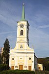
Catholic parish church hl. Georg ObjectID : 23242 |
Hauptstraße, Rappoltenkirchen 9 KG location : Rappoltenkirchen |
Catholic parish church, dedicated to St. George. Gothic elements in the choir, nave from the end of the 16th century. From 1733 to 1750 thoroughgoing Baroque style. Early classicist west facade; the tower was restored in 1816 after being destroyed in the war. |
ObjectID : 23242 Status: § 2a Status of the BDA list: 2020-02-29 Name: Catholic parish church hl. Georg GstNr .: .28 Parish Church Rappoltenkirchen |

|
Kindergarten ObjectID : 23241 |
Kreuthstraße, Rappoltenkirchen 2 KG location : Rappoltenkirchen |
Two-storey building from 1879 with a historicist facade and hipped roof. Formerly a school, until 1972 municipal office, today a kindergarten. |
ObjectID : 23241 Status: § 2a Status of the BDA list: 2020-02-29 Name: Kindergarten GstNr .: .1 |

|
Plague / Trinity Column ObjectID : 23243 |
KG location : Rappoltenkirchen |
Baroque Trinity Column, donated by Johann Adam Graf Questenberg in 1735 |
ObjectID : 23243 Status: § 2a Status of the BDA list: 2020-02-29 Name: Pest- / Dreifaltigkeitssäule GstNr .: 708/2 Dreifaltigkeitssäule Rappoltenkirchen |

|
Parsonage Object ID: 23227 |
Hauptstraße, Ried am Riederberg 9 KG location : Ried am Riederberg |
Two-story late historical building from 1884. |
ObjectID : 23227 Status: § 2a Status of the BDA list: 2020-02-29 Name: Pfarrhof GstNr .: 25 |

|
Hausberg und Wüstung Schlossberg ObjectID : 23237 |
Schlossberg location KG: Ried am Riederberg |
Castle ruins on the local mountain south of Ried am Riederberg, first documented mention of the castle in 1280, seat of the Ried taverns since 1286, deserted in the middle of the 15th century, probably used as a quarry since the 17th century, small structural remains, 1st half of the round tower ruins 13th century, 14th century castle wall and outer bailey, extensive rampart and moat system. |
ObjectID : 23237 Status : Notification Status of the BDA list: 2020-02-29 Name: Hausberg und Wüstung Schlossberg GstNr .: 417/1; 417/2; 428; 427; 426; 430/1; 430/4; 311/1 Ried castle ruins, Sieghartskirchen |

|
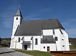
Catholic parish church hl. John the Baptist ObjectID : 23295 |
KG location : Ried am Riederberg |
Simple hall church with facade tower from 1826, surrounded by the cemetery. |
ObjectID : 23295 Status: § 2a Status of the BDA list: 2020-02-29 Name: Catholic parish church hl. John the Baptist GstNr .: .48 |
|
Catholic branch church hl. Valentin ObjectID : 23287 |
Röhrenbach 71 KG location : Röhrenbach |
Branch church of the Roman Catholic parish Sieghartskirchen on the edge of the extensive village green, dedicated to Saint Valentine. Gothic hall church with a western tower from the 15th century. |
ObjectID : 23287 Status: § 2a Status of the BDA list: 2020-02-29 Name: Kath. Filialkirche hl. Valentin GstNr .: .12 Filialkirche Röhrenbach |

|
Parsonage Object ID: 23218 |
Linzer Straße, Sieghartskirchen 2 KG location : Sieghartskirchen |
Two-storey building from the 18th century, essentially older. |
ObjectID : 23218 Status: § 2a Status of the BDA list: 2020-02-29 Name: Pfarrhof GstNr .: .34 Pfarrhof Linzer Straße, Sieghartskirchen 2 |

|
Former Parish School ObjectID : 23222 |
Linzer Straße, Sieghartskirchen 4 KG location : Sieghartskirchen |
Two-story building with a Biedermeier facade decor and hipped roof. |
ObjectID : 23222 Status: § 2a Status of the BDA list: 2020-02-29 Name: Former Parish school GstNr .: .35 Former Parish school, Sieghartskirchen |

|
Discovery zone Mühlgstätte ObjectID : 130316 |
Mühlgstätte site KG: Sieghartskirchen |
The Eisenpeutelhof , a former manor, is mentioned in a document in 1335. Note: The area was already protected in 2012 under the ID ArD-3-208. |
ObjectID : 130316 Status : Notification Status of the BDA list: 2020-02-29 Name: Fundzone Mühlgstätte GstNr .: 975/1; 976; 978; 992 |

|
Roman Villa Vogelwiese ObjectID : 128894 |
Vogelwiese location KG: Sieghartskirchen |
ObjectID : 128894 Status : Notification Status of the BDA list: 2020-02-29 Name: Römische Villa Vogelwiese GstNr .: 956/1; 957 |
|

|
Town Hall / Municipal Office, Former Post station with farm wing and stables, Nepomuk figure ObjectID : 23216 |
Wiener Straße, Sieghartskirchen 12 KG location : Sieghartskirchen |
The former post office, adapted as the town hall in 1983, is an originally single-storey building from the 16th century, which was rebuilt in a classicist style and extended in 1832. On the upper floor of the main facade there is a central balcony, above it a blind top with rectangular slots. Opposite is the former farm wing, which has been adapted several times, with stables from the 18th century. |
ObjectID : 23216 Status : Notification Status of the BDA list: 2020-02-29 Name: City Hall / Municipal Office, Former Post station with service wing and stables, Nepomuk figure GstNr .: .62 / 1 City Hall, former post station Sieghartskirchen |

|
Figure St. Johannes Nepomuk ObjectID: 23211 |
KG location : Sieghartskirchen |
Statue of St. Johannes Nepomuk with volute base at the foot of the Kirchberg, inscribed 1723. |
ObjectID: 23211 Status: § 2a Status of the BDA list: 2020-02-29 Name: Figur hl. Johannes Nepomuk GstNr .: 1470 Johannes Nepomuk, Kirchberg, Sieghartskirchen |

|
Figure St. Johannes Nepomuk ObjectID : 23212 |
KG location : Sieghartskirchen |
Statue of St. Johannes Nepomuk on volute base by the bridge over the Kleine Tulln, built in 1782. |
ObjectID : 23212 Status: § 2a Status of the BDA list: 2020-02-29 Name: Figur hl. Johannes Nepomuk GstNr .: 1456/4 Johannes Nepomuk, Postbrücke, Sieghartskirchen |
|
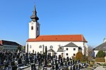
Catholic parish church hl. Margaretha ObjectID : 23214 |
KG location : Sieghartskirchen |
The core of the late Romanesque hall church, built over in Gothic style, surrounded by a cemetery and fortification wall. Mighty Romanesque gable tower and Gothic choir, interior baroque. |
ObjectID : 23214 Status: § 2a Status of the BDA list: 2020-02-29 Name: Catholic parish church hl. Margaretha GstNr .: .33 Catholic parish church hl. Margaretha Sieghartskirchen |
|
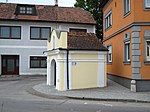
Rosalienkapelle ObjectID : 23224 |
KG location : Sieghartskirchen |
Chapel with arched portal under a curved gable from the 18th century, stands southwest of the parish church. |
ObjectID : 23224 Status: § 2a Status of the BDA list: 2020-02-29 Name: Rosalienkapelle GstNr .: 1467/3 Rosalienkapelle, Sieghartskirchen |

|
Figure shrine St. Florian statue ObjectID : 23219 |
KG location : Sieghartskirchen |
Statue of St. Florian, marked 1723, on a square stepped pillar. |
ObjectID : 23219 Status: § 2a Status of the BDA list: 2020-02-29 Name: Figurine picture stick hl. Florian statue GstNr .: 1472/3 Figure shrine St. Florian statue, Sieghartskirchen |
|
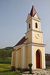
Local chapel St. Sebastian ObjectID : 23288 |
Location KG: Wagendorf |
The local chapel of St. Sebastian was built in 1906 at the suggestion of the landlord Josef Mayer as thanks for his recovery from an accident. It was consecrated in August 1907. |
ObjectID : 23288 Status: § 2a Status of the BDA list: 2020-02-29 Name: Ortskapelle hl. Sebastian GstNr .: .19 |
literature
- Peter Aichinger-Rosenberger, Evelyn Benesch, Kurt Bleicher, Sibylle Grün, Renate Holzschuh-Hofer, Wolfgang Huber, Herbert Karner, Katharina Packpfeifer, Anna Piuk, Gabriele Russwurm-Biró, Otmar Rychlik, Agnes Szendey, Franz Peter Wanek (editing). Christian Benedik, Christa Farka, Ulrike Knall-Brskovsky, Johann Kräftner , Markus Kristan, Johannes-Wolfgang Neugebauer , Marianne Pollak, Margareta Vyoral-Tschapka, Ronald Woldron (contributions): Dehio-Handbuch. The art monuments of Austria . Lower Austria south of the Danube. Part 1, A to L. Ed .: Federal Monuments Office. Berger Verlag, Horn / Vienna 2003, ISBN 3-85028-364-X , p. 385, 629, 765-769, 777-793 .
Web links
Commons : Listed objects in Sieghartskirchen - collection of images, videos and audio files
Individual evidence
- ↑ a b Lower Austria - immovable and archaeological monuments under monument protection. (PDF), ( CSV ). Federal Monuments Office , as of February 14, 2020.
- ↑ a b Bundesdenkmalamt (Ed.): Dehio-Handbuch. The art monuments of Austria . Lower Austria south of the Danube. Part 1, A to L. Berger Verlag, Horn / Vienna 2003, ISBN 3-85028-364-X , p. 3 .
- ↑ Bundesdenkmalamt (Ed.): Dehio-Handbuch. The art monuments of Austria . Lower Austria south of the Danube. Part 1, A to L. Berger Verlag, Horn / Vienna 2003, ISBN 3-85028-364-X , p. 2 .
- ↑ Bundesdenkmalamt (Ed.): Dehio-Handbuch. The art monuments of Austria . Lower Austria south of the Danube. Part 1, A to L. Berger Verlag, Horn / Vienna 2003, ISBN 3-85028-364-X , p. 4 .
- ^ Entry about Dietersdorf on Burgen-Austria
- ↑ § 2a Monument Protection Act in the legal information system of the Republic of Austria .