Loshausen
|
Loshausen
Municipality Willingshausen
Coordinates: 50 ° 53 ′ 10 ″ N , 9 ° 15 ′ 4 ″ E
|
|
|---|---|
| Height : | 216 m above sea level NHN |
| Area : | 6.91 km² |
| Residents : | 923 (Jan. 1, 2015) |
| Population density : | 134 inhabitants / km² |
| Incorporation : | 1st January 1974 |
| Postal code : | 34628 |
| Area code : | 06691 |
Loshausen is a district of the Willingshausen community in the Schwalm-Eder district in northern Hesse .
geography
Loshausen is located in the southern part of the Schwalm landscape, northeast of the main town, directly west of the confluence of the Grenff in the Eder tributary Schwalm , where the Treysa-Ziegenhain flood retention basin was created directly below Loshausen . In the village, the Wälzebach flows into the Alte Schwalm . District road 104 and state road 3263 meet in the village. Federal road 254 and district road 108 run to the east .
history
The village was first mentioned in a document in 1106. Loshausen was mentioned in documents that have survived under the following names (the year it was mentioned in brackets): Lazhusun (1106), Låzhusen (1240), Laishusen (1357), Loshusen (1365), Loshausen (1569).
During the Thirty Years' War , the village was completely burned down by the imperial troops of General Hans Rudolf von Breda on November 14, 1640, the day before the battle on Riebelsdorfer Berg , as was Niederlimitebach , Steina , Leimbach , Ransbach , Zella and Salmshausen .
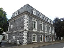
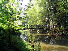
In 1891 the renaissance castle built in 1669 was demolished and replaced by the current castle . The castle park is located near the castle on both sides of the Schwalm river . In its eastern part, cultural events such as the World Music Festival and Rock im Park take place at regular intervals .
On 1 January 1974 in the wake of Loshausen was municipal reform in Hesse powerful state law with other municipalities and the community formed at 31 December 1971 Antrefftal to a new Village with the name Willingshausen together . Local districts were established for all former municipalities .
Cultural monuments
See the list of cultural monuments in Loshausen .
Infrastructure
In Loshausen there is
- a primary school
- the children's group Storchennest
- a village community center
Personalities
The doctor, theologian and painter Kurt Reuber (1906–1944) worked in Loshausen during his vicariate.
literature
- Literature about Loshausen in the Hessian Bibliography
- Search for Loshausen in the SPK digital portal of the Prussian Cultural Heritage Foundation
- Search for Loshausen in the archive portal-D of the German Digital Library
Web links
- Loshausen district. In: Internet presence. Willingshausen community
- Loshausen, Schwalm-Eder district. Historical local dictionary for Hessen. In: Landesgeschichtliches Informationssystem Hessen (LAGIS).
Individual evidence
- ↑ a b Loshausen, Schwalm-Eder district. Historical local dictionary for Hesse (as of December 11, 2014). In: Landesgeschichtliches Informationssystem Hessen (LAGIS). Hessian State Office for Historical Cultural Studies (HLGL), accessed on August 2, 2015 .
- ↑ Economy and Transport. In: website. Willingshausen community, archived from the original on April 27, 2017 ; accessed in September 2018 .
- ↑ Wikisource: Topographia Hassiae: Treysa
- ↑ Law on the reorganization of the districts Fritzlar-Homberg, Melsungen and Ziegenhain (GVBl. II 330-22) of September 28, 1973 . In: The Hessian Minister of the Interior (ed.): Law and Ordinance Gazette for the State of Hesse . 1973 No. 25 , p. 356 , § 2 ( online at the information system of the Hessian state parliament [PDF; 2,3 MB ]).
- ^ Federal Statistical Office (ed.): Historical municipality directory for the Federal Republic of Germany. Name, border and key number changes in municipalities, counties and administrative districts from May 27, 1970 to December 31, 1982 . W. Kohlhammer, Stuttgart / Mainz 1983, ISBN 3-17-003263-1 , p. 412 .


