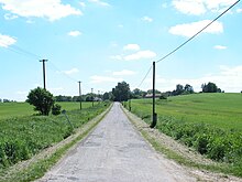
Lubno (Habry)
| Lubno | ||||
|---|---|---|---|---|
|
||||
| Basic data | ||||
| State : |
|
|||
| Region : | Kraj Vysočina | |||
| District : | Havlíčkův Brod | |||
| Municipality : | Habry | |||
| Area : | 178 ha | |||
| Geographic location : | 49 ° 45 ' N , 15 ° 27' E | |||
| Height: | 475 m nm | |||
| Residents : | 33 (2011) | |||
| Postal code : | 582 82 | |||
| License plate : | J | |||
| traffic | ||||
| Street: | Habry - Lubno | |||
Lubno is a district of the city of Habry in the Czech Republic . It is located three kilometers southwest of Habry and belongs to the Okres Havlíčkův Brod .
geography
Lubno is located in the Hornosázavská pahorkatina ( hill country on the upper Sázava ). The village is located on the left side of the Sázavka river on a small tributary. North of the village the state road II / 346 runs between Habry and Leština u Světlé , east the II / 347 between Habry and Světlá nad Sázavou .
Neighboring towns are Radinov , Chrtníč , Mlyn Kysibl and Kysibl in the north, Habry and Dolní Mlýn in the Northeast, Malý Mlýnek, Na Pekle, Miřátky and Proseč in the east, Bačkov the southeast, Zboží and Kunemil in the south, Na Obci, Dolní Dlužiny and Sázavka in South-west, Panský Mlýn, Kynice and Vrbice in the west and Dobrnice, Leština u Světlé and Štěpánov in the north-west.
history
Lubno was probably founded in the middle of the 13th century by the Wilmzell Benedictine monastery . The first written mention of the village was in 1307. Until the Hussite Wars , the place Habry with the associated villages Lubno, Štěpánov and Zboží remained in the possession of the monastery. After its destruction, Nicholas I Trčka of Lípa acquired the Habry domain and added it to the Lipnice domain . After the headquarters were moved to Světlá , the village became part of the Světlá domain.
After the death of Jan Rudolf Trčka von Lípa in 1634 the imperial general Johann Reinhard von Walmerode acquired the rule of Habry on Nymburk . He showed little interest in the new property, but couldn't find a buyer. In 1666 Johanna Eusebia Barbara Zdiarsky von Zdiar bought the Habry estate from the underage Walmerod heirs. The Countess Caretto di Millesimo by marriage sold Habry in 1681 to Johann Sebastian von Pötting and Persing on Žáky . In 1802 Adolph von Pötting and Persing sold the Habern rulership with the associated estates Tieß and Zboží to Johann von Badenthal, from whom his son Joseph inherited them in 1814.
In 1840 the village of Lubno, located in the Caslauer Kreis , consisted of 14 houses in which 84 people lived. The rectory was Smrdow . Until the middle of the 19th century, Lubno remained subject to the Habern rule.
After the abolition of patrimonial Lubno formed from 1849 a district of the municipality Zboží in the judicial district of Habern . From 1868 the village belonged to the Časlau district . Franz von Puthon, who had acquired the manor of Habern with Tieß and Zboží in 1862, sold it in 1869 to Franz Altgraf von Salm-Reifferscheidt-Hainspach on Světlá . In 1869 Lubno had 106 inhabitants and consisted of 14 houses. After the death of Franz von Salm-Reifferscheidt, the manor fell to his sister Johanna verw. from Thun and Hohenstein to Klösterle and Žehušice , in 1892 her son Joseph Oswald von Thun-Hohenstein-Salm-Reifferscheidt inherited the large estate. In 1900 there were 100 people in Lubno, in 1910 there were 90. After the death of Joseph Oswald von Thun-Hohenstein-Salm-Reifferscheidt, the manor of Světlá passed to the Prague Bodenbank in 1913, which it sold in 1914 to the entrepreneur Richard Moravetz. Lubno broke away from Zboží in 1917 and formed its own municipality. In 1930 Lubno had 94 inhabitants and consisted of 17 houses. In 1949 the municipality was assigned to the Okres Chotěboř, since the territorial reform of 1960 it has belonged to the Okres Havlíčkův Brod . In 1961 it was incorporated into Bačkov ; Since July 1, 1985 Lubno has been part of Habry. In the 2001 census, 40 people lived in the village's 14 houses.
Local division
The district forms the cadastral district of Lubno u Bačkova.
Attractions
- Cast iron cross in the village square
literature
- Historický lexikon obcí České republiky 1869–2005 , part 1, p. 550
Individual evidence
- ↑ http://www.uir.cz/katastralni-uzemi/600792/Lubno-u-Backova
- ^ Johann Gottfried Sommer : The Kingdom of Bohemia; Represented statistically and topographically. Volume 11: Caslauer Kreis. Ehrlich, Prague 1843, p. 231.
- ↑ http://www.uir.cz/katastralni-uzemi/600792/Lubno-u-Backova


