
Luro (administrative office)
| Luro administrative office | |||
|
|||
.jpg)
|
|||
| Administrative headquarters | Luro ( Upper Luro ) | ||
| surface | 125.4 km² | ||
| population | 7,124 (2015) | ||
| Sucos | Population (2015) | ||
| Afabubu | 439 | ||
| Baricafa | 1,013 | ||
| Cotamutu | 1,983 | ||
| Lacawa | 645 | ||
| Luro | 2.233 | ||
| Wairoque | 811 | ||
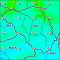
| Overview map | |||

|
|||

Luro ( Luru ) is an East Timorese administrative office ( Portuguese Posto Administrativo ) in the municipality of Lautém . It is divided into Upper and Lower Luro by the Adafuro River . The two largest settlement centers in each case are called Upper and Lower Luro , and both are often referred to as Luro. Confusion also arises because Lower Luro was the administrative center during the Indonesian occupation (1975 to 1999), but was then replaced by Upper Luro.
The locations
There are just under four kilometers between the two settlement centers of Luro. While Upper Luro is on the western border of the Sucos Luro to Cotamutu , Lower Luro is in the Suco Afabubu, on the Adafuro River .
Upper Luro
On the border between the Sucos Luro and Cotamutu lies the main town and the largest settlement center of the administrative office, which is made up of several districts. The center and the administrative headquarters of the administrative office are located in Suco Luro. These include the districts of Luro , Abere , Aelaneno , Afaia ( Afaea ), Amahira ( Amaira ), Baricafa ( Barikafa ), Ossufaso and Uatalano . The western outskirts of Cotamutu lies in the Suco Cotamutu. A little further out in Suco Luro are the villages of Fanice , Halaena , Sarelari ( Saralari ) and in Suco Cotamutu Ouroma ( Ourama , Oroma ) and Kotamutu .
The settlement center has a primary school, a medical post and a community health center. The municipal capital Lospalos is 17 km as the crow flies (65 km on the road) to the east and the state capital Dili is about 137 km to the west.
Under-Luro
The settlement center Unter-Luro ( Odufuro ) is located in Suco Afabubu , at the mouth of the Adafuro in the Raumoco river . The center of the village is on the north bank of the Adafuro, as are the districts Borugae ( Borogae , Borugai ), Boruvali ( Borowali , Boruwali ), Wairoque , Afa , Zefaliu , Soba ( sofa ), Afanami ( Ataname ), Ulturo ( Luturo ) and Dalari ( Daelari ) . To the south of the river lie the suburbs of Oneraba ( Onerafa , Onerafa ) and Lacawa ( Lakawa ). The settlement center includes a school to prepare for secondary school. The road from Ober-Luro to Lospalos runs through Unter-Luro.
The administrative office
geography

Until 2014, the administrative offices were still referred to as sub-districts .
The Luro Administrative Office is located in the west of the Lautém municipality. It is the only administrative office in Lautém that has no access to the sea. In the north and east is the Lautém administrative office, the Iliomar administrative office in the south and the municipality of Baucau with its administrative offices Baguia and Laga in the west . Before the 2015 regional reform, Luro had an area of 128.28 km². Now there are 125.4 km². Luro gave an area in the north to Lautém, but received a territory from Laga, which now protrudes in the west like an appendage into the neighboring administrative office.
Luro consists of six sucos. In Upper Luro there are the Baricafa ( Barikafa ), Cotamutu ( Cotamuto , Kotamuto ) and Luro with the administrative headquarters. In Unter-Luro ( Odufuro ) are the sucos Afabubu ( Afabubo ), Lacawa ( Lakawa ) and Wairoque ( Wairoke , Wairoce , Vairoque ). The demarcation of the sucos was significantly changed several times after the Indonesian occupation. Among other things, Afabubu and Wairoque exchanged practically all of their territory.
Luro is the highest administrative office in Lautém. It consists of a valley surrounded by hills and smaller mountains. The Legumau ( Legumaw , Apara ) in Suco Lacawa is the highest point at 1228 m (other sources after 1221 m or 1297 m ). The localities in the administrative office are spread out and are sometimes difficult to reach due to the landscape. For the 2007 parliamentary elections, some of the ballot boxes had to be transported by horses and helicopters.
- Climate data
Annual rainfall (2000)

Average annual temperature (2000)


Residents
7,124 people live in the administrative office (2015), of which 3584 are men and 3540 women. The population density is 56.8 inhabitants / km². The largest language group are the speakers of the national language Makasae . In Lower Luro, people speak the actual Makasae, while in Upper Luro the dialect Sa'ane is used. Tetum , Fataluku , Bahasa Indonesia and Portuguese (by the elders) are spoken as second languages . The average age is 17.0 years (2010, 2004: 17.3 years).
The politician Mariano Sabino Lopes was born in Luro. His father was Liurai from Luro.
politics

The administrator of the administrative office is appointed by the central government in Dili.
The politician Jacob Xavier was administrator Luros for four years in the 1960s. Jaime Camacho Amaral served as the last administrator appointed by the Portuguese from 1974 to 1975.
In 2015, Cecílio Soares was administrator.
economy
.jpg)
The administrative office has around 1000 hectares of arable land on which rice and maize are grown. 60% of the households in Luro grow corn, 54% rice, 51% coconuts, 51% cassava, 44% vegetables and 6% coffee. But many people are dependent on the income from their gardens. In addition, wild roots are collected and pets are kept. These are water buffalo, cattle, sheep, goats, pigs and, above all, chickens. In Ober-Luro there are also large numbers of ducks.
history
In June 2001 there was severe flooding, which together with mudslides destroyed many fields.
At the end of August 2011, four people died in a clash between two martial arts groups in Baricafa. As a result, Prime Minister Xanana Gusmão ordered the closure of martial arts clubs.
Web links
Individual evidence
- ↑ a b c d e Direcção-Geral de Estatística : Results of the 2015 census , accessed on November 23, 2016.
- ↑ a b c Lautém District Development Plan 2002/2003 ( Memento of the original dated February 3, 2011 in the Internet Archive ) Info: The archive link was inserted automatically and has not yet been checked. Please check the original and archive link according to the instructions and then remove this notice. (English; PDF file; 1.97 MB)
- ↑ a b c d e Ministry of State Administration and Territorial Management : Map of the Luro Administration Office ( Memento of the original from January 10, 2017 in the Internet Archive ) Info: The archive link was inserted automatically and has not yet been checked. Please check the original and archive link according to the instructions and then remove this notice. , accessed March 3, 2017.
- ↑ Jornal da República : Diploma Ministerial no 24/2014 de 24 de Julho - Orgânica dos Postos Administrativos ( Memento of March 4, 2016 in the Internet Archive )
- ↑ a b Timor-Leste GIS Portal ( Memento from June 30, 2007 in the Internet Archive )
- ↑ a b UNMIT: Timor-Leste District Atlas version 02, August 2008 ( Memento of the original dated December 3, 2011 in the Internet Archive ) Info: The archive link was inserted automatically and has not yet been checked. Please check the original and archive link according to the instructions and then remove this notice. (PDF; 389 kB)
- ↑ a b Direcção Nacional de Estatística: 2010 Census Wall Chart (English) ( Memento of the original from August 12, 2011 in the Internet Archive ) Info: The archive link was automatically inserted and not yet checked. Please check the original and archive link according to the instructions and then remove this notice. (PDF; 2.5 MB)
- ↑ List of polling stations (PDF; 121 kB)
- ↑ a b Seeds of Life
- ↑ Direcção Nacional de Estatística: Census of Population and Housing Atlas 2004 ( Memento of November 13, 2012 in the Internet Archive ) (PDF; 14 MB)
- ^ Profile on the Partido Democrático website. Archived from the original on July 12, 2012 ; Retrieved January 5, 2016 .
- ↑ Douglas Kammen: Fragments of utopia: Popular yearnings in East Timor , Journal of Southeast Asian Studies, 40 (2), pp. 385–408 June 2009, doi: 10.1017 / S0022463409000216 .
- ↑ President's Facebook page: Biografia Jaime Camacho Amaral
- ↑ Ministério da Administração Estatal: Administração Municipal ( Memento of the original from June 1, 2016 in the Internet Archive ) Info: The archive link has been inserted automatically and has not yet been checked. Please check the original and archive link according to the instructions and then remove this notice.
- ↑ Direcção Nacional de Estatística: Suco Report Volume 4 (English) ( Memento of the original from April 9, 2015 in the Internet Archive ) Info: The archive link was inserted automatically and has not yet been checked. Please check the original and archive link according to the instructions and then remove this notice. (PDF; 9.8 MB)
- ↑ Diario Nacional, 23 August 2011, Gusmão calls for closing down GAM in Lautém
Coordinates: 8 ° 33 ′ S , 126 ° 50 ′ E