Lutzberg
|
Lutzberg
community Gerstungen
Coordinates: 50 ° 57 ′ 50 ″ N , 10 ° 6 ′ 53 ″ E
|
|
|---|---|
| Height : | 315 m above sea level NN |
| Postal code : | 99834 |
| Area code : | 036922 |
|
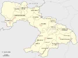
Lutzberg in the west of the municipality
|
|
The Lutzberg is a district of the Gerstungen municipality in the Wartburg district in Thuringia .
location
The Lutzberg is located about three kilometers east of Gerstungen and about nineteen kilometers (as the crow flies ) northwest of the district town of Bad Salzungen . The Lutzberg is located in a wooded area in a cleared area of the Böller . The geographic height of the place is 315 m above sea level. NN .
history
Hof Lutzberg belonged to a group of farms and small settlements that were founded in the Brandenburg area near Lauchröden . The place had always been parish and schooled in Herda . The size of the corridor was 54.6 hectares .
traffic
The Lutzberg was once built on a branch of the Kurz Hessen trade route , and the Sallmannshäuser Rennsteig runs right past the farm. Today, the settlement is somewhat remote from traffic and can be reached via the Gerstungen - Oberellen local road .
literature
- Erich Winter: The village settlements of the Eisenacher Land between Werra, Hainich and Thuringian Forest . Jena 1932, p. 78 .
Web links
Individual evidence
- ↑ Official topographic maps of Thuringia 1: 10,000. Wartburgkreis, district of Gotha, district-free city of Eisenach . In: Thuringian Land Survey Office (Hrsg.): CD-ROM series Top10 . CD 2. Erfurt 1999.
- ↑ Erich Winter The village settlements of the Eisenacher Land between Werra, Hainich and Thuringian Forest . Jena 1932.
- ^ C. Kronfeld, Regional Studies of the Grand Duchy of Saxony-Weimar-Eisenach. Second part. Weimar 1879. p. 63


