Mölmeshof
|
Mölmeshof
community Gerstungen
Coordinates: 50 ° 55 ′ 16 ″ N , 10 ° 10 ′ 43 ″ E
|
|
|---|---|
| Height : | 240 m above sea level NN |
| Incorporated into: | Marksuhl |
| Postal code : | 99834 |
| Area code : | 036925 |
|
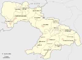
Mölmeshof in the south of the municipality
|
|
The Mölmeshof is a district of the Gerstungen community in the Wartburg district in Thuringia .
location
The Mölmeshof is located about 1.8 kilometers west of the local area of Marksuhl and about 12 kilometers (as the crow flies ) from the district town of Bad Salzungen . It is located in a wooded area on the Mölmesbach, a left tributary of the Suhl . There is a fish pond at the height of the locality .
history
The Mölmeshof belongs to a group of farms and small settlements ( Baueshof , Claus Berg , Lutz Mountain , Warrior Mountain , Hütschhof , Frommeshof , Rangenhof , Meileshof , Lindigshof , Josthof and others) that the dominion of the Franks Steiner counts and their home monastery Frauensee since the High Middle Ages in Buntsandstein Hill country near Marksuhl were founded. In the middle of the 19th century the building yard had 5 houses and 27 residents. The place had always been parish and schooled in Marksuhl. Not far to the west of the village are the remains of a late medieval glassworks near a spring . The oldest written mention of the Mölmeshof took place in 1531.
The villa-like manor building has been extensively renovated since the 1990s and has served as a training and conference location since 1997.
traffic
The Mölmeshof is on the local connection road Baueshof - Mölmeshof - Josthof, on Landstrasse 1023. There is no direct bus connection to Mölmeshof. The closest stop is at the building's yard, it belongs to the bus line L-52 on the Eisenach - Förtha - Marksuhl - Berka / Werra - Dankmarshausen - Großensee transport company operated by the Wartburgkreis.
Culture and sights
The Mölmeshof is located on the ecumenical pilgrimage route in the section from Eisenach via Frauensee, Vacha to Bad Hersfeld and Fulda . The lovingly restored manor building can be used as a pilgrimage hostel.
literature
- Erich Winter: The village settlements of the Eisenacher Land between Werra, Hainich and Thuringian Forest . Jena 1932, p. 78 .
- W. Döpel: History of Marksuhl , printing and publishing house of the Hofbuchdruckerei Eisenach H. Kahle, Eisenach 1909
Web links
Individual evidence
- ↑ Official topographic maps of Thuringia 1: 10,000. Wartburgkreis, district of Gotha, district-free city of Eisenach . In: Thuringian Land Survey Office (Hrsg.): CD-ROM series Top10 . CD 2. Erfurt 1999.
- ↑ Erich Winter The village settlements of the Eisenacher Land between Werra, Hainich and Thuringian Forest . Jena 1932.
- ^ C. Kronfeld, Regional Studies of the Grand Duchy of Saxony-Weimar-Eisenach. Second part. Weimar 1879. pp. 47f


