Lindigshof (Gerstungen)
|
Lindigshof
community Gerstungen
Coordinates: 50 ° 53 ′ 21 ″ N , 10 ° 12 ′ 51 ″ E
|
|
|---|---|
| Height : | 260 m above sea level NN |
| Area : | 4.11 km² |
| Incorporation : | March 5th 1970 |
| Incorporated into: | Marksuhl |
| Postal code : | 99834 |
| Area code : | 036925 |
|
Lindigshof in the south of the municipality
|
|
|
Partial view from the east (2012)
|
|
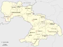
The Lindigshof is a district of the Gerstungen community in the Wartburg district in Thuringia .
location
The Lindigshof is located about one and a half kilometers southeast of the local area of Marksuhl and about ten kilometers (as the crow flies ) from the district town of Bad Salzungen . The Lindigshof is located in a wooded area on the upper reaches of the Suhl River . The dam of the Ettenhausen dam is located in the 4.11 km² area .
history
Today, Lindigshof is the largest district in terms of population of a group of farms and small settlements ( Baueshof , Clausberg , Lutzberg , Kriegersberg , Hütschhof , Frommeshof , Rangenhof , Mölmeshof , Meileshof , Josthof and others) that belong to the domain of the Frankenstein counts and their home monastery Frauensee were founded since the High Middle Ages in the red sandstone hill country near Marksuhl. In 1879, based on the census of 1875, statistical information on the place Lindigshof was published for the first time. Lindigshof had 13 houses with 69 residents this year. The place had always been parish and schooled in Ettenhausen an der Suhl . Politically, he belonged to the Frauensee office , which came from the Electorate of Hesse to the Grand Duchy of Saxony-Weimar-Eisenach in 1815 . The size of the fields was 144 hectares - of which farms and gardens 2.3 hectares, meadows 40 hectares, arable land 68 hectares, forests 4.6 hectares, ponds, streams and rivers 0.9 hectares. Paths, drifts, wastelands and orchards were allotted 27 hectares. On the northern outskirts there was a mill on the bank of the Suhl. The original Lindigshof and the majority of the old half-timbered buildings were replaced by massive brick buildings after 1900. The small town already consists of around 30 percent new buildings from the post-reunification period. Until July 6, 2018, Lindigshof belonged to the Marksuhl community and merged with it in the Gerstungen community.
traffic
The Lindigshof is located on the Möhra - Marksuhl local road on Landstrasse 1023. The 119 bus runs to Lindigshof on the Eisenach - Förtha - Marksuhl - Burkhardtroda - Kupfersuhl route operated by the Wartburgmobil transport company .
literature
- Erich Winter: The village settlements of the Eisenacher Land between Werra, Hainich and Thuringian Forest . Jena 1932, p. 78 .
- W. Döpel: History of Marksuhl , printing and publishing house of the Hofbuchdruckerei Eisenach H. Kahle, Eisenach 1909
Individual evidence
- ↑ Official topographic maps of Thuringia 1: 10,000. Wartburgkreis, district of Gotha, district-free city of Eisenach . In: Thuringian Land Survey Office (Hrsg.): CD-ROM series Top10 . CD 2. Erfurt 1999.
- ↑ Erich Winter The village settlements of the Eisenacher Land between Werra, Hainich and Thuringian Forest . Jena 1932.
- ^ C. Kronfeld, Regional Studies of the Grand Duchy of Saxony-Weimar-Eisenach . Second part. Weimar 1879. p. 47


