Mönchengladbach city center
|
former city district
Mönchengladbach-Stadtmitte City of Mönchengladbach
|
|
|---|---|
| Coordinates: 51 ° 11 '39 " N , 6 ° 25' 54" E | |
| Height : | 40-77 m above sea level NN |
| Area : | 15.8 km² |
| Residents : | 57,550 (Dec. 31, 2008) |
| Population density : | 3,642 inhabitants / km² |
| Postcodes : | 41061, 41063, 41065 41066, 41068, 41069 |
| Area code : | 02161 |
|
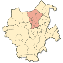
Location of the former Stadtmitte district in the city of Mönchengladbach until October 2009
|
|
Until 2009, Mönchengladbach-Stadtmitte was the most populous of the ten boroughs of the city of Mönchengladbach at the time, with over 57,000 inhabitants . In addition to the actual city center ( Gladbach district ), the district also included the official districts of Windberg (with Großheide ), Eicken , Am Wasserturm , Waldhausen , Westend (with Speick ), Dahl (with Hermges ) and Ohler .
The municipality was merged with the Hardt district to form the new northern district on October 22, 2009 . This administrative reform was passed on February 27, 2008 by the Mönchengladbach City Council with a narrow majority of just one vote.
Gladbach:
Mönchengladbach MinsterGladbach:
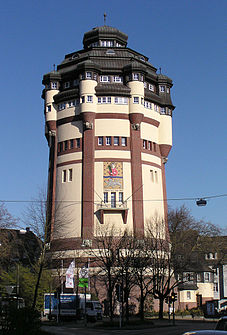
Central stationAt the water tower:
Kaiser-Friedrich-Halle
Individual evidence
-
↑ Statistisches Handbuch Mönchengladbach 2006–2010 ( page no longer available , search in web archives ) Info: The link was automatically marked as defective. Please check the link according to the instructions and then remove this notice. Online brochure from the City of Mönchengladbach, Department of Urban Development and Planning. Retrieved January 16, 2013.
- ^ City districts and districts . City of Mönchengladbach. Retrieved January 15, 2013.
- ↑ 4 boroughs without asking the citizens . BürgerZeitung Mönchengladbach. Retrieved January 15, 2013.
- ^ Ralf Jüngermann: Four districts - one trembling victory . RP Online GmbH. February 28, 2008. Retrieved January 15, 2013.


