Mühlenbachtal near Trittau
Coordinates: 53 ° 38 ′ 4 " N , 10 ° 24 ′ 13" E
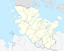
The Mühlenbachtal near Trittau is a nature reserve in the Schleswig-Holstein communities of Grönwohld and Trittau in the Stormarn district.
The 81.3 hectare nature reserve is registered with the number 121 in the directory of nature reserves of the Ministry of Agriculture, Environment and Rural Areas. It was expelled in 1986 (date of regulation: June 5, 1986). The nature reserve is part of the 120 hectare FFH area “Trittauer Mühlenbach and Drahtmühlengebiet”. The responsible lower nature conservation authority is the Stormarn district.
The nature reserve is located east of Hamburg . It comprises the valley of the Mühlenbach between Grönwohldhof and Trittau and the valley of the Obek, a tributary of the Mühlenbach, southeast of Grönwohld. Mühlenbach and Obek flow through the area close to nature. They have flooding aquatic vegetation and are often accompanied by bushes, alluvial forests and swamp forests , but also swamp perennials and reeds . In parts, the brooks also flow through extensively used meadows . There are artificially created fish ponds in several places.
The former embankment of the Schwarzenbek – Bad Oldesloe railway line , which is now used as a cycle path , crosses the nature reserve in several places .
Individual evidence
- ^ State ordinance on the nature reserve "Mühlenbachtal bei Trittau" of June 5, 1986 , state regulations and state case law, state government Schleswig-Holstein. Retrieved March 25, 2013.
- ↑ Trittauer Mühlenbach and wire mill area , profiles of the Natura 2000 areas, Federal Agency for Nature Conservation . Retrieved September 24, 2019.
- ↑ Tour 10 - Pedaling on old railroad tracks , cycling in Stormarn, Stormarn district. Retrieved March 25, 2013.


