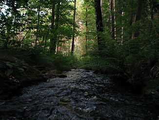
Münzbach (Freiberg Mulde)
|
Münzbach Loßnitzbach |
||
|
The Münzbach between the Erzengler and Rothbach ponds |
||
| Data | ||
| Water code | DE : 54216 | |
| location | Saxony , Germany | |
| River system | Elbe | |
| Drain over | Freiberger Mulde → Mulde → Elbe → North Sea | |
| Headwaters | At Brand-Erbisdorf 50 ° 50 ′ 23 ″ N , 13 ° 19 ′ 57 ″ E |
|
| Source height | approx. 520 m above sea level NHN | |
| muzzle | At Halsbrücke in the Freiberger Mulde coordinates: 50 ° 57 '31 " N , 13 ° 19' 49" E 50 ° 57 '31 " N , 13 ° 19' 49" E |
|
| Mouth height | approx. 300 m above sea level NHN | |
| Height difference | approx. 220 m | |
| Bottom slope | approx. 12 ‰ | |
| length | 18.5 km | |
| Medium-sized cities | Freiberg | |
| Small towns | Brand-Erbisdorf | |
The Münzbach (mostly regionally referred to as the Münzbach) or Loßnitzbach is an 18.5 km long left tributary of the Freiberg Mulde in Saxony .
course
The Münzbach rises about 3 km south of Brand-Erbisdorf in the Niederfrei forest, about 535 m above sea level . Even in this part of the forest, it ties in the Kohlbach artificial ditch or absorbs its water. It flows in a northeasterly direction and feeds the Erzengler pond and the artificial ponds Rothbächer pond and Lother pond at 495 m above sea level . With the Lother pond, it touches the Hohbirker Kunstgraben at the same time . In the western part of Weißenborn / Erzgeb. Belonging place Berthelsdorf , he passes the road Brand-Erbisdorf - Weißenborn and the railway line Freiberg - Brand-Erbisdorf - Großhartmannsdorf to flow into the Great Hüttenteich at approx. 445 m above sea level. The Münzbach leaves this again in a northerly direction and passes the Langenrinne district . The new pond in Oberloßnitz was not restored after its break on June 2, 1839.
The Münzbach has been piped in the city of Freiberg since the 19th century . The beginning of the piping is located south of the Saxony-Franconian main road about 400 m above sea level. The Münzbach is still the main receiving water of the Freiberg sewer system, since 2003 the renewal of the Münzbach collecting sewer has been carried out in stages to separate the stream and the sewage (mixed water). After about 2.5 km at a height of about 375 m above sea level, it leaves the underground course heading north, after it has taken in the also piped Goldbach as the only noteworthy tributary . It flows through the Freiberg district of Loßnitz and then enters its ever-deepening valley. On the last section it runs again at about 300 m under a 30 m high dump that seals off the valley of the Münzbach .
Near the Altväterbrücke and the Rothenfurter Mühle, the Münzbach flows into the Freiberg Mulde after about 5 km between Halsbrücke and Rothenfurth at a height of 295 m above sea level.
The Münzbach overcomes a height difference of around 220 m.
See also
literature
- Schräber, Dieter: The Münzbachtal between the Berthelsdorfer Hüttenteich and the city of Freiberg: a contribution to research into local history ; Open Monument Day 2003. Freiberg: City Administration, Monument Office, 2003. - 24 pp.

