Mendlingbach
|
Mendlingbach Lassingbach |
||
|
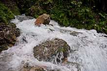
Middle reaches of the Mendlingbach |
||
| Data | ||
| Water code | AT : 40109 | |
| River system | Danube | |
| Drain over | Salza → Enns → Danube → Black Sea | |
| River basin district | Danube below Jochenstein (DUJ) | |
| confluence | several streams 47 ° 46 ′ 6 ″ N , 14 ° 50 ′ 26 ″ E |
|
| Source height | approx. 720 m above sea level A. | |
| muzzle | For ore heaps in the Salza coordinates: 47 ° 42 ′ 44 ″ N , 14 ° 49 ′ 51 ″ E 47 ° 42 ′ 44 ″ N , 14 ° 49 ′ 51 ″ E |
|
| Mouth height | 492 m above sea level A. | |
| Height difference | approx. 228 m | |
| Bottom slope | approx. 23 ‰ | |
| length | 10 km | |
| Catchment area | 45.99 km² | |
| Left tributaries | Schwarzbachgraben, Schwölleckbach, Königsgraben, Dürrengraben, Bösgraben | |
| Right tributaries | Legoner, Halstal, Raffelbach | |
| Communities | Hollenstein an der Ybbs , Göstling an der Ybbs , Landl | |
The Mendlingbach is a small tributary of the Salza in the Lower Austrian - Styrian border area in the Ybbstal Alps .
Run and landscape
The Mendlingbach, about ten kilometers long, circles the Scheibenberg ( 1400 m above sea level ), the eastern foothills of the Gamssteinzug ( pre-alpine group of the Ybbstal pre-Alps ).
The Mendlingbach rises east of the Promau , between Scheibenberg in the south and Königsberg 1,452 m above sea level. A. in the north, where it is formed from several small bodies of water ( Großer Höllgraben, Kleiner Höllgraben, Seitgraben, Lebersgraben from Königsberg and Schwarzbachgraben from Bodingsattel).
From above Großegg , near Halstal , the brook turns to the southeast, first in a short gorge section, then a gentle valley, on the left is the Schwölleck ( 1069 m above sea level ), on the right the broad sides of the Scheibenberg. The Großegger spring , a karst spring, is also located near Grossegg .
At Lassing , which is about 100 m higher, the brook then swings southwest and flows straight on until it (also known as Lassingbach ) flows into the Salza at Erzhalden . Mendling is located in the lower reaches of the valley . From the Hochkar in the south the Mendlingbach takes up the channels from Königsgraben, Dürrengraben and Bösgraben , from the Scheibenberg the Raffelgraben .
Nature, traffic and tourism
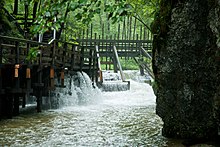
The middle Mendlingtal today forms the adventure world Auf dem Holzweg in the middle Mendlingtal, which documents the ironmongery of the Eisenwurzen as an open-air museum . It is one of the last existing functioning wood drift systems in Central Europe, with mills, a Venetian boardsaw, blacksmith's journeyman's house, fish ponds and, in summer, drifting demonstrations. The hiking trail leads from the upper end of the village to the Hammerherrenhaus in Großegg.
The overflow in Lower Austria is in the natural park [ Niederösterreichische ] Eisenwurzen , the agent running in protected landscape Oetscher-Dürrenstein , the steirische underflow in the protected area Wildalpener Salzatal and natural park [ Steirische ] Eisenwurzen .
Although the Erlauftal Straße B 25 runs on the lower reaches , despite the town and the middle reaches used for hydraulic engineering (there the L6179 Lassing - Hof-Großegg runs above the slope), the valley is largely natural, on the upper reaches natural, the municipal road Großegg - Hollenstein runs sideways a side ditch.
The creek is not an explicit destination for white water sports , but is managed with difficulty level II / III.
Großegger spring
The Großegger spring , also known as the Großegger spring , (location) is a karst spring at the northern foot of the approximately 1400 m above sea level. A. high Scheibenberg . It is located on the orographic right bank of the Mendlingbach south of Großegg . The stream that rises there is used to operate a flour mill. The spring water rises from a vertical shaft cave in the rock.
literature
- Ernst Zettel: Our Mendlingttal as I experience it. undated ( pdf , goestling.at, accessed April 22, 2012)
- M. Moser: Report 2003 on geological recordings in the Lassing (Lower Austria) - Mendlingbach - Scheibenberg area on sheet 101 iron ore. Federal Geological Institute, Vienna 2004.
Web links
- www.erlebniswelt-mendlingtal.at
- Photo gallery of the market town of Göstling an der Ybbs → Erlebniswelt Mendlingtal , goestling.at
Individual evidence
-
↑ a b only in ÖK 200, at the mouth; Usage of the name for the lower reaches
Lassing [ bach ] are also called the next two streams upstream at Gußwerk and at Wildalpen (Holzäpfelbach) -
↑ a b c d source in map series not exactly determined; Atlas river map (in the search "Places / Mountains / Areas:" enter "Mendlingbach") → Coordinate measurement;
Information according to the water book Water code numbers / groundwater body: 401090001 Mendlingbach lower course : 2,000 m; 401090002 Mendlingbach middle course 1 : 3,000 m; 401090003 Mendlingbach Middle Run 2 : 2,500 m; 401090004 Mendlingbach upper course : 2,500 m;
Styrian share according to the digital body of water index Styria : Mendlingbach ; Water number: 2519; Length of water: 4.173 km; wis.stmk.gv.at , (https) - ↑ Digital Atlas Styria Map Service: Flora & Fauna , Waters → Coordinate Measurement
- ↑ BMLFUW (Hrsg.): List of areas of the Austrian river basins: Enns area. In: Contributions to Austria's Hydrography Issue No. 61, Vienna 2011, p. 38. PDF download , accessed on July 7, 2018.
- ^ Werner: Grosseggerquelle. Traffic report from Grosseggerquelle on December 8th, 2006 ( page no longer available , search in web archives ) Info: The link was automatically marked as defective. Please check the link according to the instructions and then remove this notice. (pdf, cavediving.aeliumcetium.at, accessed April 22, 2012)
- ↑ Mendlingbach , flow database, 4-paddlers.com


