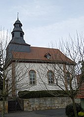
Moischeid
|
Moischeid
community Gilserberg
Coordinates: 50 ° 58 ′ 0 ″ N , 9 ° 2 ′ 56 ″ E
|
|
|---|---|
| Height : | 334 m above sea level NHN |
| Area : | 7.64 km² |
| Residents : | 295 (Jun. 30, 2016) |
| Population density : | 39 inhabitants / km² |
| Incorporation : | 1st January 1974 |
| Postal code : | 34630 |
| Area code : | 06696 |
Moischeid [ ˈmøːʃaɪ̯t ] is a district of about 300 inhabitants in the community of Gilserberg in the Schwalm-Eder district in North Hesse .
Geographical location
The place is about two kilometers northwest of the core village Gilserberg in the Gilserberg highlands , a plateau that extends along the upper reaches of the Gilsa , which flows east of Moischeid . To the north of the village rises 585 m above sea level belonging to the Kellerwald and the Kellerwald-Edersee Nature Park . NN high Jeust .
The state road 3155 leads through Moischeid from Gilserberg to Gemünden , from which the district road 94 branches off to Schönstein .
history
Moischeid was first mentioned as Munescheiz in 1253 , when the knights Rudolph and Konrad Krug transferred the place they held as a fief from the Counts of Ziegenhain to the Haina monastery . The village was administered by the office of Schönstein . In the center of the village there was an aristocratic mansion, which was sold by the von Storck family in 1909 and whose main building, the so-called Old Castle , was demolished in 1956 due to its disrepair. Only the so-called “tenant house” still stands today.
The Kellerwaldbahn , opened in 1911 and shut down in 1972, ran in a loop south around the village, a train station was located between Moischeid and Gilserberg.
On January 1, 1974, the municipality of Moischeid lost its independence and, in the course of the regional reform in Hesse, became part of the greater municipality of Gilserberg by state law .
Natural monuments
- Oak with a chest height of 8.12 m (2014).
Individual evidence
- ↑ a b Moischeid, Schwalm-Eder district. Historical local dictionary for Hessen. (As of November 11, 2014). In: Landesgeschichtliches Informationssystem Hessen (LAGIS).
- ↑ Gilserberg - data and facts. Population numbers. BVB-Verlagsgesellschaft mbH, 2016, accessed on May 3, 2018 .
- ^ Helfrich Bernhard Wenck: Hessische Landesgeschichte, second volume. Document book for the second volume of the Hessian national history. Varrentrapp and Wenner, Frankfurt and Leipzig, 1789, p. 176 (CXLIX)
- ↑ Law on the reorganization of the districts Fritzlar-Homberg, Melsungen and Ziegenhain (GVBl. II 330-22) of September 28, 1973 . In: The Hessian Minister of the Interior (ed.): Law and Ordinance Gazette for the State of Hesse . 1973 No. 25 , p. 356 , § 1 ( online at the information system of the Hessian state parliament [PDF; 2,3 MB ]).
- ^ Federal Statistical Office (ed.): Historical municipality directory for the Federal Republic of Germany. Name, border and key number changes in municipalities, counties and administrative districts from May 27, 1970 to December 31, 1982 . W. Kohlhammer, Stuttgart / Mainz 1983, ISBN 3-17-003263-1 , p. 412 .
- ^ Entry in the directory of monumental oaks . Retrieved January 10, 2017
Web links
- Districts on the website of the community of Gilserberg.
- Moischeid, Schwalm-Eder district. Historical local dictionary for Hessen. In: Landesgeschichtliches Informationssystem Hessen (LAGIS).
- Literature on Moischeid in the Hessian Bibliography


