
Nuglar-St. Pantaleon
| Nuglar-St. Pantaleon | |
|---|---|
 |
|
| State : |
|
| Canton : |
|
| District : | Dorneck |
| BFS no. : | 2478 |
| Postal code : | 4412 |
| Coordinates : | 619 182 / 257970 |
| Height : | 488 m above sea level M. |
| Height range : | 357–715 m above sea level M. |
| Area : | 6.34 km² |
| Residents: | 1487 (December 31, 2018) |
| Population density : | 235 inhabitants per km² |
| Website: | www.nuglar.ch |
| Location of the municipality | |
  |
|
Nuglar-St. Pantaleon is a municipality in the district of Dorneck in the canton of Solothurn in Switzerland . The place name goes back to the Latin word nucariolum (walnut grove ) and is pronounced in the dialect Nuglä-Bäntlion .
geography

Nuglar-Sankt Pantaleon is 488 m above sea level. M. , around 4 km southwest of the city of Liestal (linear distance). The clustered village of Nuglar extends on a plateau inclined to the east, the lower level of the Gempen plateau in the Tafeljura , above the Oristal, in the Schwarzbubenland .
The area of the 6.3 km² municipal area covers a section of the northern Jura . The eastern border is formed by the Orisbach , which flows in a valley sunk into the Tabular Jura with a valley floor of around 200 m wide and steep valley flanks. The Brunnenbachtal and a short valley that separates Nuglar from Sankt Pantaleon flow into the Oristal on the municipal spell . Between these valleys are the high plateaus of Nuglar and Sankt Pantaleon. These gradually rise towards the west, before a densely wooded, around 100 m high steep step to the plateau of the Gempen plateau follows. The layer level is structured from south to north by the protrusions of Schlimmberg ( 680 m above sea level ), Chanzel ( 700 m above sea level ) and Disliberg ( 700 m above sea level ). At 715 m above sea level M. the highest point of Nuglar-Sankt Pantaleon is reached at the watch . The western boundary of the municipality mostly runs on the eastern edge of the Gempen plateau above the steep drop to the lower areas. To the north, the parish extends over the Muni plateau ( 580 m above sea level ) into the Röserental . In 2014/15, 12% of the municipal area was accounted for by settlements, 42% for forests and woodlands, 45% for agriculture and a little less than 1% for unproductive land.
Nuglar-Sankt Pantaleon includes the districts of Nuglar ( 487 m above sea level ) on the plateau below the Chanzel, Sankt Pantaleon ( 488 m above sea level ) on the plateau below Schlimmberg and Herrenberg, the hamlet of Neunuglar ( 360 m above sea level) . M. ) and Orismühle ( 373 m above sea level ) in the Oristal and some individual farms. Neighboring communities of Nuglar-Sankt Pantaleon are Büren (SO) and Gempen in the canton of Solothurn and Frenkendorf , Liestal , Seltisberg and Lupsingen in the canton of Basel-Landschaft .
population
With 1,487 inhabitants (as of December 31, 2018), Nuglar-Sankt Pantaleon is one of the smaller communities in the canton of Solothurn. 96.3% of the residents speak German, 0.7% speak Italian and 0.7% speak English (as of 2000). The population of Nuglar-Sankt Pantaleon was 658 in 1850 and 666 in 1900. In the course of the 20th century the population increased slowly but steadily. Only since 1980 (880 inhabitants) has a significant increase in population been recorded.
economy
Until the second half of the 20th century, Nuglar-Sankt Pantaleon was primarily an agricultural village. Even today, arable farming and fruit growing (especially cherry trees) as well as dairy farming and cattle breeding play an important role in the income structure of the population. Further jobs are available in local small businesses and in the service sector, including in companies in the construction industry, wood processing and mechanical workshops. In the last few decades the village has developed into a residential community. Many workers are therefore commuters who work mainly in the Liestal region and in the Basel agglomeration .
traffic
The community is located off the main thoroughfares on a connecting road from Liestal to Dornach . Both Nuglar and Sankt Pantaleon are connected to the public transport network through a Postbus course , which covers the route from Liestal to Büren .
history
Individual stray finds show that the municipality of Nuglar-Sankt Pantaleon was already populated during the Neolithic . There was probably a Roman manor near Sankt Pantaleon .
Nuglar was first mentioned in a document in 1147 under the name Nugerolo . Later the names Nugerol (1156), Nugeron (1289), Nuglen (1436), Nugler (1458), Niglars (1482) and Nuglar (1509) appeared. Sankt Pantaleon is mentioned for the first time in 1285. A settlement must have existed much earlier, however, which had taken the name of the church patron in the course of the 13th century. Later spellings are Sant Panthaleon (1372) and Sant Pantlion (1470).
Nuglar and Sankt Pantaleon have belonged to the real estate of Beinwil Monastery since they were first mentioned . The counts of Thierstein later held secular rule. In 1522 both villages came to Solothurn and were assigned to the Thierstein Vogtei. After the collapse of the Ancien Régime (1798), Nuglar and Sankt Pantaleon belonged to the Dornach district during the Helvetic Republic and to the Dorneck district from 1803. In the 19th century, both localities were united into one political municipality.
Attractions
The Catholic parish church of Saint Pantaleon, which dates back to a chapel from the 13th century, was rebuilt in 1823. Together with the rectory (1756) and the Meierhaus (1684) as well as the churchyard and the rectory garden, it forms a closed church district. In Nuglar there is the Sankt Wendelinskapelle, built in 1713, with a remarkable baroque crucifix. Both town centers have preserved characteristic farmhouses from the 17th to 19th centuries.


Old school house, Nuglar
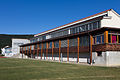
Primary school, Nuglar

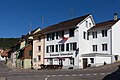
Village square, Nuglar

Kirchgasse, St. Pantaleon

Farmhouse from 1775, St. Pantaleon
Restaurant Schwarzbueb, Nuglar


literature
- Gottlieb Loertscher: The art monuments of the canton of Solothurn, Volume III: The districts of Thal, Thierstein, Dorneck. (= Art Monuments of Switzerland. Volume 38). Edited by the Society for Swiss Art History GSK. Bern 1957, DNB 750089342 .
Web links
- Official website of the municipality of Nuglar-Sankt Pantaleon
- Lukas Schenker: Nuglar-Sankt Pantaleon. In: Historical Lexicon of Switzerland .
- Lukas Schenker: Saint Pantaleon. In: Historical Lexicon of Switzerland .
Individual evidence
- ↑ Permanent and non-permanent resident population by year, canton, district, municipality, population type and gender (permanent resident population). In: bfs. admin.ch . Federal Statistical Office (FSO), August 31, 2019, accessed on December 22, 2019 .