Ozark, Missouri
| Ozark | |
|---|---|
|
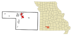
Location in Missouri
|
|
| Basic data | |
| Foundation : | 1890 |
| State : | United States |
| State : | Missouri |
| County : | Christian County |
| Coordinates : | 37 ° 2 ′ N , 93 ° 13 ′ W |
| Time zone : | Central ( UTC − 6 / −5 ) |
| Residents : | 17,820 (as of 2010) |
| Population density : | 619.8 inhabitants per km 2 |
| Area : | 28.75 km 2 (approx. 11 mi 2 ) |
| Height : | 356 m |
| Postal code : | 65721 |
| Area code : | +1 417 |
| FIPS : | 29-55766 |
| GNIS ID : | 723933 |
| Website : | ozarkmissouri.com |
| Mayor : | Shane Nelson |
Ozark is a city (with the status " City ") and the administrative seat of Christian County in the southwest of the US -amerikanischen state of Missouri . At the 2010 census , Ozark had a population of 17,820.
Ozark is part of the metropolitan area around the city of Springfield .
geography
Ozark is in the middle of the hilly landscape of the Ozark Plateau at 38 ° 47'04 "north latitude and 90 ° 43'50" west longitude. The city extends over an area of 28.75 km².
Neighboring towns are McCracken (3.2 miles east), Highlandville (10.1 miles southwest), Nixa (9.4 km west), Springfield (30.3 km northeast), and Linden (10 miles northeast).
The nearest major cities are St. Louis (365 km northeast), Memphis , Tennessee (454 km southeast), Arkansas ' capital Little Rock (323 km south), Tulsa , Oklahoma (312 km southwest), Kansas' largest city Wichita (424 km west) and Missouri's largest city, Kansas City (296 km northwest).
traffic
Ozark is located on US Highway 65 , which has been converted into a freeway , which is the shortest connection from Springfield to Branson . Missouri State Route 14 intersects downtown .
The nearest airports are Springfield-Branson National Airport and Branson Airport .
Demographic data
| Population development | |||
|---|---|---|---|
| Census | Residents | ± in% | |
| 1900 | 830 | - | |
| 1910 | 813 | -2% | |
| 1920 | 798 | -1.8% | |
| 1930 | 885 | 10.9% | |
| 1940 | 961 | 8.6% | |
| 1950 | 1087 | 13.1% | |
| 1960 | 1536 | 41.3% | |
| 1970 | 2384 | 55.2% | |
| 1980 | 2980 | 25% | |
| 1990 | 4243 | 42.4% | |
| 2000 | 9665 | 127.8% | |
| 2010 | 17,820 | 84.4% | |
| 1900-1990 2000-2010 | |||
According to the 2010 census , Ozark had 17,820 people in 6,506 households. The population density was 619.8 inhabitants per square kilometer. The city has almost doubled its population between the last two censuses.
The racial the population was composed of 95.2 percent white, 0.8 percent African American, 0.5 percent Native American, 0.5 percent Asian and other ethnic groups; 2.0 percent were descended from two or more races. Hispanic or Latino of any race was 3.2 percent of the population.
Statistically, 2.53 people lived in each of the 6,506 households.
30.2 percent of the population were under 18 years old, 59.7 percent were between 18 and 64 and 10.1 percent were 65 years or older. 52.7 percent of the population was female.
The median income for a household was 48,473 USD . The per capita income was $ 22,457. 14.2 percent of the population lived below the poverty line.
Individual evidence
- ↑ a b c U.S. Census Bureau, State & County QuickFacts - Ozark, MO ( Memento of the original from October 23, 2012 in the Internet Archive ) Info: The archive link was automatically inserted and has not yet been checked. Please check the original and archive link according to the instructions and then remove this notice. Retrieved March 18, 2012
- ↑ Distance information according to Google Maps. Accessed on March 18, 2012
- ↑ travelmath - Major airports near Ozark. Retrieved March 18, 2012
- ↑ Missouri Population 1900-1990 ( Memento of the original from July 4, 2014 in the Internet Archive ) Info: The archive link was inserted automatically and has not yet been checked. Please check the original and archive link according to the instructions and then remove this notice. (PDF; 110 kB) Retrieved March 18, 2012
