Permecke
|
Permecke
Finnentrop municipality
Coordinates: 51 ° 10 ′ 55 ″ N , 8 ° 4 ′ 36 ″ E
|
||
|---|---|---|
| Height : | 430 (415-440) m above sea level NHN | |
| Residents : | 9 (Dec 31, 2016) | |
| Postal code : | 57413 | |
| Area code : | 02724 | |
|
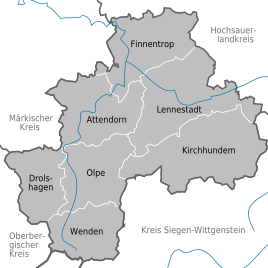
Location of Permecke in the district of Olpe |
||
|
View of Permecke
|
||
Permecke is a district of Finnentrop with around 10 inhabitants. In a side valley of the Fretterbach on the Leiermecke lies the small town at the head of the valley. This means that it is located below the watershed leading to the Elspetal , about two kilometers from Haus Valbert .
history
Permecke (formerly Pelmecke ) belonged to the municipality of Oedingen in the Meschede district . This was dissolved on July 1, 1969. Permecke came to Finnentrop.
Individual evidence
- ↑ Population statistics of the municipality of Finnentrop (as of December 31, 2016). (PDF) Municipality of Finnentrop, accessed on May 16, 2017 .
- ↑ Martin Bünermann: The communities of the first reorganization program in North Rhine-Westphalia . Deutscher Gemeindeverlag, Cologne 1970, p. 89 f .


