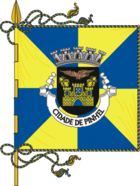
Pinhel
| Pinhel | ||||||
|---|---|---|---|---|---|---|
|
||||||
| Basic data | ||||||
| Region : | Centro | |||||
| Sub-region : | Beiras e Serra da Estrela | |||||
| District : | Guarda | |||||
| Concelho : | Pinhel | |||||
| Coordinates : | 40 ° 46 ′ N , 7 ° 4 ′ W | |||||
| Residents: | 3518 (as of June 30, 2011) | |||||
| Surface: | 44.65 km² (as of January 1, 2010) | |||||
| Population density : | 79 inhabitants per km² | |||||
| Postal code : | 6400 | |||||
| politics | ||||||
| Mayor : | Carlos Alberto Videira dos Santos | |||||
| Address of the municipal administration: | Junta de Freguesia de Pinhel Rua Conde Ferreira, nº 25 Rua Conde Ferreira |
|||||
| Website: | freguesiadepinhel.com.sapo.pt | |||||
| Pinhel district | ||||||
|
||||||
| Residents: | 9627 (as of June 30, 2011) | |||||
| Surface: | 484.51 km² (as of January 1, 2010) | |||||
| Population density : | 20 inhabitants per km² | |||||
| Number of municipalities : | 18th | |||||
| administration | ||||||
| Administration address: | Câmara Municipal de Pinhel Praça Sacadura Cabral 6400-444 Pinhel |
|||||
| President of the Câmara Municipal: | António Luís Monteiro Ruas ( PSD ) | |||||
| Website: | www.cm-pinhel.pt | |||||
Pinhel is a municipality and city in Portugal , belonging to the Guarda district in the sub-region of the northern, inner Beira, with about 3500 inhabitants.
history
Some historians date the first origins of the city of Pinhel to 5000 BC. In 1179 Pinhel was recaptured from the Moors by Dom Afonso Henriques . The Pinhel district received certain rights (Foral) from Dom Sancho in 1209. These rights were confirmed by Dom Afonso II in 1217 and by Dom Dinis in 1282. Dom Manuel issued a new foral in 1510. Pinhel received town charter in 1770 through Dom José and became a bishopric by dividing the diocese of Lamego. In 1881 the Pinhel diocese was dissolved and integrated into the Guarda diocese .
administration
Pinhel is the seat of a district of the same name with a total area of 486.15 km² and 10,954 inhabitants (2001). The neighboring areas are (starting clockwise in the north): Figueira de Castelo Rodrigo , Almeida , Guarda , Celorico da Beira , Trancoso , Mêda and Vila Nova de Foz Côa .
The following municipalities ( freguesias ) are in the Pinhel district:
| local community | Population (2011) |
Area km² |
Density of population / km² |
LAU code |
|---|---|---|---|---|
| Agregação das Freguesias Sul de Pinhel | 434 | 40.82 | 11 | 091028 |
| Alto do Palurdo | 242 | 47.31 | 5 | 091032 |
| Alverca da Beira / Bouça Cova | 567 | 19.73 | 29 | 091029 |
| Atalaia e Safurdão | 207 | 34.32 | 6th | 091035 |
| Ervedosa | 190 | 12.84 | 15th | 091009 |
| Freixedas | 905 | 33.11 | 27 | 091010 |
| Lamegal | 253 | 21.96 | 12 | 091012 |
| Lameiras | 290 | 17.76 | 16 | 091013 |
| Manigoto | 186 | 15.89 | 12 | 091014 |
| Pala | 543 | 14.24 | 38 | 091015 |
| Pinhel | 3,518 | 44.65 | 79 | 091017 |
| Pinzio | 453 | 27.13 | 17th | 091018 |
| Souro Pires | 588 | 15.67 | 38 | 091024 |
| Terras de Massueime | 274 | 12.39 | 22nd | 091030 |
| Valbom / Bogalhal | 251 | 32.33 | 8th | 091031 |
| Vale do Côa | 235 | 52.20 | 5 | 091033 |
| Vale do Massueime | 305 | 24.07 | 13 | 091034 |
| Vascoveiro | 186 | 18.09 | 10 | 091027 |
| Pinhel district | 9,627 | 484.51 | 20th | 0910 |
Individual evidence
- ↑ www.ine.pt - indicator resident population by place of residence and sex; Decennial in the database of the Instituto Nacional de Estatística
- ↑ a b Overview of code assignments from Freguesias on epp.eurostat.ec.europa.eu
- ↑ www.ine.pt - indicator resident population by place of residence and sex; Decennial in the database of the Instituto Nacional de Estatística
Web links
- Map of the Freguesia Pinhel at the Instituto Geográfico do Exército


