Aguiar da Beira
| Aguiar da Beira | ||||||
|---|---|---|---|---|---|---|
|
||||||
| Basic data | ||||||
| Region : | Centro | |||||
| Sub-region : | Viseu Dão-Lafoes | |||||
| District : | Guarda | |||||
| Concelho : | Aguiar da Beira | |||||
| Coordinates : | 40 ° 49 ′ N , 7 ° 33 ′ W | |||||
| Residents: | 1475 (as of June 30, 2011) | |||||
| Surface: | 35.73 km² (as of January 1, 2010) | |||||
| Population density : | 41 inhabitants per km² | |||||
| Height: | 871 m | |||||
| Postal code : | 3570-018 | |||||
| politics | ||||||
| Address of the municipal administration: | Junta da Freguesia de Aguiar da Beira Travessa Junta Freguesia 3570-018 Aguiar da Beira |
|||||
| Website: | http://www.aguiardabeira.com/ (link not available) | |||||
| Aguiar da Beira district | ||||||
|
||||||
| Residents: | 5473 (as of June 30, 2011) | |||||
| Surface: | 206.76 km² (as of January 1, 2010) | |||||
| Population density : | 26 inhabitants per km² | |||||
| Number of municipalities : | 10 | |||||
| administration | ||||||
| Administration address: | Câmara Municipal de Aguiar da Beira Av. da Liberdade 3570-018 Aguiar da Beira |
|||||
| President of the Câmara Municipal: | Joaquim António Marques Bonifácio ( PSD ) | |||||
| Website: | www.cm-aguiardabeira.pt | |||||
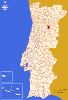
Aguiar da Beira is a small town ( Vila ) in northern Portugal, in the Guarda district and in the Centro statistical region . It is located in the Serra da Lapa mountains at an altitude of 807 meters. It has 1475 inhabitants (as of June 30, 2011). It is also the seat of a district of the same name ( Município ).
history
The exact date of the founding of Aguiar da Beira is unknown, traces point back to Celtic and Roman settlements. A castle was built under the Romans, the remains of which can still be seen today. A Roman city had developed around the castle. After the Moorish conquest of large parts of the Iberian Peninsula, the city was part of the Kingdom of León , which had remained under Christian rule. Nevertheless, the Moors managed to temporarily occupy Aguiar da Beira in 985 . In 1120 Aguiar da Beira received the first newer town charter (according to another opinion 1258), which was renewed in 1512 by King Manuael I. In 1300 the city was granted the right to hold its own mass under King Dinis (1261-1325), which was only allowed to important cities.
In addition to the ruins of the Roman fort, there is also a clock tower from the 15th century restored in 1777, as well as a stake from 1512 and an old former Benedictine monastery .
administration
circle
Aguiar da Beira is the seat of a district of the same name ( concelho ) in the Guarda district . On June 30, 2011 the district had 5,473 inhabitants on an area of 206.8 km².
The neighboring districts are (starting clockwise in the north): Sernancelhe , Trancoso , Fornos de Algodres , Penalva do Castelo and Sátão .
With the regional reform in September 2013, several municipalities were merged into new municipalities, so that the number of municipalities decreased from 13 to ten.
The district is made up of the following ten parishes ( Freguesias ):
| local community | Population (2011) |
Area km² |
Density of population / km² |
LAU code |
|---|---|---|---|---|
| Aguiar da Beira e Coruche | 1,631 | 43.36 | 38 | 090114 |
| Carapito | 442 | 17.26 | 26th | 090102 |
| Cortiçada | 341 | 12.65 | 27 | 090103 |
| Dornelas | 690 | 23.75 | 29 | 090105 |
| Eirado | 230 | 9.24 | 25th | 090106 |
| Forninhos | 222 | 9.62 | 23 | 090107 |
| Pena Verde | 813 | 29.40 | 28 | 090109 |
| Pinheiro | 232 | 15.88 | 15th | 090110 |
| Sequeiros e Gradiz | 421 | 23.92 | 18th | 090115 |
| Souto de Aguiar da Beira e Valverde | 451 | 21.68 | 21st | 090116 |
| Aguiar da Beira district | 5,473 | 206.76 | 26th | 0901 |
Population development
According to the last census in 2011, the district has 5,521 inhabitants, compared to 10,215 in 1960. The strong decline is justified with emigration and emigration to the big cities.
| Population in Aguiar da Beira County (1801–2011) | |||||||||
|---|---|---|---|---|---|---|---|---|---|
| 1801 | 1849 | 1900 | 1930 | 1960 | 1981 | 1991 | 2001 | 2011 | |
| 3 292 | 6 759 | 8 466 | 8 545 | 10 215 | 7 285 | 6 725 | 6 247 | 5 521 | |
Municipal holiday
- February 10th
Town twinning
-
 Ireland : Lisdoonvarna (since 1998)
economy
The district is characterized by agriculture, especially cattle breeding and fruit growing. The industry is particularly represented by companies in the wood processing and food industries. Ores are mined in the district. Tourism has gained in importance, in addition to rural tourism, the Caldas da Cavaca thermal baths, established in 1924 and reopened in 2008 after being closed in 1995, are of particular importance.
sons and daughters of the town
- Pedro da Fonseca (1528–1599), Jesuit philosopher
- Manuel Dias Loureiro (* 1951), lawyer and PSD politician, two-time minister
Web links
- Map of the Freguesia Aguiar da Beira at the Instituto Geográfico do Exército
- Official website of the city administration
- Photos by AGUIAR DA BEIRA on Flickr
Individual evidence
- ↑ www.ine.pt - indicator resident population by place of residence and sex; Decennial in the database of the Instituto Nacional de Estatística
- ↑ a b Overview of code assignments from Freguesias on epp.eurostat.ec.europa.eu
- ↑ a b www.ine.pt - indicator resident population by place of residence and sex; Decennial in the database of the Instituto Nacional de Estatística
- ↑ {{Web archive | url = http: //www.aguiardabeira.com/ | wayback = 20150801005310 | text = - | archiv-bot = 2018-08-22 11:34:02 InternetArchiveBot}} (link not available)
- ^ Publication of the administrative reorganization in the Diário da República gazette of January 28, 2013, accessed on March 16, 2014
- ↑ Demografia. Câmara Municipal de Aguiar da Beira, archived from the original on December 18, 2009 ; Retrieved January 18, 2015 (Portuguese).
- ↑ www.anmp.pt , accessed on February 2, 2013
- ↑ Wirtschaftspassage in the community portrait on the website of the city administration , accessed on November 25, 2013


