Portage (Indiana)
| Portage | ||
|---|---|---|
|
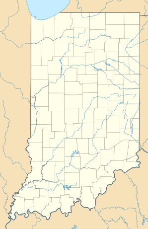
Location in Indiana
|
||
| Basic data | ||
| Foundation : | 1967 | |
| State : | United States | |
| State : | Indiana | |
| County : | Porter County | |
| Coordinates : | 41 ° 35 ′ N , 87 ° 11 ′ W | |
| Time zone : | Central ( UTC − 6 / −5 ) | |
| Residents : | 36,828 (as of 2010) | |
| Population density : | 554.8 inhabitants per km 2 | |
| Area : | 71.51 km 2 (approx. 28 mi 2 ) of which 66.38 km 2 (approx. 26 mi 2 ) is land |
|
| Height : | 194 m | |
| Postal code : | 46368 | |
| Area code : | +1 219 | |
| FIPS : | 18-61092 | |
| GNIS ID : | 0449815 | |
| Website : | www.ci.portage.in.us | |
| Mayor : | Jim Snyder | |
| Population development | |||
|---|---|---|---|
| Census | Residents | ± in% | |
| 1960 | 11,822 | - | |
| 1970 | 19,127 | 61.8% | |
| 1980 | 27,409 | 43.3% | |
| 1990 | 29,060 | 6% | |
| 2000 | 33,496 | 15.3% | |
| 2010 | 36,828 | 9.9% | |
| Source: US Census Bureau | |||
Portage is a city in Portage Township , Porter County , Indiana , USA . A 2010 census found 36,828 residents. Portage is the largest city in Porter County and the third largest in northwest Indiana.
geography
Geographical location
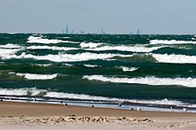
The geographic location of Portage is: 41 ° 34′55 ″ N 87 ° 11′12 ″ W (41.581850, −87.186553). The urban area borders directly on Lake Michigan in two sections . The adjacent coastal location is, however, interrupted in the middle by the neighboring village of Ogden Dunes .
Today the Little Calumet River flows into Lake Michigan through the Burns Waterway within the parish .
Neighboring places
| Gary (Indiana) | Ogden Dunes, Indiana | Burns Harbor |
| Lake Station (Indiana) |

|
Chesterton |
| Hobart, Indiana | South Haven, Indiana |
population
According to the results of the United States Census 2010 , the city has an area of 71.5 km², of which 66.4 km² (or 92.83%) is land, or 5.1 km² (or 7.17%) is water.
climate
|
Monthly Average Temperatures and Rainy Days for Portage, Indiana
|
|||||||||||||||||||||||||||||||||||||||||||||||||||||||||||||||||||||||||||||||||||||||||||||||||||||||||||||||||||||||||||||||||||||||||||
history
Early churches
Before Portage became a town, it consisted of three separate parishes and lots of farmland. The parishes were named McCool, Crisman, and Garyton. LaPorte County received jurisdiction over Porter County in 1835 and incorporated the Portage Ward that same year.
Railways
The Portage parish was primarily a peasantry until railroad construction began in the 1850s and 1860s. Michigan Central was the first railroad in the area to be completed in 1852, connecting Detroit and Chicago . This made it easy for farmers to move their cattle, dairy products, and crops to Chicago and other locations. The construction of the railway quickly proved to be a boon for the population and enabled them to buy more land and use it for agriculture. The Michigan Central Railroad was later bought up by the New York Central Railroad . In 1874, Portage began building a second railroad, the Baltimore and Ohio Railroad . She crossed Michigan Central near the village of Crisman . Aside from the apparent success of the early railroads, the area remained mostly agricultural and relied on the railroad to keep the economy going. The sand business also developed due to the continued growth of Chicago. The railroads helped deliver the sand to Chicago more effectively.
Great Depression and War
In the period between the 1870s and the Great Depression, Portage did not grow much. It has been estimated that between 1880 and 1950 the annual growth rate was around 64 inhabitants. Despite the growth of neighboring western cities such as Gary , Hammond and East Chicago , this was due to industrialization through steel mills. Portage was not unaffected by the Great Depression. Due to the financially difficult situation of the steel mills, farmers did not have the need to produce their products as the demand fell. This gave them food for themselves, but no money, which is why many lost their farms. Like many churches in the United States, Portage was heavily influenced by World War I and World War II. Steel mills increased production and a large number of workers were required, which drew many people to the area.
Economy and Infrastructure
traffic
aviation
The nearest commercial airport is Gary / Chicago Airport in Gary. Most of the air traffic in the greater Chicago area, however, is handled by Chicago O'Hare and Chicago Midway airports .
railroad
The South Shore Line (NICTD) railway connects Portage with Chicago (west) and South Bend, Indiana (east). The local train station Portage / Ogden Dunes is on this line in the border area of the two named places.
Further south, the Porter Subdivision and Garrett Subdivision of the CSX Corporation cross the urban area
Motorized private transport
Portage is crossed by various highways. It is about:
- the Interstate 94 ,
- Interstates 80 / 90 (in this area as Indiana Toll Road called)
such as
- the US Highway 6 ,
- the US Highway 12 ,
- the US Highway 20
Next to it is Indiana State Road 249 within the urban area.
Public facilities
In the urban area is located on the southern shore of Lake Michigan harbor Burns Harbor of state-owned authority Ports of Indiana
Parks
Parks in Portage offer a wide variety of activities such as sports, crafts, hiking and water sports.
| park | size | deals |
|---|---|---|
| Imagination Glen Park | 103.6 ha | Softball field, soccer field, BMX trails, footpaths, playground, fishing, picnic, access to Duneland Trail |
| Woodland Park | 25.9 ha | Skate park, playgrounds, banquet hall, softball field, baseball field |
| Lakefront & Riverwalk | 23.1 ha | Footpaths, pier, beach, pavilion with coffee, toilets and a classroom |
| Countryside Park | 13.4 ha | Playground, historical museum, toboggan slope, fishing, hiking trails |
| Deer Trail Park | 6.5 ha | Hiking trails, fishing |
| Olson Memorial Park | 5.7 ha | Playground, tobogganing slope, accommodation with toilets, access to Duneland Trail |
| Wolfe Park | 4 ha | Softball field, picnic, accommodations |
| Frank Gilbert Jr. Memorial Park | 2 ha | Lookout point and square, footpaths, memorial for firefighters and police officers |
| Perry Park | 1.6 ha | Picnic, playground |
| Community Acres Park | 0.5 ha | Basketball court, playground, picnic |
| Harbor Oaks Park | 0.5 ha | - |
| Founder's Square Park | 0.5 ha | - |
The public marina in Portage allows mooring and casting off from / to nearby Lake Michigan . Part of Lake Michigan Beach is also located in Portage.
politics
The current mayor of Portage is Jim Snyder, who took office on January 1, 2012. Snyder won the election against Olga Velazquez, who was mayor for a term. Doug Olson was Mayor from 2000 to 2008.
education
The Portage Township School System comprises eleven public schools: eight elementary schools (kindergarten through grade 5), two middle schools (grades 6–8) and one high school (grades 9–12). The schools are Indiana Exemplary District schools, two of which have received four stars each.
| Elementary schools | Middle schools | High schools |
|---|---|---|
| Aylesworth | Fegely | Portage High School |
| Central | Willowcreek | |
| Crisman | ||
| Jones | ||
| Kyle | ||
| Myers | ||
| Saylor | ||
| South Haven |
There are also three private schools in Portage:
- Portage Christian School - A Christian school for children from kindergarten to year 12
- Nativity of Our Savior School - A Roman Catholic school for children from Kindergarten to Grade 8
- Maranatha Christian Academy - A school of the Church of God for children from kindergarten to grade 11
Individual evidence
- ↑ a b c d Bruce Sawochka: Portage in Three Stages of its Growth. In: Steel Shavings. Volume 20, 1991, pp. 4-6.
- ^ Dennis Norman, James Wright: Images of America Portage Township. Arcadia, Chicago 2003.
- ^ City of Portage, Indiana / Parks & Recreation
- ↑ City of Portage, Indiana / Imagination Glen Park
- ↑ Portage Township Schools / Overview ( Memento of the original from May 13, 2015 in the Internet Archive ) Info: The archive link has been inserted automatically and has not yet been checked. Please check the original and archive link according to the instructions and then remove this notice.
- ^ Private Schools


