Pouilly-le-Monial
| Pouilly-le-Monial | ||
|---|---|---|

|
|
|
| local community | Porte des Pierres Dorées | |
| region | Auvergne-Rhône-Alpes | |
| Department | Rhône | |
| Arrondissement | Villefranche-sur-Saône | |
| Coordinates | 45 ° 58 ′ N , 4 ° 39 ′ E | |
| Post Code | 69400 | |
| Former INSEE code | 69159 | |
| Incorporation | January 1, 2017 | |
| status | Commune déléguée | |
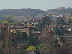
 View of Pouilly-le-Monial |
||
Pouilly-le-Monial is a commune Déléguée in the French community Porte des Pierres Dorées with 974 inhabitants (at January 1, 2017) in the department of Rhône in the region of Auvergne Rhône-Alpes .
With effect from January 1, 2017, the former municipalities of Liergues and Pouilly-le-Monial were merged to form the Commune nouvelle Porte des Pierres Dorées. Since then, Pouilly-le-Monial has had the status of a Commune déléguée. The municipality of Pouilly-le-Monial was part of the arrondissement of Villefranche-sur-Saône and the canton of Le Bois-d'Oingt (until 2015: canton Anse ).
geography
Pouilly-le-Monial is located about 26 kilometers north-north-west of Lyon and about six kilometers southwest of Villefranche-sur-Saône in the Bourgogne wine region . Pouilly-le-Monial is surrounded by the neighboring towns of Jarnioux in the north, Liergues in the east and Theizé in the south.
Population development
| year | 1962 | 1968 | 1975 | 1982 | 1990 | 1999 | 2006 | 2012 |
| Residents | 464 | 493 | 535 | 598 | 654 | 721 | 824 | 946 |
| Source: Cassini and INSEE | ||||||||
Attractions
- historical center
- Saint-Jean-d'Essarts Chapel of the Order of Malta
