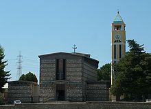
Priolo Gargallo
| Priolo Gargallo | ||
|---|---|---|

|
|
|
| Country | Italy | |
| region | Sicily | |
| Free community consortium | Syracuse (SR) | |
| Local name | Priolu | |
| Coordinates | 37 ° 10 ′ N , 15 ° 11 ′ E | |
| height | 30 m slm | |
| surface | 57.58 km² | |
| Residents | 11,687 (Dec. 31, 2019) | |
| Population density | 203 inhabitants / km² | |
| Post Code | 96010 | |
| prefix | 0931 | |
| ISTAT number | 089021 | |
| Popular name | Priolesi | |
| Patron saint | Angelo Custode | |
| Website | Priolo Gargallo | |
Priolo Gargallo is a town in the municipality consortium Syracuse outdoors in the region of Sicily in Italy with 11,687 inhabitants (December 31, 2019).
Location and dates
Priolo Gargallo is 12 km northwest of Syracuse . The inhabitants work mainly in the chemical industry ( petroleum processing ) and in agriculture.
The neighboring communities are Melilli , Syracuse , Solarino and Sortino .
history
The earliest traces of human settlement date from the Bronze Age .
Attractions
- Thapsos , a prehistoric settlement outside of Priolo Gargallo on the Magnisi Peninsula.
- Church of San Focà, built in the 5th century (outside the village)
Individual evidence
- ↑ Statistiche demografiche ISTAT. Monthly population statistics of the Istituto Nazionale di Statistica , as of December 31 of 2019.
Web links
Commons : Priolo Gargallo - collection of images, videos and audio files
- Information about Priolo Gargallo (Italian)


