
Ranrapalca
| Nevado Ranrapalca | ||
|---|---|---|
 Ranrapalca from the northeast (2012) |
||
| height | 6162 m | |
| location | Ancash , Peru | |
| Mountains | Cordillera Blanca , Andes | |
| Dominance | 7.1 km → Palcaraju Oeste | |
| Notch height | 950 m ↓ nameless notch | |
| Coordinates | 9 ° 24 '40 " S , 77 ° 25' 0" W | |
|
||
| Type | Ice peaks | |
| rock | Batholith | |
| First ascent | Walther Brecht, Siegfried Rohrer, Karl Schmid and Hans Schweizer on June 25, 1939 | |
| Normal way | High tour from the northeast ( D ) | |

The Nevado Ranrapalca ( Ranrapallqa in Ancash-Quechua ) is a 6,162 m high mountain in the Peruvian Cordillera Blanca . It lies in the area of the well-known Tocllaraju and Palcaraju peaks .
Surname
The name Ranrapallqa comes from the Quechua dialect ( Ancash-Quechua ) widespread in the Ancash region and is made up of the words ranra (stony) and pallqa (forked, divided into two). The Spanish name is recorded on the map of the Alpine Club with the attribute Nevado (snowy, snow-covered), which stands for glaciated mountain peaks throughout the Andes (cf. for example Nevado Huascarán ).
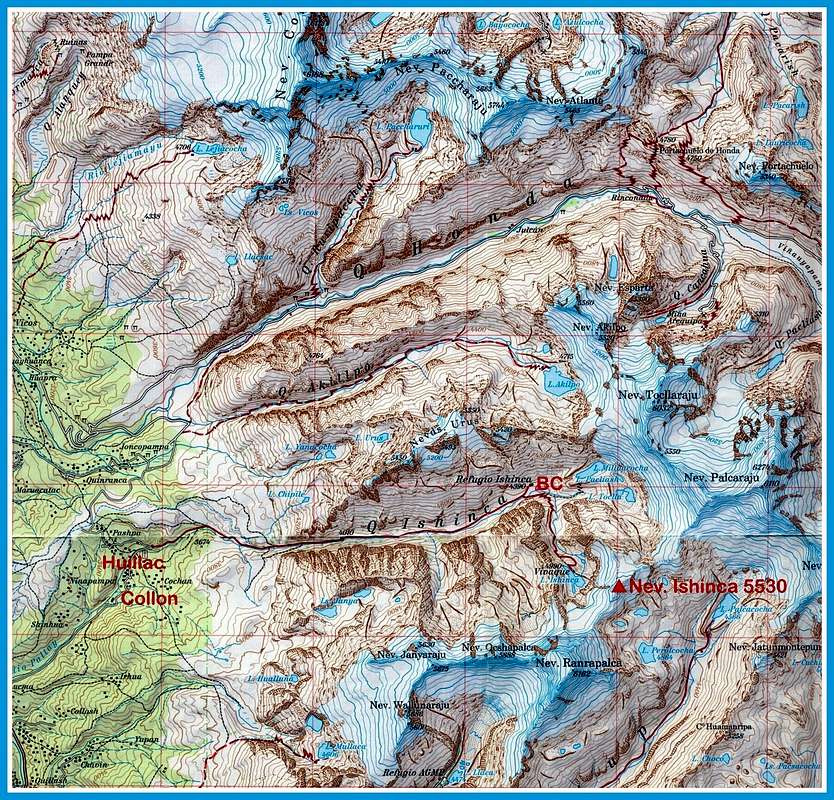
Location and surroundings

The Ranrapalca is located in the Huascarán National Park in the southern part of the Cordillera Blanca around 18 km northeast of Huaraz . The glaciated summit forms a ridge with the neighboring Nevado Oeshapalca ( 5888 m ) and the Nevado Ishinca ( 5530 m ) and towers above the glacial lakes Lago Ishinca in the north, Lago Perolcocha in the east and Lago Llaca in the southwest. The closest bases are the Refugio Ishinca ( 4390 m ) in the valley of the same name and the Refugio AGMP ( 4480 m ), both of which can be reached via trekking trails .
Alpinism
The first ascent of Ranrapalca was made by a German expedition who stayed in the region as part of the Andes Tour in 1939. Walther Brecht, Siegfried Rohrer, Karl Schmid and Hans Schweizer reached the summit on June 25th from the northwest and made for one of numerous first ascents in the course of this trip.
Literature and maps
- Alpine Club Card 03 / b. Cordillera Blanca Sud (Peru) , 1: 100,000. Austrian Alpine Association 2005. ISBN 3-937530-05-3
- Hans Kinzl , Hans Schweizer, Walther Brecht & Karl Schmid: The Andes Tour of the German Alpine Club to Peru in 1939. Bruckmann Verlag , Munich 1941, 24 pp.
- Walter Amstutz : A visit to the Ishinca valley, Cordillera Blanca, 1968. In: Alpine Journal 1969, pp. 39-46. ( PDF ) (English).
Individual evidence
- ↑ a b Alpine Club Map 03 / b. Cordillera Blanca Sud (Peru), 1: 100,000. Austrian Alpine Association 2005. ISBN 3-937530-05-3 . Excerpt .
- ↑ Teofilo Laime Ajacopa: Diccionario Billingüe / Iskay simipi yuyayk'ancha (Quechua-Castellano - Castellano-Quechua). Segunda edición mejorada, La Paz 2007, 215 pp. ( PDF ) (Spanish).
- ^ Walter Amstutz : A visit to the Ishinca valley, Cordillera Blanca, 1968. In: Alpine Journal 1969, pp. 39-46. PDF (English).