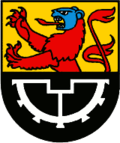
Retschwil
| Retschwil | ||
|---|---|---|
| State : |
|
|
| Canton : |
|
|
| Constituency : | Hochdorf | |
| Residential municipality : | Hitzkirch | |
| Postal code : | 6285 | |
| former BFS no. : | 1038 | |
| Coordinates : | 661 719 / 227189 | |
| Height : | 482 m above sea level M. | |
| Area : | 2.55 km² | |
| Residents: | 174 (December 31, 2007) | |
| Population density : | 68 inhabitants per km² | |
| map | ||
|
|
||
Retschwil is a village in the municipality of Hitzkirch in the Hochdorf district of the canton of Lucerne in Switzerland .
Retschwil was a political municipality until December 31, 2008 . As of January 1, 2009, the communities of Hitzkirch, Gelfingen , Hämikon , Mosen , Müswangen , Retschwil and Sulz merged to form the new community of Hitzkirch.
geography
Retschwil is three and a half kilometers northwest of Hochdorf on the eastern slope of the Erlosen. The western bank of the Baldeggersee forms the eastern land border. In addition to the village, the four hamlets of Vorderzelg (700 m southwest; 648 m above sea level), Wolfetschwil (800 m northwest; 482 m above sea level), Stäfligen (2.1 km northwest; 471 m above sea level ) belonged to the village . M.) - the last two like the village also on the west bank of the Baldeggersee - and Hinterzelg (1.1 km west; 654 m. Above sea level) to the former municipality Retschwil. The former municipal area comprised 261 hectares including the lake area. 67.5% of the 255 hectares of land is used for agriculture; Forest and wood cover 24.7% of the municipal area and 7.8% are settlement areas. There are several streams in the municipality, all of which flow in a west-east direction and flow into the Baldeggersee. The Mülibach flows through the village and the Burgbach through Wolfetschwil.
Neighboring communities
Retschwil bordered on Hitzkirch and Römerswil . Until January 1, 2005 also to Herlisberg , which merged with Römerswil on this date.
population
Population development
| Population development | |
|---|---|
| year | Residents |
| 1850 | 229 |
| 1900 | 145 |
| 1930 | 161 |
| 1950 | 162 |
| 1960 | 171 |
| 1970 | 157 |
| 1980 | 121 |
| 1990 | 166 |
| 2000 | 191 |
| 2004 | 181 |
From 1850 to 1900 the population fell massively by 36.7% as a result of emigration. After that, it stagnated for decades around a value of 160 residents, before reaching the highest value of the 20th century in 1960. Within 20 years it sank to a record low (1960–1980: −29.2%) and then increased massively over the next two decades (1980–2000: +57.9%). At the moment the population is falling again.
languages
The population uses a highly Alemannic dialect as their everyday language . The last census in 2000 brought the following results: 96.34% spoke German, 2.62% Portuguese and 0.52% French as their main language / everyday language.
Religions - denominations
Traditionally, all residents used to be Roman Catholic. Today (as of 2000) 84.29% are Roman Catholic and 10.47% Protestant Reformed Christians. A small minority of 1.57% are non-denominational.
Origin and nationality
At the end of 2006, 166 of the 172 local residents were Swiss and 6 (= 3.5%) were foreigners. The 2000 census showed 96.33 (including dual citizens 97.38%) Swiss citizens. Of the seven foreigners, five came from Portugal (= 2.62%) and one (naturalized) person each from Italy and Sri Lanka.
politics
Elections, referendums and the municipal assembly offer the eligible citizen - who is the sovereign - the opportunity to express themselves politically.
Municipal council
The municipal council manages the affairs of the municipality on behalf of the citizens. He is elected in the majority procedure and works part-time. Due to its small population, Retschwil only has three municipal councils. In the last election in 2004, there was no fighting election. With a participation of 64.22% the following were elected:
- Romy Buck-Schneider ( CVP ), mayor
- Otto Lang (CVP), mayor
- Franz Oehen (CVP)
Elections to the Grand Council (cantonal parliament)
In the last Grand Council elections in 2003, the CVP won an absolute majority with 51.54% of the vote. It was followed by the SVP with 23.22% and the FDP with 17.45% . The SP received 6.85% of all votes.
traffic
Retschwil is not connected to the public transport network. The closest train stations to Hitzkirch and Hochdorf (both on the Lucerne – Lenzburg line ) are a few kilometers away.
The community is on the Hochdorf – Retschwil – Ermensee road. The nearest motorway connections are Gisikon on the A14 in 14 km and Emmen-Nord on the A2 in 20 km or Sursee.
history
In a confirmation of ownership from 1173 from King Friedrich I to the Canons of Beromünster , a Richartshoule is mentioned, which presumably means Retschwil. The first reliable mention is a deed of donation from the brothers Albrecht IV and Rudolf III. from the Habsburg dynasty to the Canon Monastery. Back then, in 1232, the place was called Reschinwile . Retschwil remained part of the Habsburg family until 1415. In that year the Bernese and Lucerne residents conquered the Habsburg property in Aargau, to which the community belonged. In 1425 it was assigned to the Free Offices . From 1798 to 1803 it belonged to the canton of Baden ; since then to the Hochdorf office in the canton of Lucerne.


