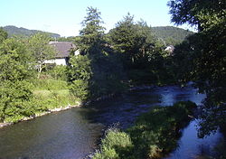
Rhine-Westerwald Nature Park
Coordinates: 50 ° 33 ' N , 7 ° 26' E
The approximately 470 km² Rhein-Westerwald nature park is located on the right bank of the Rhine in the north of the state of Rhineland-Palatinate between Neuwied and Unkel and extends from the Rhine over the terraces on the right bank of the Rhine up to the first ridges of the Niederwesterwald . The Rhine-Westerwald nature park is over 50 years old and is one of the oldest nature parks in Germany. It was founded in 1962 and celebrated its 50th anniversary in 2012. The legal entity is the "Naturpark Rhein-Westerwald eV" association.
The basis for the Rhine-Westerwald Nature Park is a state ordinance from 1978, which was issued by the Rhineland-Palatinate Minister for Agriculture, Viticulture and Environmental Protection and which regulates its protective purpose in Section 4 (1):
- "The protection purpose for the entire nature park is the preservation of the unique landscape, the beauty and the special recreational value for long-term and short vacations of the Vorderen Westerwald, largely untouched by development and interventions in the landscape, as well as the right-hand Rhine slopes between Neuwied and the northern border".
location
The nature park comprises parts of the Neuwied district and the Altenkirchen district . The following municipalities and cities are located in the nature park:
- Asbach ,
- Bad Hönningen ,
- Dierdorf ,
- Flammersfeld ,
- Linz on the Rhine ,
- City of Neuwied ,
- Puderbach ,
- Rengsdorf-Waldbreitbach ,
- Uncle .
Core zones
The core areas are the Rheinbrohler Wald, Heimbacher Wald, Märker Wald, Fockenbachtal and Lahrer Herrlichkeit . For these five core zones, it is an additional protective purpose to enable relaxation in silence .
Natural spaces
Essentially, the nature park consists of the following natural landscapes, but does not exactly follow the natural boundaries, but rather those of the participating municipalities - and all the more the state borders, which is why all North Rhine-Westphalian parts of the natural areas are outside the nature park (first in the northern part, then in the South part from west to east):
-
(to 292 Lower Middle Rhine Region )
- 292.3 Linz terrace
-
(to 324 Niederwesterwald )
- 324.9 Rheinwesterwälder volcanic ridges
- 324.80 Asbach plateau
- 324.4 Rhine-Wied ridge
- 324.5 Waldbreitbacher Wiedtal
- 324.6 Sayn-Wied plateau
The units 324.4 to 324.6 as well as 324.9, together with the Siebengebirge , originally formed the main unit 325 Rheinwesterwald in the handbook of the natural spatial structure of Germany (map from 1954 and 4th delivery 1957) , which, however, in the map from 1960 already in the larger main unit 324 was incorporated. The area of the nature park roughly corresponds to the landscape commonly known as the Vorderwesterwald .
See also
Web links
Individual evidence
- ↑ a b State ordinance on the "Rhine-Westerwald Nature Park" of August 18, 1978
- ^ Ewald Glässer: Geographical land survey: The natural space units on sheet 122/123 Cologne / Aachen. Federal Institute for Regional Studies, Bad Godesberg 1978. → Online map (PDF; 8.7 MB)
- ↑ Heinz Fischer: Geographical Land Survey: The natural spatial units on sheet 124 Siegen. Federal Institute for Regional Studies, Bad Godesberg 1972. → Online map (PDF; 4.1 MB)
- ↑ Heinrich Müller-Miny, Martin Bürgener: Geographical land survey: The natural spatial units on sheet 138 Koblenz. Federal Institute for Regional Studies, Bad Godesberg 1971. → Online map (PDF; 5.7 MB)
- ^ Emil Meynen , Josef Schmithüsen (editor): Handbook of the natural spatial structure of Germany . Federal Institute for Regional Studies, Remagen / Bad Godesberg 1953–1962 (9 deliveries in 8 books, updated map 1: 1,000,000 with main units 1960).


