
Rogoźnik (Nowy Targ)
| Rogoźnik | |||
|---|---|---|---|
 Help on coat of arms |
|
||
| Basic data | |||
| State : | Poland | ||
| Voivodeship : | Lesser Poland | ||
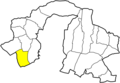
| Powiat : | Nowy Targ | ||
| Gmina : | Nowy Targ | ||
| Geographic location : | 49 ° 27 ' N , 19 ° 56' E | ||
| Height : | 610-700 m npm | ||
| Residents : | 910 (2004) | ||
| Telephone code : | (+48) 18 | ||
| License plate : | KNT | ||

Rogoźnik (formerly Bystre or Ciche ) is a village with a school administration of the municipality Nowy Targ in the powiat Nowotarski of the Lesser Poland Voivodeship in Poland .
geography
The place is in so-called Podhale on the Rogoźnik brook.
Village in the parish

Place view


history
The place was first mentioned in a document in 1237. It later belonged to the Cistercians in Ludźmierz , and from the 14th century it belonged to the crown estate .
When Poland was first partitioned in 1772, the village became part of the new Kingdom of Galicia and Lodomeria of the Habsburg Empire (from 1804).
In 1918, after the end of the First World War and the collapse of the Austro-Hungarian monarchy, Rogoźnik came to Poland. This was only interrupted by the occupation of Poland by the Wehrmacht in World War II .
In 1967 the Roman Catholic parish was established.
From 1975 to 1998 Rogoźnik was part of the Nowy Sącz Voivodeship .
Web links
- Side of the village (polish)
Individual evidence
- ↑ a b c d Sołectwo Rogoźnik . In: www.ugnowytarg.pl .
- ↑ Dz.U. 1975 no 17 poz. 92 (Polish) (PDF file; 783 kB)
