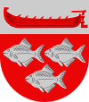
Ruovesi
| coat of arms | map |
|---|---|

|

|
| Basic data | |
| State : |
|
| Landscape : | Pirkanmaa |
| Administrative community : | Oberpirkanmaa |
| Geographical location | 61 ° 59 ′ N , 24 ° 5 ′ E |
| Surface: | 950.16 km² |
| of which land area: | 776.20 km² |
| of which inland waterways: | 173.96 km² |
| Residents : | 4,398 (Dec 31, 2018) |
| Population density : | 5.7 inhabitants / km² |
| Municipality number : | 702 |
| Language (s) : | Finnish |
| Website : | ruovesi.fi |
Ruovesi [ ruɔvɛsi ] is a municipality in the landscape Pirkanmaa in western Finland . It is located around 80 km north of Tampere , on the lake Ruovesi of the same name , which is part of the Näsijärvi lake system. Ruovesi has 4398 inhabitants (as of December 31, 2018). The municipality covers an area of 950.2 km², of which 174 km² are pure water. The population speaks only Finnish .
Culture and sights
Ruovesi is considered the most beautiful church village in Finland . In addition to the church from 1778, the Rietonniemi mansion , where Johan Ludvig Runeberg worked on his book Ensign Stahl , is worth visiting. Also worth seeing is Kalela , the former country studio of the famous painter Akseli Gallen-Kallela .
Ruovesi is the starting point of the Pirkan Taival hiking trail , which leads across the Helvetinjärvi National Park to Virrat .
Economy and Infrastructure
In Ruovesi there is a landing stage for the Poet's Path , the waterway between Tampere and Virrat . There is no railway line, but there are regular bus connections to Virrat, Tampere and even to Helsinki .
Sons and daughters
- Aarne Michaël Tallgren (1885–1945), prehistoric
Web links
Individual evidence
- ↑ Maanmittauslaitos (Finnish land surveying office): Suomen pinta-alat kunnittain January 1, 2010 . (PDF; 199 kB)
- ↑ Statistical Office Finland: Table 11ra - Key figures on population by region, 1990-2018
