
Ruta Interbalnearia
| Ruta IB in Uruguay | |||||||||||||||||||||||||||||||

|
|||||||||||||||||||||||||||||||
| map | |||||||||||||||||||||||||||||||
 |
|||||||||||||||||||||||||||||||
| Basic data | |||||||||||||||||||||||||||||||
| Operator: |
Ministerio de Transporte y Obras Públicas |
||||||||||||||||||||||||||||||
| Overall length: | 90 km | ||||||||||||||||||||||||||||||
|
Course of the road
|
|||||||||||||||||||||||||||||||
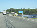
The Ruta Interbalnearia is a trunk road in Uruguay .
The four-lane road, 120 kilometers long, also known as IB for short , is located in the south of the country and leads through the departments of Canelones and Maldonado . There it runs parallel to the coast of the Río de la Plata and serves to connect the seaside resorts there.
As a continuation of Ruta 101, it leads east from Aeropuerto Internacional de Carrasco to Punta del Este . After 12 kilometers it then joins the Avenida Giannattasio , which is the continuation of the IB between Montevideo and Arroyo Pando.
The Ruta Interbalnearia, which is of great importance for the country's tourism sector, is the most modern and busiest road in Uruguay during the summer months and on weekends. It is therefore in the best condition, which is not always exemplary for the other roads in the country.

Ruta Interbalnearia in the Canelones department

Ruta Interbalnearia near Costa Azul

Ruta Interbalnearia near the Peaje Solís toll station

Ruta Interbalnearia at Jaureguiberry
Ruta Interbalnearia at Arroyo Solís Grande

Ruta Interbalnearia near Portezuelo and the junction of the Camino Lussich


