Sao Roque do Pico
| Sao Roque do Pico | ||||||
|---|---|---|---|---|---|---|
|
||||||
| Basic data | ||||||
| Autonomous Region : | Azores | |||||
| Concelho : | Sao Roque do Pico | |||||
| Coordinates : | 38 ° 32 ′ N , 28 ° 19 ′ W | |||||
| Residents: | 1316 (as of June 30, 2011) | |||||
| Surface: | 42.23 km² (as of January 1, 2010) | |||||
| Population density : | 31 inhabitants per km² | |||||
| Sao Roque do Pico district | ||||||
|
||||||
| Residents: | 3388 (as of June 30, 2011) | |||||
| Surface: | 142.35 km² (as of January 1, 2010) | |||||
| Population density : | 24 inhabitants per km² | |||||
| Number of municipalities : | 5 | |||||
| administration | ||||||
| Administration address: | Câmara Municipal de Sao Roque do Pico Alameda 10 de Novembro de 1542 9940-353 Sao Roque do Pico |
|||||
| President of the Câmara Municipal: | Luís Filipe Ramos Macedo da Silva | |||||
| Website: | www.municipiosrp.pt | |||||
São Roque do Pico ( [ sɐ̃w ˈʁɔk (ɨ) ðu ˈpiku ] ) is a small town ( Vila ) and a district ( Concelho ) on the Azores island of Pico , Portugal . São Roque do Pico has 3388 inhabitants (as of June 30, 2011) on 142.4 km².
history
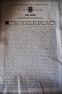
After the slow settlement of the island of Pico from 1460 onwards, the Flemish Josse Van Huerter received permission from 1466 to establish settlements here. The Lajes do Pico district was created in 1501 and included the entire island. In 1542, the district of São Roque do Pico was rebuilt by splitting off and reorganizing the municipalities of the previous district. In 1732, another circle was created, Madalena , through the same procedure and by separating the two previous circles.
In 2004 UNESCO named the wine-growing culture of the island of Pico, which is traditionally also practiced in the São Roque do Pico district, a world heritage site .
administration
circle
São Roque do Pico is the administrative seat of a district of the same name ( concelho ). The two other districts of the island are Lajes do Pico in the south and Madalena in the west. The following municipalities ( Freguesias ) are in the district:
| local community | Population (2011) |
Area km² |
Density of population / km² |
LAU code |
|---|---|---|---|---|
| Prainha | 547 | 26.10 | 21st | 460301 |
| Santa Luzia | 422 | 30.13 | 14th | 460302 |
| Santo Amaro | 288 | 11.86 | 24 | 460303 |
| Santo António | 815 | 32.03 | 25th | 460304 |
| Sao Roque do Pico | 1,316 | 42.23 | 31 | 460305 |
| Sao Roque do Pico district | 3,388 | 142.35 | 24 | 4603 |
Population development
| Population in the São Roque do Pico County 1849–2011 | |||||||||
| year | 1849 | 1900 | 1930 | 1960 | 1981 | 1991 | 2001 | 2004 | 2011 |
|---|---|---|---|---|---|---|---|---|---|
| Residents | 7618 | 6314 | 5112 | 5292 | 3678 | 3675 | 3629 | 3705 | 3388 |
Municipal holiday
- August 16
sons and daughters of the town
- Roque Francisco Furtado de Melo (1805–1892), brigadier general and politician, father-in-law of the first Republican President of Portugal, Manuel José de Arriaga
- Manuel de Azevedo Gomes (1847–1907), naval officer, officer in the American Civil War , son-in-law of the opera singer and Portuguese royal wife Elise Friederike Hensler
- Fernando Machado Soares (1930–2014), lawyer and fadista , one of the innovators of Fado de Coimbra
- Duarte Freitas (* 1966), politician, MEP from 2004 to 2009
Web links
Individual evidence
- ↑ www.ine.pt - indicator resident population by place of residence and sex; Decennial in the database of the Instituto Nacional de Estatística
- ↑ a b Overview of code assignments from Freguesias on epp.eurostat.ec.europa.eu
- ↑ www.ine.pt - indicator resident population by place of residence and sex; Decennial in the database of the Instituto Nacional de Estatística
- ↑ www.monumentos.pt (under Cronologia ), accessed on August 26, 2013
- ↑ History page of the Lajes do Pico County website , accessed on August 26, 2013
- ↑ www.monumentos.pt (under Cronologia ), accessed on August 28, 2013


