Santa Cruz das Flores
| Santa Cruz das Flores | ||||||
|---|---|---|---|---|---|---|
|
||||||
| Basic data | ||||||
| Autonomous Region : | Azores | |||||
| Concelho : | Santa Cruz das Flores | |||||
| Coordinates : | 39 ° 27 ′ N , 31 ° 7 ′ W | |||||
| Residents: | 1725 (as of June 30, 2011) | |||||
| Surface: | 39.68 km² (as of January 1, 2010) | |||||
| Population density : | 43 inhabitants per km² | |||||
| Postal code : | 9970-xxx | |||||
| Santa Cruz das Flores county | ||||||
|
||||||
| Residents: | 2289 (as of June 30, 2011) | |||||
| Surface: | 70.91 km² (as of January 1, 2010) | |||||
| Population density : | 32 inhabitants per km² | |||||
| Number of municipalities : | 4th | |||||
| administration | ||||||
| Administration address: | Câmara Municipal de Santa Cruz das Flores Rua Senador André de Freitas 13 9970-337 Santa Cruz das Flores |
|||||
| President of the Câmara Municipal: | José Carlos Pimentel Mendes ( PS ) | |||||
| Website: | www.cmscflores.pt | |||||
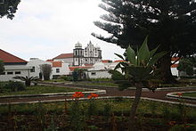
Santa Cruz das Flores ( [ ˈsɐ̃tɐ ˈkɾuʒ ðɐʃ ˈfloɾɨʃ ] ) is the capital of the Azores island of Flores and the seat of a district ( concelho ). With 1725 inhabitants (as of June 30, 2011) it is the most populous municipality on the island and next to Lajes das Flores in the south the second place on the island with tourist facilities.
geography
Santa Cruz das Flores is the furthest east of all places on the island.
history
Santa Cruz was founded around 1500, received city rights in 1548 and became the capital of the island of Flores at the beginning of the 17th century. In 1642 the Franciscans began building the monastery, which was completed around 1750. In 1693 Santa Cruz had 900 inhabitants. From 1966 to 1993 the French armed forces operated a military listening station in the city.
Culture and sights
The former Franciscan monastery now houses the island museum Museu das Flores . A permanent exhibition deals with whaling . Remarkable are the Scrimshaw -Exponate from sperm whale teeth . The decor of the monastery church Igreja de Sao Boaventura shows Latin American influences.
The three-aisled main church Igreja Matriz da Nossa Senhora da Conceição dates from the 16th century, but did not get its current form until 1859.
Economy and Infrastructure
economy
The Empresa de Pesca de Baleia Esperança has been whaling from Santa Cruz since 1924 . The whale factory was built in 1941–1944 and made the city the center of this industry on Flores. In 1981 whaling was stopped. Today fishing is carried out on a smaller scale.
The dairy industry also plays a role. The Queijo Uniflores is made in the local cheese dairy . 4000 to 5000 liters of milk are processed every day.
Since the 1990s tourism has become more and more important. Santa Cruz das Flores places the majority of the guest beds on Flores.
traffic
Santa Cruz is connected to all important places on the east coast via the main road R 1-2. The fastest way to get to the west coast is via the R 2-2, which branches off the R 1-2 3 km southwest of the city. Santa Cruz has three ports, the cargo and passenger port of Porto das Poças , the fishing port of Porto Velho at the lighthouse and the Porto do Boqueirão at the former whale factory. The only airport on the island has been located in the immediate vicinity of the city since 1968 . There are direct flight connections to the Azores islands of São Miguel , Terceira , Faial and Corvo .
education
In Santa Cruz das Flores there is a primary school, a secondary school and a high school.
administration
Santa Cruz das Flores county
Santa Cruz das Flores County occupies the northern part of Flores. It borders on the Lajes das Flores district to the south, and on the Atlantic Ocean in the other directions . The district is divided into four freguesias (municipalities):
| local community | Population (2011) |
Area km² |
Density of population / km² |
LAU code |
|---|---|---|---|---|
| Caveira | 77 | 3.28 | 23 | 480201 |
| Cedros | 128 | 10.30 | 12 | 480202 |
| Ponta Delgada | 359 | 17.65 | 20th | 480203 |
| Santa Cruz das Flores | 1,725 | 39.68 | 43 | 480204 |
| Santa Cruz das Flores county | 2,289 | 70.91 | 32 | 4802 |
Population development
| Population in Santa Cruz das Flores County (1849–2011) | |||||||||
| year | 1849 | 1900 | 1930 | 1960 | 1981 | 1991 | 2001 | 2004 | 2011 |
|---|---|---|---|---|---|---|---|---|---|
| Residents | 4858 | 3629 | 3484 | 3207 | 2456 | 2628 | 2493 | 2500 | 2289 |
Municipal holiday
- June 24th
Web links
- Official website
- Santa Cruz das Flores - the capital of Flores in the Azores Online
Individual evidence
- ↑ www.ine.pt - indicator resident population by place of residence and sex; Decennial in the database of the Instituto Nacional de Estatística
- ↑ a b Overview of code assignments from Freguesias on epp.eurostat.ec.europa.eu
- ↑ www.ine.pt - indicator resident population by place of residence and sex; Decennial in the database of the Instituto Nacional de Estatística


