Südradde
| Südradde | ||
|
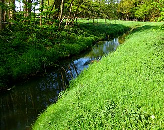
The Südradde near Klein-Roscharden in the municipality of Lastrup |
||
| Data | ||
| Water code | EN : 3672 | |
| location | Districts of Cloppenburg and Emsland ; Lower Saxony ( Germany ) | |
| River system | Ems | |
| Drain over | Hase → Ems → North Sea | |
| source | near Osterlinden and Peheim at NSG Molberger Dose 52 ° 51 ′ 25 ″ N , 7 ° 50 ′ 20 ″ E |
|
| Source height | approx. 35 m above sea level NHN | |
| muzzle | at Herzlake in the Hase coordinates: 52 ° 41 ′ 15 ″ N , 7 ° 34 ′ 17 ″ E 52 ° 41 ′ 15 ″ N , 7 ° 34 ′ 17 ″ E |
|
| Mouth height | approx. 18 m above sea level NHN | |
| Height difference | approx. 17 m | |
| Bottom slope | approx. 0.54 ‰ | |
| length | 31.5 km | |
| Catchment area | 139.05 km² | |
| Discharge at the Augustenfeld A Eo gauge : 81.7 km² Location: 17.5 km above the estuary |
NNQ (11/09/1960) MNQ 1959/2008 MQ 1959/2008 Mq 1959/2008 MHQ 1959/2008 HHQ (10/28/1998) |
50 l / s 304 l / s 906 l / s 11.1 l / (s km²) 6.03 m³ / s 14.1 m³ / s |
| Left tributaries | Timmerlager Bach | |
| Right tributaries | Rundesfeldgraben | |
| Communities | Lindern , Lastrup , Herzlake | |
The Südradde is a 31.5 km long, northeastern and orographically right tributary of the Hase in the Lower Saxony districts of Cloppenburg and Emsland and belongs to the brooks of the Hümmling .
course
The Südradde rises in the Oldenburger Münsterland in the triangle of Lindern (in the north-west), Molbergen (in the north-east) and Lastrup (in the south-east). Its source is north-east of Osterlemmen and south of Peheim near the Lindern farmers' association Hegel on the edge of the Ginger Dose moorland, which is part of the Molberger Dose nature reserve . The river runs almost exclusively in a south-westerly direction, roughly parallel to the Mittelradde in the north-west and the Löninger Mühlenbach in the south-east. It flows into the Ems tributary Hase, which comes from the east , about 1.3 km west of the center of the municipality of Herzlake .
Protected areas
The source of the Südradde lies in the Molberger Dose nature reserve ( CDDA no. 164652; designated in 1988; 6 km² in size; NSG no. WE 192) through which the upper course near the source flows. Large parts of the river run through the EU bird sanctuary Niederungen der Süd- and Mittelradde and the Marka (VSG-Nr. 3211-431; 43.77 km²), as rare bird species of the wet grassland find a habitat here.
Individual evidence
- ↑ a b c d e Environmental Maps Service of the Lower Saxony Ministry for the Environment, Energy and Climate Protection ( information )
- ^ Deutsches Gewässerkundliches Jahrbuch Weser-Ems 2008 Lower Saxony State Agency for Water Management, Coastal Protection and Nature Conservation, accessed on January 22, 2016 (PDF, German, 6184 kB).
