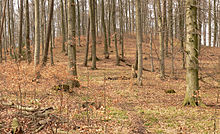
Süllberg (Calenberger Land)
| Süllberg | ||
|---|---|---|
| height | 199 m above sea level NHN | |
| location | at Holtensen ; Region Hannover , Lower Saxony ( Germany ) | |
| Dominance | 3.2 km → Kalenberg (Deister) | |
| Notch height | 75 m | |
| Coordinates | 52 ° 15 '10 " N , 9 ° 39' 15" E | |
|
|
||
The Süllberg is about 199 m above sea level. NHN high elevation of the Calenberger Land . It is located near Holtensen / Wennigsen in the Hanover region of Lower Saxony ( Germany ) and originated in the Jurassic period .
geography
location
The Süllberg rises together with its foothills Vörier Berg in the north and Wolfsberg in the northeast a few kilometers east of the low mountain range Deister . The three-headed elevation lies in the areas of the city of Springe and the municipality of Wennigsen . It spread belonging to Jump villages Bennigsen in the south-southeast and Lüdersen in the East as well as the counting to Wennigsen villages Holtensen in the northwest and in the transition area to Deister, Bredenbeck the west and Stein in the southwest around the survey.
On the eastern flank of the Süllbergs springing Schille as a left-sided swelling stream of Fuchs Bach , who in the catchment area of the rope in the old line opens.
Natural allocation
The Süllberg belongs to the natural spatial main unit group Lower Saxony Börden (No. 52), in the main unit Calenberger Lößbörde (521) and in the subunit Hannoversche Börde (521.0) to the natural area Gehrdener Loesshügel (521.01). Neighboring natural areas are Benther Land (521.02) in the north, Pattenser Ebene (521.03) in the northeast and east and Eldagser Loesshügel (521.04) in the south-southeast. To the west the landscape leads into the natural area Barsinghausener Deister (378.30), which belongs to the main unit group Weser-Leine-Bergland (37) and the main unit Calenberger Bergland (378) to the sub-unit South-Hanoverian Mountains (378.3).
Mountain heights and crests
The Süllberg has three knolls: The west knoll (approx. 199 m ) shows the summit of the elevation in the municipality of Wennigsen. The northeast crest is about 196 m and the southeast crest about 189 m high; both are in the urban area of Springe. A forest path between the west and south-east knoll is at 182.3 m height.
Landscape protection
Parts of the landscape protection area (LSG) Landwehr-Süllberg ( CDDA no. 322484; designated 1968; 15.718 km² ) and the LSG Süd-Deister (CDDA no. 324904; 1967; 33.792 km²) are located on the Süllberg . The former with the No. H-22 of the Hanover region is currently being revised. After a political decision it should become part of the Norddeister (H-23). The need for protection is based, among other things, on the centrally located part of the Calenberger Lößbörde natural area.
Transport links and hiking
About a kilometer west of the Süllberg runs between Holtensen in the north and Steinkrug in the south, the federal road 217 , from which you can drive on state and district roads and on secondary roads branching off in Bennigsen and Lüdersen on its flanks. The Hanover – Altenbeken railway line with the nearby Holtensen / Linderte and Bennigsen stops runs past the elevation to the east . There are various forest and forest paths on the wooded elevation. Its summit is only accessible via paths. From the edge of the forest, the Brocken in the Harz can be seen on a clear day in the southeast .
Others
Sandstone was quarried in the Süllberg in the 19th century . Numerous quarries still bear witness to this, especially on the western slope of the elevation. During the Second World War there was an air defense position on the top of the ridge , as evidenced by many bomb craters and the poured concrete foundation. East of the Süllberg, in the direction of Lüdersen, there is a bunker from the Cold War era . The Federal Property Administration has now given this to a private investor from the archiving and document security sector as a warehouse.
Individual evidence
- ↑ a b c Topographic map with the Süllberg ( memento of the original from August 2, 2016 in the Internet Archive ) Info: The archive link was inserted automatically and has not yet been checked. Please check the original and archive link according to the instructions and then remove this notice. [for heights see top contour lines (hilltop heights) and height information (forest path point) in DTK50 – AK2.5], on natur-erleben.niedersachsen.de
- ^ Sofie Meisel: Geographical land survey: The natural space units on sheet 86 Hanover. Federal Institute for Regional Studies, Bad Godesberg 1962. → Online map (PDF; 4.0 MB)
- ↑ Map services of the Federal Agency for Nature Conservation ( information )
- ↑ LSG-H 22 - Landwehr-Süllberg. Reference: Nds. Ministerialblatt No. 39/1968 of September 16, 1968, p. 981 (PDF; 41 kB). hannover.de, accessed on January 9, 2016 .


