Sainte-Luce (Martinique)
| Sainte-Luce | |
|---|---|

|
|
| region | Martinique |
| Department | Martinique |
| Arrondissement | Le Marin |
| Community association | Espace Sud de la Martinique |
| Coordinates | 14 ° 28 ′ N , 60 ° 55 ′ W |
| height | 0-371 m |
| surface | 28.02 km 2 |
| Residents | 9,816 (January 1, 2017) |
| Population density | 350 inhabitants / km 2 |
| Post Code | 97228 |
| INSEE code | 97227 |
 Local panorama |
|
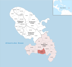
Sainte-Luce is a French commune in the overseas department of Martinique with 9816 inhabitants (as of January 1, 2017). Administratively it belongs to the Arrondissement Le Marin . The residents call themselves Lucéen (ne) s. Until its dissolution in 2015, Sainte-Luce was the main town ( chief lieu ) of the canton of the same name .
geography
The city is located in the south of the island. It is passed by the N5 national route , which connects the city with Le Lamentin and Le Marin . For this purpose, the Pont sur le Trou au Diable , an 187 meter long bridge over the Baie du Trou au Diable , was built and opened in October 1984. The neighboring municipalities are Le Marin, Le Diamant , Rivière-Salée , Saint-Esprit and Rivière-Pilote .
Population development
| 1961 | 1967 | 1974 | 1982 | 1990 | 1999 | 2006 | 2015 |
|---|---|---|---|---|---|---|---|
| 3,653 | 3,978 | 4.124 | 4,478 | 5,881 | 7,724 | 8,910 | 9,943 |
Web links
Commons : Sainte-Luce - Collection of images, videos and audio files