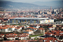
Serdivan
| Serdivan | ||||
|
||||
| Basic data | ||||
|---|---|---|---|---|
| Province (il) : | Sakarya | |||
| Coordinates : | 40 ° 46 ' N , 30 ° 22' E | |||
| Height : | 26 m | |||
| Residents : | 128,121 (2016) | |||
| Telephone code : | (+90) 264 | |||
| Postal code : | 54055 | |||
| License plate : | 54 | |||
| Structure and administration (status: 2014) | ||||
| Mayor : | Yusuf Alemdar ( AKP ) | |||
| Website: | ||||
| Serdivan county | ||||
| Residents : | 128,121 (2016) | |||
| Kaymakam : | Ramazan Şahin | |||
| Website (Kaymakam): | ||||
Serdivan is a district of the Turkish province of Sakarya and at the same time a district of the Büyükşehir belediyesi (big city commune) Sakarya. The county seat is in the west of the provincial capital Adapazarı .
The district is located in the west of the province. It is bordered by Adapazarı to the north and east, Arifiye to the south-east, Sapanca to the south, and Kocaeli province to the west . In the south of the district is the lake Sapanca Gölü . The D-100 highway runs along its banks and runs from Istanbul in the west to the Iranian border.
In the southeast of the district, the Sangarius Bridge (also Justiniansbrücke ) crosses a tributary of the Sakarya , in ancient times Sangarius . When the bridge was built in the 6th century, it still spanned the Sangarius, the bed of which later shifted to the east.
Individual evidence
- ↑ a b www.nufusu.com , accessed Sep. 2017


