Sipperhausen
|
Sipperhausen
Malsfeld municipality
Coordinates: 51 ° 3 ′ 49 ″ N , 9 ° 28 ′ 40 ″ E
|
|
|---|---|
| Height : | 319–325 m above sea level NHN |
| Area : | 3.95 km² |
| Residents : | 199 (December 31, 2012) |
| Population density : | 50 inhabitants / km² |
| Incorporation : | 1st January 1974 |
| Postal code : | 34323 |
| Area code : | 05685 |
|
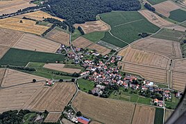
Sipperhausen from above
|
|
Sipperhausen is a district of the municipality of Malsfeld in the Schwalm-Eder district in northern Hesse .
Geographical location
Sipperhausen is located about 5 km southwest of the Malsfeld core town on the Schwalm tributary Rhünda . State road 3428 runs through the village, where district roads 25 and 31 meet, and federal motorway 7 passes to the east . To the north-north-west lies the Goldbergsee , a former open-cast brown coal mine and today's nature reserve .
history
The settlement of Bubenrode belongs to Sipperhausen , a manor first documented in 1407, which was acquired in 1956 by the settlement company "Hessische Heimat" and divided into five settlement sites of 15 to 23 hectares each.
The village was first mentioned in a document in 1141. The spelling of the place name changed over time, depending on how the writer put what he heard on paper.
On 1 January 1974 in the wake of were municipal reform in Hesse municipalities Malsfeld (with the districts Elfershausen and Dagobertshausen) Beiseförth, Mosheim (by virtue of state law county Fritzlar-Homberg ), Ostheim and Sipperhausen (county Fritzlar-Homberg) for new large community Malsfeld together . At the same time, Malsfeld moved to the newly established Schwalm-Eder district. Malsfeld was designated as the seat of the municipal administration. Local districts were set up for all formerly independent communities .
Natural monument
Worth seeing, especially for tree lovers , is the Sipperhäuser Linde , which stands east of the town center on a hill in front of the sports field.
Web links
- Sipperhausen district . In: Website of the municipality of Malsfeld.
- Sipperhausen, Schwalm-Eder district. Historical local dictionary for Hessen. In: Landesgeschichtliches Informationssystem Hessen (LAGIS).
- Literature about Sipperhausen in the Hessian Bibliography
Individual evidence
- ↑ a b Sipperhausen, Schwalm-Eder district. Historical local dictionary for Hessen. (As of June 8, 2018). In: Landesgeschichtliches Informationssystem Hessen (LAGIS).
- ↑ Sipperhausen district, In: Website of the municipality of Malsfeld, accessed in October 2018
- ↑ See LAGIS: Svipburgehusun (before 1141), Suigburgehusen (1193), Swippurgeh (usen) (1194), Swiburgehusen (1244), Serpurgh (usen) (1267), Socket (1275), Swiporgehusen (1282), Sipporgehusin (1322) , Siporgehusen (around 1340), Sipperigehusin (around 1360), Syüergehusen (1366), Syppurgehusin (1366), Siprigehusen (1400), Siprigshausen (1403), Sipriehusen (1403), Sippergehusen (1438), Sypperigehusen (around 1450), (1488), Sippriehusen (around 1490), Syperhausen (1537), Sipperhausen (1558)
- ↑ Law on the reorganization of the districts Fritzlar-Homberg, Melsungen and Ziegenhain (GVBl. II 330-22) of September 28, 1973 . In: The Hessian Minister of the Interior (ed.): Law and Ordinance Gazette for the State of Hesse . 1973 No. 25 , p. 356 , §§ 13 and 27 ( online at the information system of the Hessian state parliament [PDF; 2,3 MB ]).
- ^ Federal Statistical Office (ed.): Historical municipality directory for the Federal Republic of Germany. Name, border and key number changes in municipalities, counties and administrative districts from May 27, 1970 to December 31, 1982 . W. Kohlhammer, Stuttgart / Mainz 1983, ISBN 3-17-003263-1 , p. 405 .


