Stadlhof (Sengenthal)
|
Stadlhof
Community Sengenthal
Coordinates: 49 ° 12 ′ 58 " N , 11 ° 25 ′ 40" E
|
|
|---|---|
| Height : | 419 m above sea level NHN |
| Residents : | 19 (2012) |
| Postal code : | 92369 |
| Area code : | 09181 |
|
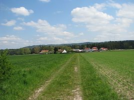
Stadlhof near Forst
|
|
The hamlet Stadlhof is a part of the municipality of Sengenthal in the Neumarkt district in Upper Palatinate in Bavaria .
location
Stadlhof lies in front of the Albrand of the Upper Palatinate Jura at 419 m above sea level. NHN between a larger forest area in front of the Wiefelsbach to the west and the Sengenthal district of Forst .
history
In 1798 the Stadelhof farmer vowed to build a chapel to Saints Leonhard and Wendelin because of a cattle disease.
After the end of the Old Kingdom (1802), in the new Kingdom of Bavaria (1806), the Stadlhof belonged to the tax district of Forst formed between 1810 and 1820, and after 1818 to the rural community of the same name , which in addition to the Stadlhof from Forst itself, the Braunshof and Rocksdorf and in the municipality of Wiefelsbach with its ten wastelands was integrated. Assigned to the district court (from 1862 district office , from 1879 district) Neumarkt, the municipality of Forst around 1867 comprised eight other places in addition to Forst and the Stadlhof, namely the Birkenmühle , the Braunmühle , the Braunshof, the Dietlhof , the Gollermühle , the Kastenmühle , which are not today more existing Kindlmühle and the Schlierfermühle .
According to the census of December 1, 1875, Stadlhof, belonging to the Catholic parish and school Reichertshofen , had six buildings (probably 2 courtyards) with 17 residents, four horses and 36 cattle. Twenty-five years later, little had changed: 14 people now lived in two residential buildings.
Shortly before the regional reform in Bavaria , Forst had the following twelve districts: Forst and the Stadlhof, the Birkenmühle, the Braunmühle, the Braunshof, the Dietlhof, the Gollermühle, Greißelbach-Bahnhof , the canal lock 31 (uninhabited around 1960), the canal lock 32 (1987 uninhabited), the box mill and the Schlierfermühle with the Schlierferhaide . In the course of the regional reform in Bavaria, on January 1, 1972, the municipality of Forst and thus also of the Stadlhof district was incorporated into the municipality of Sengenthal in the Neumarkt district.
Population numbers
- 1830: 20 (2 houses)
- 1836: 18 (3 houses)
- 1867: 17 (4 buildings)
- 1875: 17
- 1900: 14 (2 residential buildings)
- 1938: 20
- 1961: 18 (5 residential buildings)
- 1987: 33 (5 residential buildings, 5 apartments)
- 2012: 19
traffic
Stadlhof can be reached via a municipal road from Forst and another from the NM 18 district road.
literature
- Franz Xaver Buchner : The diocese of Eichstätt. Volume I and II, Eichstätt: Brönner & Däntler, 1937/1938
- Bernhard Heinloth: Historical Atlas of Bavaria. Part Altbayern, Issue 16: Neumarkt , Munich: Commission for Bavarian State History, 1967
Individual evidence
- ↑ Buchner I, p. 103
- ↑ Heinloth, p. 322 f.
- ^ Joseph Heyberger: Topographical-statistical manual of the Kingdom of Bavaria with an alphabetical local dictionary , Munich 1867, Col. 707
- ↑ Kgl. Statistical Bureau in Munich (edit.): Complete list of localities of the Kingdom of Bavaria ... based on the results of the census of December 1st. 1875 , Munich 1876, column 881
- ↑ Kgl. Statistical Bureau in Munich (edit.): List of localities of the Kingdom of Bavaria ... [based on the results of the census of Dec. 1, 1900] , Munich 1904, column 865
- ^ Official register of places for Bavaria. Territorial status on October 1, 1964 with statistical information from the 1961 census , Munich 1964, column 548 f.
- ^ Karl Friedrich Hohn: The rain district of the Kingdom of Bavaria, described geographically and statistically , Stuttgart and Tübingen: Cotta, 1830, p. 143
- ↑ Popp, Th. D. (ed.): Matrikel des Bissthumes Eichstätt , Eichstätt: Ph. Brönner, 1836, p. 41
- ^ Joseph Heyberger: Topographical-statistical manual of the Kingdom of Bavaria with an alphabetical local dictionary , Munich 1867, Col. 707
- ↑ Complete list of localities of the Kingdom of Bavaria ... based on the results of the census of December 1st. 1875 , column 881
- ^ Locations directory of the Kingdom of Bavaria ... [based on the results of the census of December 1, 1900] , column 865
- ↑ Buchner II, p. 453
- ^ Official register of places for Bavaria. Territorial status on October 1, 1964 with statistical information from the 1961 census , Munich 1964, column 549
- ↑ Official directory for Bavaria, territorial status: May 25, 1987 , Munich 1991, p. 260
- ↑ Müller's Großes Deutsches Ortsbuch 2012 , Berlin / Boston 2012, p. 1310

