District of Neumarkt in the Upper Palatinate
| coat of arms | Germany map |
|---|---|

|

Coordinates: 49 ° 13 ' N , 11 ° 34' E |
| Basic data | |
| State : | Bavaria |
| Administrative region : | Upper Palatinate |
| Administrative headquarters : | Neumarkt idOPf. |
| Area : | 1,344.11 km 2 |
| Residents: | 134,573 (Dec. 31, 2019) |
| Population density : | 100 inhabitants per km 2 |
| License plate : | NM, PAR |
| Circle key : | 09 3 73 |
| NUTS : | DE236 |
| Circle structure: | 19 municipalities |
| Address of the district administration: |
Nürnberger Str. 1 92318 Neumarkt idOPf. |
| Website : | |
| District Administrator : | Willibald Gailler ( CSU ) |
| Location of the district of Neumarkt idOpf. in Bavaria | |
The district of Neumarkt in the Upper Palatinate , officially the district of Neumarkt idOPf. is the westernmost district of the administrative district of Upper Palatinate in Bavaria . It is located in a triangle between the cities of Nuremberg , Regensburg and Ingolstadt and belongs to the Nuremberg metropolitan region and the Regensburg planning region . The economic and cultural center of the district is Neumarkt in the Upper Palatinate . In its current form, the district of Neumarkt was created during the regional reform in Bavaria in 1972, when the district of Parsberg in particular was incorporated into today's district.
geography
location
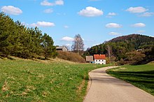
The district of Neumarkt in the Upper Palatinate lies roughly in the middle of Bavaria on the edge of Franconian Switzerland and the Upper Palatinate Jura . The eastern half of the district in particular is characterized by a varied mountain landscape, which is criss-crossed by numerous stream and river valleys. The edge of the Franconian Alb runs roughly on a line between Berg bei Neumarkt - Neumarkt - Berching. To the west of this, the terrain slopes down into a flat landscape, in which only isolated witness mountains washed out by the Tethys (for example the Buchberg and the Dillberg ) indicate that the edge originally ran further west.
The highest point in the district is the Limpelberg near Hörmannsdorf at 640.9 meters above sea level, the lowest point is west of Pyrbaum at 376 meters above sea level.
The European watershed , which divides the outflowing water towards the Rhine / North Sea or Danube / Black Sea , runs from Freystadt via Postbauer-Heng to Neumarkt through the district. The largest rivers in the district are the tributaries of the Danube to the south, the Sulz and the White Laber (both over the Altmühl ), the Black Laber and the Lauterach (over the Naab ). Only the Schwarzach drains northwards in the direction of Rednitz - Regnitz - Main - Rhine.
Neighboring areas
Neighboring areas are in the north the district of Nürnberger Land and the district of Amberg-Sulzbach , in the east the district of Schwandorf and the district of Regensburg , in the south the district of Kelheim and the district of Eichstätt and in the west the district of Roth .
Expansion and land use
The maximum north-south extent between Schweibach bei Lauterhofen and Zell bei Dietfurt is approx. 48 km, the maximum east-west extent between Mörsdorf bei Freystadt and Hohenfels is approx. 49 km.
The district has an area of 1,344.04 km², about ten percent of which is accounted for by settlement and traffic areas and 30.5% by forest areas. Another 46.5% are used for agriculture. The easternmost part of the district in the area of the municipalities of Velburg and Hohenfels is used for military purposes; the Hohenfels training area of the US Army is located here .
population
Before the regional reform in 1972, the Neumarkt district consisted of 69 communities with 42,390 inhabitants, the former Parsberg district had 55 communities with 39,847 inhabitants. Immediately after the district reform, the population of the new district of Neumarkt was 94,679 inhabitants, which at that time were still 59 communities. Further incorporations followed, so that the Neumarkt district today still consists of 19 communities.
Around 128,000 people live in the Neumarkt district today, around 40,000 of them in Neumarkt. Other larger towns and communities are Berching, Freystadt and Berg, each with around 8,000 inhabitants, and Postbauer-Heng, with around 7,000 inhabitants. This results in a population density of around 94 inhabitants per square kilometer, making the district one of the most sparsely populated in Bavaria.
|
|
||||||||||||||||||||||
To this day, the number of residents in the district is growing steadily. Up to the year 2000 the number of inhabitants increased annually by 800 to 1000 people, but this trend is slowly weakening again, so that the growth rate in 2003 was only around 600 people.
Between 1988 and 2008 the district of Neumarkt grew by over 21,000 inhabitants or around 20%. From 2005 to 2011 the trend was towards a high of approx. 129,000 inhabitants. From 2012 the district population increased again.
Between 1988 and 2018 the district grew from 106,841 to 133,561 by 26,720 inhabitants or 25% - after the district and city of Regensburg, the highest increase in the Upper Palatinate.
The following figures refer to the territorial status on May 25, 1987.
| Population development | ||||||||||||||
|---|---|---|---|---|---|---|---|---|---|---|---|---|---|---|
| year | 1840 | 1900 | 1939 | 1950 | 1961 | 1970 | 1987 | 1991 | 1995 | 2000 | 2005 | 2010 | 2014 | 2019 |
| Residents | 55.219 | 57,853 | 65,917 | 83,338 | 82,272 | 92,705 | 105,346 | 113,944 | 120,519 | 126,369 | 128,613 | 127,769 | 128,975 | 134,573 |
climate
Due to its location in Central Europe, the Neumarkt district is in the cool, temperate climatic zone . The district lies in the transition area between the humid Atlantic and the dry continental climate .
|
Average temperature and precipitation values
|
||||||||||||||||||||||||||||||||||||||||||||||||||||||||||||||||||||||||||||||||||||||||||||||||||||||||||||||||||||||||||||||||||||||||||||||||||||||
history

From prehistory to the early Middle Ages
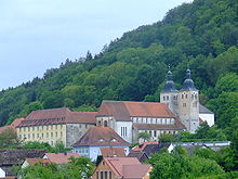
This region was first settled in the Neolithic Age , around 3000 BC, as indicated by numerous finds of burial mounds and ceramic remains. During the Bronze Age from 1000 BC, settlement activity continued to increase. Traces of Celtic ramparts can still be found today, for example near Berngau or on the Buchberg. The Romans , who reached the Danube in the 1st century AD, did not succeed in expanding their territory into the area of today's district, the Limes ran just south of the Danube at today's Kelheim to the west.
After the fall of the Roman Empire , the Bavarians penetrated today's Bavaria and slowly expanded north of the Danube . The numerous places that end in -ing date from this time, the 6th or 7th century, such as Pölling or Deining . The first Franconian royal courts then appeared in Berngau and Lauterhofen.
From the high Middle Ages to the 19th century
From around 1100 the Wolfstein-Sulzbürg family came into being and began to extend their rule to the area between Sulzbürg, Seligenporten and Lauterhofen. The southern area was mainly under the influence of the Lords of Hirschberg . Numerous castle complexes were built throughout the region, which are only partially preserved today. From 1130 the city of Neumarkt emerged and quickly developed into a new center. From 1410 it became the Palatinate residence city, large parts of today's district area now belonged to the Duchy of Palatinate-Neumarkt or the Electoral Palatinate . The Landshut War of Succession also affected the Neumarkt area in 1504, which, however, largely remained in the hands of Wittelsbach and belonged to the Pfalz-Neuburg from the middle of the 16th century . During the Thirty Years' War , Swedish troops repeatedly advanced into this region. In 1628 the entire current district area came to the Electorate of Bavaria . Neumarkt was no longer a residential city, so the city and the surrounding area lost a lot of their importance. In the coalition wars at the end of the 18th century there were several insignificant skirmishes between Austrian and French troops.
Regional courts
In 1803 the regional courts in Neumarkt , Hilpoltstein and Parsberg were established. Neumarkt and Hilpoltstein initially belonged to the Altmühlkreis and from 1810 to the Oberdonaukreis . In 1838 both regional courts came to the Regenkreis , to which the regional court Parsberg already belonged.
District Offices
The Neumarkt district office was re-established in 1862 through the merger of the older district courts Hilpoltstein and Neumarkt. Parsberg came to the district office of Velburg .
On January 1, 1880, the Hilpoltstein area was separated from the Neumarkt district office in Upper Palatinate and merged with the Greding area from the Beilngries district office to form the new Hilpoltstein district office , which now belonged to Middle Franconia . The district office of Neumarkt in the Upper Palatinate received the area around Kastl from the disbanded district office of Velburg. At the same time, a new Parsberg district office was formed from the previous areas of Velburg and Hemau .
On January 1, 1895, the Nuremberg District Office took over the municipality of Hagenhausen from the Neumarkt District Office in Upper Palatinate.
Industrialization made itself felt in the entire district office . Although the villages continued to be predominantly agricultural, initially isolated, later increasingly industrial companies settled. Little by little, almost all places were connected to the public power supply until around 1930, and later also to the water and gas supply.
On January 1, 1900, the municipality of Eismannsberg was reclassified from the Neumarkt District Office in the Upper Palatinate to the Nuremberg District Office.
On January 1, 1903, the city of Neumarkt in the Upper Palatinate was eliminated from the district office and became a city immediately within the district.
On October 1, 1926, the Neumarkt district office in Upper Palatinate was enlarged to include the Großalfalterbach community of the Beilngries district office.
From 1933, as everywhere in the German Reich , the NSDAP took over power in the rural districts .
District of Neumarkt in the Upper Palatinate
As part of the regional reform , the district was redefined on July 1, 1972:
- The city of Neumarkt in the Upper Palatinate lost its district freedom and was incorporated into the district. It received the status of a major district town .
- The dissolved district of Beilngries, with the exception of the town of Beilngries and its surroundings, was added to the district.
- Most of the dissolved Parsberg district came to the district.
- The municipalities of Michelbach and Mörsdorf were added to the district from the dissolved Middle Franconian district of Hilpoltstein .
- The city of Dietfurt an der Altmühl and the communities of Eutenhofen , Gimpertshausen , Griesstetten , Hainsberg, Mallerstetten , Mühlbach , Premerzhofen, Staadorf, Unterbürg, Wildenstein and Zell were added to the district from the dissolved Riedenburg district.
- For its part, the Neumarkt district gave the communities of Allersburg, Hausen, Kastl , Pfaffenhofen, Ransbach, Thonhausen, Utzenhofen, Winkl and Wolfsfeld to the new Amberg-Sulzbach district .
On May 1, 1978, the regional reform in the district was completed. Since then it has developed into an economically stable region.
In the 1970s, another section of the A3 motorway was built, which connects the district with Nuremberg and Regensburg. This primarily relieved long-distance traffic in the through traffic along federal highway 8 . In 1992 the Main-Danube Canal was completed, which crosses the district via Berching, Mühlhausen and Dietfurt.
In 1998 the eighth Bavarian State Garden Show took place in Neumarkt . The district has been part of the Nuremberg Metropolitan Region since 2005 .
politics
District Administrator
Since 2014 Willibald Gailler district administrator of the district of Neumarkt. He ran for the CSU. In the 2020 local elections, he was confirmed in office with 50.8% of the valid votes.
Before him ruled the district administrators Otto Schedl (1948–1957), Josef Werner Bauer (1958–1996) and Albert Löhner (1996–2014), all members of the CSU.
District council
After the district council election on March 15, 2020 , the district council will be composed as follows:
| Party / group | 2020 | 2014 | 2008 | |
|---|---|---|---|---|
| CSU | 25 seats | 28 seats | 28 seats | |
| SPD | 6 seats | 9 seats | 9 seats | |
| FW / UPW | 15 seats | 16 seats | 17 seats | |
| GREEN | 7 seats | 6 seats | 4 seats | |
| FDP | 1 seat | 1 seat | 2 seats | |
| AfD | 2 seats | - | - | |
| left | 1 seat | - | - | |
| ödp | 3 seats | - | - | |
| total | 60 seats | 60 seats | 60 seats |
State and federal elections
The Neumarkt district has been a stronghold of the CSU since 1945. In the state elections , the CSU was always able to get a two-thirds majority or only just missed it. In the Bundestag elections , too, the results were between 60 and 65 percent. The election results reached a high in 2002 when the CSU achieved 69 percent. These values were even higher in the previous European elections , here the CSU result in 1999 was even 75 percent. In the state elections in 2008 and in the European and federal elections in 2009, the CSU suffered significant losses, but remained the strongest force with results of almost 50 and 60 percent respectively in the European elections.
The proportion of votes of the other parties is correspondingly low, for example the SPD usually reaches values of around 20 percent, the other parties even less. In the state elections, however, a clear strengthening of the free voters should be mentioned.
coat of arms
| Blazon : “Split by black and silver; in front a golden lion turned to the left, armored in red and crowned in red; behind each other two red lions, the upper one striding, the lower one erect. " | |
| Justification of the coat of arms: The red-crowned golden lion as the heraldic animal of the Electoral Palatinate represents the extensive old possessions of the Wittelsbachers in today's district. The two red lions represent one of the most important lords of this area, the lords of Wolfstein-Sulzbürg , whose oldest seal, dating from 1292, shows two lions on top of each other, of which the upper one is shown striding and the lower one erect. |
Economy and Infrastructure
The Neumarkt district benefits greatly from its location between the two large cities of Nuremberg and Regensburg. Numerous, mainly medium-sized companies have settled here: In 2004 there were 41 companies per 1000 inhabitants, which means that the district is just below the Bavarian average of 48 companies per 1000 inhabitants. The district is also around the Bavarian average when it comes to data on tax revenue and public finances.
The proximity to Nuremberg and Regensburg also influences the flow of commuters: the rate of inbound commuters is 61.7 percent and that of outbound commuters 68.4 percent. The northern and western parts of the district are mainly oriented towards Nuremberg, the south-eastern part towards Regensburg.
In the Future Atlas 2016 , the district of Neumarkt in the Upper Palatinate ranked 112th out of 402 districts, municipal associations and independent cities in Germany, making it one of the regions with “future opportunities”.
Industry and service
The Neumarkt district was able to develop as a business location, especially after the Second World War. A variety of companies from different industries have settled here. The economic center of the district is Neumarkt.
The approximately 5280 companies and businesses in the district employ an average of six people, which means that the district is in the lower third of the Bavarian average for the size of industrial companies. Out of 1000 inhabitants, around 78 are employed in manufacturing and 39 in construction.
The largest company in the district is Pfleiderer GmbH in Neumarkt, which is active in the wood-based materials sector. The Max Bögl group of companies and Klebl GmbH , also both in Neumarkt, are two large construction companies that also operate internationally. The headquarters of the international Freitag Group is located in Parsberg . Nuremberg-based DEHN SE + Co KG has a branch in Neumarkt. The Bionorica is at Neumarkt herbal medicines ago.
The Huber SE in Erasbach near Berching is an international producer of sewage systems. There is a large limestone quarry in Lauterhofen, among others. The Kago GmbH & Co. KG in Postbauer-Heng manufactured chimneys and stoves until 2016.
Agriculture
To date, the plays agriculture , especially in the rural communities a major role. The average farm size is around 23 hectares. In 2003 there were 2,645 farms with a size of more than two hectares in the district, in 1999 it was 3078, in 1979 it was 4909.
75 percent of the entire agricultural area in the district is used as arable land and 25 percent as permanent grassland . Animal breeding consists largely of pig and cattle breeding, with sheep breeding following in third place. An average cattle breeding farm has a herd size of approx. 46, the value in pig breeding is 56.
tourism
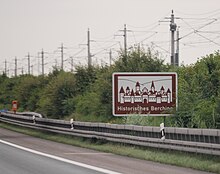
Since the 1990s, the district of Neumarkt in the Upper Palatinate has increasingly developed into a region that is popular with tourists. Tourism has long played a special role in the communities in the Altmühltal Nature Park , in Berching and Dietfurt, where most of the overnight stays are recorded, and the same applies to Velburg. More recently, Neumarkt has also developed into a tourist attraction, the 1998 state horticultural show and a completely new tourism concept were decisive for this.
The holiday route Straße der Kaiser und Könige leads from Nuremberg via Neumarkt to Regensburg, the German holiday route Alps – Baltic Sea runs along the Altmühl also through the southernmost part of the district. Several national cycling and hiking trails, for example the Five Rivers Cycle Path , the Tour de Baroque and the Franconian Path , lead through the district.
The district is trying to expand its tourist infrastructure even further. Several regional cycling and hiking routes have been newly created and marked, and information boards point out places of interest in numerous places. The district is, among other things, a member of the Ostbayern Tourist Association and advertises under the label Oberpfälzer Jura-Täler , Neumarkt itself together with Amberg, Deggendorf , Landshut , Regensburg and Straubing among cities in Eastern Bavaria .
| Tourism in 2016 | |
|---|---|
| Total overnight stays | 444.224 |
| Average length of stay of guests in days | 1.9 |
| Average bed occupancy | 35.5% |
| Proportion of guests from abroad | 23.1% |
traffic
Road traffic
The most important road connections are the federal highway 3 from Nuremberg to Regensburg and the federal highways 8 and 299 , which cross in Neumarkt.
The A3 passes the district from northwest to southeast and has five junctions there. The motorways A 6 from Nuremberg to Prague and A 9 from Nuremberg to Munich touch the district in the north near Lauterhofen and in the west near Pyrbaum and Freystadt.
The federal highway 8, coming from Nuremberg, runs parallel to the A3 from north-west to south-east through the district. It touches the places Postbauer-Heng, Neumarkt, Deining, Seubersdorf and Parsberg. Then it leaves the district and continues via Beratzhausen to Regensburg. The federal road 299, coming from Amberg, reaches the district near Lauterhofen and continues via Pilsach, Neumarkt, Sengenthal, Mühlhausen and Berching to Beilngries and in the direction of Landshut.
A dense network of state and district roads covers the entire district.
The existing connections will be improved and expanded through accelerated road construction. Larger plans provide for the construction of bypasses (e.g. in Mühlhausen on the B 299 or in Berg).
|
||||||||
Rail and local transport
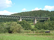
The area of today's district received the railway connection in the years 1871/1873 through the Nuremberg – Neumarkt – Regensburg line of the AG der Bayerischen Ostbahnen . Starting from Neumarkt, the Bavarian State Railway had a local railway built into the Sulztal to Berching and Beilngries in 1888 , which at the same time had a branch in Greißelbach to Freystadt . The extension from Beilngries – Dietfurt followed in 1909.
In addition, the following communities in today's district received a connection through local railways:
- 1902 Pyrbaum on the Burgthann – Allersberg line
- 1903 Lauterhofen as the end point of the route from Amberg .
Over half of the total network of 91 kilometers in length was lost due to the cessation of passenger traffic on the local railways:
- 1960: Greißelbach – Freystadt (10 km)
- 1962: Amberg – Kastl – Brunn-Lauterhofen (3 km)
- 1966: Beilngries – Dietfurt (4 km)
- 1973: Burgthann – Pyrbaum – Seligenporten – Allersberg (8 km)
- 1987: Neumarkt – Greißelbach – Berching – Beilngries (25 km)
Only 41 kilometers of the main line remained, today's timetable 880. Its most important station is Neumarkt , a station for local and long-distance traffic. The S3 line of the Nuremberg S-Bahn started operating in December 2010 between Nuremberg and Neumarkt. The southern and western municipalities also benefit from the two new regional train stations in Kinding and Allersberg on the high-speed route Nuremberg – Ingolstadt – Munich .
In addition, local transport is mainly served by numerous bus routes that almost completely cover the district and are largely oriented in a star shape towards Neumarkt. City buses also run in Neumarkt . The entire district is integrated into the transport network for the greater Nuremberg area , and the south-eastern part is also integrated into the Regensburg transport network.
Water transport
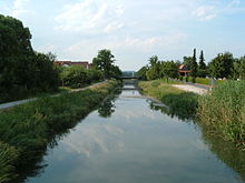
From 1830 the construction of the Ludwig-Danube-Main Canal began in the Neumarkt area and was completed in 1846. This connection between the Main and the Danube crosses today's district via Berg, Neumarkt and Berching from north to south. Between Sengenthal and Schwarzenbruck there is the apex of the canal on which it crosses the European watershed. Ports were in Neumarkt and Berching. After traffic was stopped in 1950, partly because of the severe war damage and partly because of its inefficiency, the canal is now a popular recreational area for anglers, cyclists and walkers.
Its successor, the Main-Danube Canal , was completed in 1992 after several years of construction and also runs through the district. A goods yard was established in Mühlhausen, and tourist ships dock mainly in Berching. The Berching, Bachhausen and Dietfurt locks are also located in the district.
media
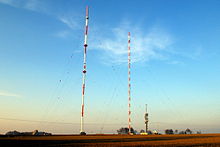
In the area of print media , two large daily newspapers appear in the district, the Neumarkter Nachrichten as the local edition of the Nürnberger Nachrichten and the Neumarkter Tagblatt as the local edition of the Mittelbayerische Zeitung , and the Donaukurier also reports in its B edition from Berching and Dietfurt. In addition, various advertising papers appear on a weekly basis, such as the Rundschau , the Neumarkter Wochenblatt or the Wochen-Anzeiger , but sometimes only in parts of the district. The monthly scene magazine Hugo Neumarkt reports on the culture and nightlife in Neumarkt as well as in Nuremberg, Regensburg and Ingolstadt.
The show marktplatz neumarkt of the Nuremberg local broadcaster Franken TV is specially geared towards topics from the city of Neumarkt and the district. The station is available via satellite and cable television . The intv , which could be received in Neumarkt from 1992 to 2019 , has been discontinued. The Regensburg radio station Charivari can be received with its own Neumarkt regional edition in the entire district via DAB + and ultra-short wave .
Authorities and public institutions
All authorities in the district, including the district office , the tax office , the forestry office and the health department, have their headquarters in Neumarkt, some of them have branch offices in various places in the district. The Neumarkt employment agency is also responsible for the entire district.
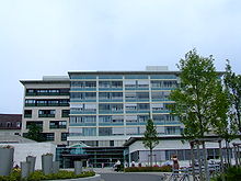
Health care is primarily provided by the Neumarkt Clinic in Upper Palatinate , with other hospitals in Parsberg and Berching. A total of approx. 560 beds are available.
The district is part of the Regensburg police headquarters, there are police inspections in Neumarkt and Parsberg.
The road network is of the road maintenance care and Neumarkt Parsberg, for Bundesautobahn 3 is Autobahnmeisterei in Neumarkt, for the A 6 Autobahnmeisterei Lauterhofen responsible.
Education and child care
In all municipalities there are elementary schools , in some cases also middle schools . Realschulen are located in Neumarkt, Berching and Parsberg, in addition to the Willibald-Gluck-Gymnasium and the Ostendorfer-Gymnasium in Neumarkt there is also a Gymnasium in Parsberg. The Beilngries grammar school in the Eichstätt district is also attended by students from Berching and Mühlhausen. The special educational support centers in Neumarkt and Parsberg take on support and preparatory tasks with regard to school life for children from preschool age. The education and support of disabled and mentally ill people takes place in the district mainly at Lebenshilfe Neumarkt e. V. takes place, for example in the learning pedagogy center in the Höhenberg district or in the Jura workshops.
|
|
||||||||||||||||||||||||
There is also a vocational school , a vocational high school , a technical high school and an agricultural school in Neumarkt .
The University of Applied Management in Neumarkt offers various business management courses. In addition, the TH Nürnberg Management course in the organic sector in Neumarkt is offered. The Georg-Simon-Ohm University of Applied Sciences in Nuremberg has a branch in the nursing school at the clinic, in which the business administration course with a focus on health economics is offered.
The nearest state universities are in Nuremberg , Erlangen and Regensburg .
There is a training center for chimney sweepers in the Mühlbach district of Dietfurt .
In addition, the adult education center in Neumarkt and several libraries in the various locations take on the educational task of the population.
Sights, art and culture

Attractions
The former Palatinate residence city of Neumarkt is the cultural center of the district. In the historic old town you will find the Palatine Palace , the Court Church and the St. Johannes Church . In 1998 the Bavarian State Garden Show took place there, and a large part of the site was preserved.
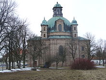
Berching calls itself the “gem of the Middle Ages”. The medieval townscape with the complete town fortifications is still preserved. Dietfurt, the southernmost district municipality, advertises with the slogan "Seven Valleys City": Several streams from seven different valleys meet the Altmühl there. In Freystadt there is one of the most important church buildings in the district, the baroque pilgrimage church Maria-Hilf with ceiling frescoes by the Asam brothers . Velburg also has a medieval town center, in which the town hall stands out.
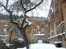
The monastery Gnadenberg in the same district of the municipality mountain was in 1426 by Count Palatine Johann von Neumarkt built. The remains of the wall still give an idea of the former size of the monastery. The pilgrimage church of St. Sebastian in Breitenbrunn dates back to the 14th century, below a healing spring rises. The oldest choir stalls in Germany from the 13th century can be viewed in the Seligenporten monastery church .
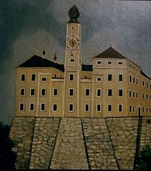
The moated castle in Pilsach is said to have been the prison in which the mysterious Kaspar Hauser spent much of his childhood: a theory that has now largely been refuted. Numerous castles and castle ruins are spread across the entire district. The ruins of Wolfstein and Velburg are particularly well-known . Most of Parsberg Castle has been preserved and houses a museum that deals with the Nazi era in the region between Neumarkt and Regensburg.
The diverse landscape of the district also offers some natural sights, for example a stone channel near Erasbach, the König Otto stalactite cave and the so-called Hohllochberg near Velburg.
Celebrations and festivals
Numerous festivals take place in the district throughout the year. The largest are the Neumarkter Jura-Volksfest and the Berchinger Rossmarkt , both of which attract several 10,000 people every year. The Dietfurt Chinese Carnival, a carnival on Nonsensical Thursday, is known far beyond Bavaria. The German-American folk festival in the Hohenfels military training area combines German and American festival traditions. Numerous other folk and church fairs complete the calendar of events.
Museums
Most of the museums in the district deal with regional topics, often against a historical background. There are also various art museums and several private galleries.
The Neumarkt City Museum illuminates the history of the city since the 12th century and places particular emphasis on the 19th and 20th centuries. It also has an extensive collection of old bicycles and motorcycles from the Express brand, which is produced in Neumarkt . The Lothar Fischer Museum at the Stadtpark in Neumarkt is entirely dedicated to the art of the sculptor and painter Lothar Fischer and the artist group Spur , of which Fischer was a member. In the Neumarkt Glossner Brewery, the brewery museum gives you a glimpse of the old art of brewing beer. The museum for historic Maybach vehicles is dedicated to luxury automobiles from the 1920s and 1930s.
In Dietfurt, the museum in the Hollerhaus presents finds from prehistoric times and documents the settlement of the Dietfurt Valley to this day. The Altmühltaler Mühlenmuseum includes a 500 year old watermill that is still functional today.
In the Mühlhausen district of Sulzbürg, the Landlmuseum provides information about the eventful history of the area around Mühlhausen. In addition to prehistoric finds, exhibits on the life of the former Jewish community in Sulzbürg and on rural life since the 18th century are shown.
The local history museum in Parsberg Castle deals primarily with the time of National Socialism in the region between Regensburg and Neumarkt. It also includes an exhibition on the history of Parsberg and relates above all to the history of the castle complex.
An old farmhouse from the 1920s can be viewed in the Fleischmichelhaus village museum in Pavelsbach in the market town of Postbauer-Heng.
Cultural monuments
There are numerous stone crosses in the district, most of which are also listed as architectural monuments .
Protected areas
There are seven nature reserves , 24 landscape protection areas , six protected landscape components , 98 natural monuments , 19 FFH areas and at least 63 geotopes designated by the Bavarian State Office for the Environment in the district (as of October 2016).
See also
- List of nature reserves in the Neumarkt district in the Upper Palatinate
- List of landscape protection areas in the Neumarkt district in the Upper Palatinate
- List of protected landscape components in the Neumarkt district in the Upper Palatinate
- List of natural monuments in the Neumarkt district in the Upper Palatinate
- List of FFH areas in the Neumarkt district in the Upper Palatinate
- List of geotopes in the Neumarkt district in the Upper Palatinate
Nature reserves
- Deusmauer Moor
- Night eaves at Pollanten
- White Laaber near Waltersberg
- Neumarkt sand dunes
- Valley of the White Laaber near Deining
- Schwarzachwiesen bird sanctuary near Freystadt
- Wolfsberg near Dietfurt
Communities
(Population figures as of December 31, 2019)
|
Other communities
|
Municipalities of the district before the territorial reform 1971/78
Before the beginning of the Bavarian regional reform, the district comprised 69 municipalities in the 1960s. The churches that still exist today are written in bold :
| former parish | today's parish | today's district |
|---|---|---|
| Allersburg | Hohenburg | Amberg-Sulzbach district |
| Aßlschwang | Freystadt | District of Neumarkt idOPf. |
| Berg near Neumarkt idOPf. | Berg near Neumarkt idOPf. | District of Neumarkt idOPf. |
| Berngau | Berngau | District of Neumarkt idOPf. |
| Well | Lauterhofen | District of Neumarkt idOPf. |
| Yours | Yours | District of Neumarkt idOPf. |
| Your swing | Lauterhofen | District of Neumarkt idOPf. |
| Dietkirchen | Pilsach | District of Neumarkt idOPf. |
| Döllwang | Yours | District of Neumarkt idOPf. |
| Engelsberg | Lauterhofen | District of Neumarkt idOPf. |
| Forest | Sengenthal | District of Neumarkt idOPf. |
| Freystadt | Freystadt | District of Neumarkt idOPf. |
| Gebertshofen | Lauterhofen | District of Neumarkt idOPf. |
| Großalfalterbach | Yours | District of Neumarkt idOPf. |
| Häuselstein | Berg near Neumarkt idOPf. | District of Neumarkt idOPf. |
| Hausen | Ursensollen | Amberg-Sulzbach district |
| Home | Berg near Neumarkt idOPf. | District of Neumarkt idOPf. |
| Helena | Neumarkt idOPf. | District of Neumarkt idOPf. |
| Heng | Postbauer-Heng | District of Neumarkt idOPf. |
| Holzheim | Neumarkt idOPf. | District of Neumarkt idOPf. |
| Kastl | Kastl | Amberg-Sulzbach district |
| Kleinalfalterbach | Yours | District of Neumarkt idOPf. |
| Kruppach | Mulhouse | District of Neumarkt idOPf. |
| Laaber | Pilsach | District of Neumarkt idOPf. |
| Labersricht | Neumarkt idOPf. | District of Neumarkt idOPf. |
| Lauterhofen | Lauterhofen | District of Neumarkt idOPf. |
| People Bach | Yours | District of Neumarkt idOPf. |
| Lippertshofen | Neumarkt idOPf. | District of Neumarkt idOPf. |
| Litzlohe | Pilsach | District of Neumarkt idOPf. |
| Loderbach | Berg near Neumarkt idOPf. | District of Neumarkt idOPf. |
| Mittersthal | Yours | District of Neumarkt idOPf. |
| Möning | Freystadt | District of Neumarkt idOPf. |
| Mills | Neumarkt idOPf. | District of Neumarkt idOPf. |
| Mulhouse | Mulhouse | District of Neumarkt idOPf. |
| Oberbuchfeld | Yours | District of Neumarkt idOPf. |
| Oberhembach | Pyrbaum | District of Neumarkt idOPf. |
| Oberndorf | Freystadt | District of Neumarkt idOPf. |
| Oberölsbach | Berg near Neumarkt idOPf. | District of Neumarkt idOPf. |
| Pavelsbach | Postbauer-Heng | District of Neumarkt idOPf. |
| Pelchenhofen | Neumarkt idOPf. | District of Neumarkt idOPf. |
| Pettenhofen | Lauterhofen | District of Neumarkt idOPf. |
| Pfaffenhofen | Kastl | Amberg-Sulzbach district |
| Pfeffertshofen | Pilsach | District of Neumarkt idOPf. |
| Pilsach | Pilsach | District of Neumarkt idOPf. |
| Polling | Neumarkt idOPf. | District of Neumarkt idOPf. |
| Postman | Postbauer-Heng | District of Neumarkt idOPf. |
| Pyrbaum | Pyrbaum | District of Neumarkt idOPf. |
| Ransbach | Hohenburg | Amberg-Sulzbach district |
| Reichertshofen | Sengenthal | District of Neumarkt idOPf. |
| Rengersricht | Pyrbaum | District of Neumarkt idOPf. |
| Röckersbühl | Berngau | District of Neumarkt idOPf. |
| Blessed Porten | Pyrbaum | District of Neumarkt idOPf. |
| Sengenthal | Sengenthal | District of Neumarkt idOPf. |
| Sindlbach | Berg near Neumarkt idOPf. | District of Neumarkt idOPf. |
| Special field | Freystadt | District of Neumarkt idOPf. |
| Stauf | Neumarkt idOPf. | District of Neumarkt idOPf. |
| Stöckelsberg | Berg near Neumarkt idOPf. | District of Neumarkt idOPf. |
| Sulzbuerg | Mulhouse | District of Neumarkt idOPf. |
| Thannhausen | Freystadt | District of Neumarkt idOPf. |
| Thonhausen | Ursensollen | Amberg-Sulzbach district |
| Thundorf | Freystadt | District of Neumarkt idOPf. |
| Traunfeld | Lauterhofen | District of Neumarkt idOPf. |
| Trautmannshofen | Lauterhofen | District of Neumarkt idOPf. |
| Sub-book field | Yours | District of Neumarkt idOPf. |
| Utzenhofen | Kastl | Amberg-Sulzbach district |
| Wappersdorf | Mulhouse | District of Neumarkt idOPf. |
| Angle | Ursensollen | Amberg-Sulzbach district |
| Woffenbach | Neumarkt idOPf. | District of Neumarkt idOPf. |
| Wolfsfeld | Kastl | Amberg-Sulzbach district |
The municipality of Mittelricht was incorporated into Röckersbühl on April 1, 1933 and the Haimburg municipality to Sindlbach on April 1, 1939.
License Plate
On July 1, 1956, the district was assigned the distinguishing mark NM when the vehicle registration number that is still valid today was introduced . It is still issued today. Since July 10, 2013, the license plate liberalization has also resulted in the PAR (Parsberg) distinguishing mark .
Web links
- Literature from and about the district of Neumarkt in der Oberpfalz in the catalog of the German National Library
- Entry on the coat of arms of the Neumarkt district in the Upper Palatinate in the database of the House of Bavarian History
Individual evidence
- ↑ "Data 2" sheet, Statistical Report A1200C 202041 Population of the municipalities, districts and administrative districts 1st quarter 2020 (population based on the 2011 census) ( help ).
- ↑ District of Neumarkt idOPf. 09 373 A selection of important statistical data. (PDF) www.statistik.bayern.de, August 2016, accessed on December 30, 2017 .
- ↑ FOCUS Online: 425 cities and districts in the check: That's how high the proportion of foreigners in your city is - video . In: FOCUS Online . ( focus.de [accessed December 30, 2017]).
- ↑ District of Neumarkt idOPf. 09 373 A selection of important statistical data. (PDF) August 2016, accessed December 30, 2017 .
- ↑ District of Neumarkt idOPf. 09 373 A selection of important statistical data. (PDF) August 2016, accessed December 30, 2017 .
- ↑ Numbers and facts District Neumarkt in the Upper Palatinate: District Office District Administration Authority. Retrieved August 22, 2020 .
- ^ Wilhelm Volkert (ed.): Handbook of Bavarian offices, communities and courts 1799–1980 . CH Beck, Munich 1983, ISBN 3-406-09669-7 , p. 532 .
- ^ Ordinance on the reorganization of Bavaria into rural districts and independent cities of December 27, 1971
- ↑ Election of the District Administrator 2020, District Neumarkt idOPf. - Official final result , accessed on April 15, 2020
- ↑ Election of the District Assembly 2020, District Neumarkt idOPf. - Official final result , accessed on April 15, 2020
- ↑ Entry on the coat of arms of the Neumarkt district in the Upper Palatinate in the database of the House of Bavarian History , accessed on September 4, 2017 .
- ↑ Future Atlas 2016. (No longer available online.) Archived from the original on October 2, 2017 ; accessed on March 23, 2018 . Info: The archive link was inserted automatically and has not yet been checked. Please check the original and archive link according to the instructions and then remove this notice.
- ↑ Density of tourism in the IHK district. (PDF) IHK Regensburg for Upper Palatinate / Kelheim, February 2017, accessed on December 29, 2017 .
- ^ NP: Neumarkt location in the Upper Palatinate - Technical University of Nuremberg Georg Simon Ohm. Retrieved December 30, 2017 .
- ↑ "Data 2" sheet, Statistical Report A1200C 202041 Population of the municipalities, districts and administrative districts 1st quarter 2020 (population based on the 2011 census) ( help ).
- ^ Official register of places for Bavaria 1964


