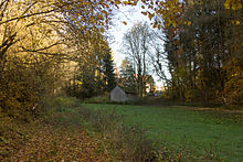
Traunfeld (Lauterhofen)
|
Traunfeld
Lauterhofen market
Coordinates: 49 ° 24 ′ 47 " N , 11 ° 28 ′ 39" E
|
|
|---|---|
| Height : | 546 m above sea level NHN |
| Residents : | 263 (Dec. 31, 2014) |
| Incorporation : | May 1, 1978 |
| Postal code : | 92283 |
| Area code : | 09189 |
|
Traunfeld
|
|
Traunfeld is a district of the Lauterhofen market in the Upper Palatinate district of Neumarkt in the Upper Palatinate in Bavaria .
location
The church village of Traunfeld is located about 10.5 kilometers northwest of Lauterhofen. Clockwise neighboring towns are Schupf , Waller , Aglasterhof , Deinschwang , Reicheltshofen , Häuselstein , Eismannsberg and Dippersricht . The place is on the NM10 district road between Deinschwang and Schupf.
description
The place is rural. In the center there are some listed buildings and the Catholic parish church of St. Willibald.
Traunfelder Bachtal
To the west of Traunfeld lies the Traunfelder Bachtal . The eponymous Traunfelder Bach, which rises in Traunfeld, has dug itself deep into the Alb plateau . On the slopes, which are mostly covered with beech trees, there are numerous springs, some of which also feed fish ponds . The Traunfelder Bach flows into the Raschbach at Hagenhausen, which flows into the Schwarzach at Schleifmühle .
In the valley floor there were once some mills, of which only the names of the Eratsmühle and Mauertsmühle can be found today . The valley is an integral part of the designated protected landscape Traun fields Bachtal (LSG number LSG 00121.14;.. WDPA No. 395 584).
Web links
Individual evidence
- ↑ http://www.lauterhofen.de/rathaus-daten.html
- ↑ Gorge of the Traunfelder Bach (accessed January 30, 2016)
- ↑ BayernAtlas, Traunfelder Bachtal (accessed on January 30, 2016)


