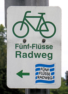
Five rivers cycle route
| Five rivers cycle path | |
|---|---|

|
|
| overall length | approx. 320 km |
| location |
|
| Places along the way | Regensburg , Kelheim , Nuremberg , Amberg |
| Flooring | partly gravel, partly asphalt |
| difficulty | light |
| Connection to | Danube Cycle Path , Tour de Baroque , Altmühltal Cycle Path , Naabtal Cycle Path |
| Website URL | fuenf-fluesse-radweg.info |
The Five Rivers Cycle Path is an approx. 320 km long long-distance cycle path that connects the cities of Nuremberg , Amberg , Regensburg and Kelheim as a circular route .
Route profile
The Five Rivers Cycle Route is easy to cycle, and steep inclines are rare. In some places the signage is insufficient.
Route
From Nuremberg it first goes past the Wöhrder See and Langsee along the Pegnitz to the east. In Hersbruck the valley narrows and passes close Happurgs through a small wooded valley up to the European watershed . At Sulzbach-Rosenberg , the cycle path passes the disused Maxhütte , an industrial monument of steel production in Bavaria. Further in the Vilstal is Amberg , the former capital of the Upper Palatinate . Down through the wooded valleys of Vils and Naab you reach Regensburg . Continue along the Danube to Kelheim , then follow the romantic Altmühltal cycle path to Berching . From here along the Main-Danube Canal on mostly unpaved paths to the vicinity of Freystadt . Here the route branches off to the east and finally reaches the old residential town of Neumarkt in the Upper Palatinate . From there, the route leads along the Ludwig-Danube-Main Canal via Berg near Neumarkt in the Upper Palatinate , Schwarzenbruck and Wendelstein back to Nuremberg.
Villages along the route
- Nuremberg
- Ebensee
- Röthenbach on the Pegnitz
- Run on the Pegnitz
- Hersbruck
- Sulzbach-Rosenberg
- Maxhütte
- Poppenricht
- On the mountain
- Vineyards
- Vilshofen
- Ensdorf
- Schmidmühlen
- Kallmünz
- Pielenhofen
- Etterzhausen
- Mariaort
- Sinzing
- regensburg
- Bad Abbach
- Kelheim winemaker
- Kelheim
- Essing
- Riedenburg
- Dietfurt
- Neumarkt in the Upper Palatinate
- Schwarzenbach
- Sengenthal
- Freystadt
- Berching
- Beilngries
See also
literature
- Cycling map - Leporello Five Rivers Bike Path. Publicpress-Verlag, 1: 50,000, ISBN 978-3-89920-407-0 .
- Five rivers cycle path - cycle guide 1: 50,000, Galli-Verlag. ISBN 3-928908-09-X .
- Bikeline Radtourenbuch Fünf-Flüsse-Radweg , 1: 50,000, Verlag Esterbauer , 9th edition 2019, ISBN 978-3-85000-367-4
Web links
- Homepage Five Rivers Cycle Route
- Bike tour wiki: Five Rivers Bike Path (very detailed information)
- Openstreetmap: Five Rivers Cycle Path
Individual evidence
- ↑ a b Holiday Planner German Rivers: Five Rivers Cycle Path - Through three federal states , on mybike-magazin.de, accessed on April 5, 2019
Coordinates: 49 ° 26 '55 " N , 11 ° 5' 52" E