
Starzelbach
| Starzelbach | ||
 Catchment area of the Starzelbach. The most important elevations are shown in tinted colors. The brown bands show the schematic course of the terminal moraine lines (light brown: crack ice age, dark brown: worm ice age) |
||
| Data | ||
| Water code | DE : 164394 | |
| location | Districts Fürstenfeldbruck and Starnberg , Upper Bavaria , Bavaria , Germany | |
| River system | Danube | |
| Drain over | Amper → Isar → Danube → Black Sea | |
| origin | at Schöngeising 48 ° 7 ′ 50 ″ N , 11 ° 13 ′ 25 ″ E |
|
| Source height | 597 m above sea level NN | |
| muzzle | in the Amper near Olching Coordinates: 48 ° 11 '59 " N , 11 ° 18' 50" E 48 ° 11 '59 " N , 11 ° 18' 50" E |
|
| Mouth height | 505 m | |
| Height difference | 92 m | |
| Bottom slope | 5.8 ‰ | |
| length | 15.9 km | |
| Catchment area | 104.64 km² | |
| Medium-sized cities | Olching | |
| Communities | Schöngeising , Gilching , Alling , Emmering , Eichenau | |
 Starzelbach in Alling |
||
The Starzelbach is an approximately 16 km long right tributary of the Amper in Upper Bavaria .
geography
course
The Starzelbach arises from several source streams in the Bernried Forest in the area of the municipality of Schöngeising on the outermost terminal moraine of the Isar-Loisach glacier in the Wurmi -Age . In the immediate vicinity of the source region of the 144-meter-high stands telecommunications tower Schoengeising, a highly visible landmark . The Starzelbach initially flows to the southeast and east, past the Rottenried estate ( Gilching municipality ). On the Klingelberg, the Starzelbach breaks through the foothills of the outermost Worm Ice Age terminal moraine and flows from now on in a north-easterly direction through an Ice Age drainage valley coming from the south, which is also called the Starzelbachtal from here on. At Alling , the Riss-Ice Age terminal moraine lines are also pierced, whereby the Starzelbachtal narrows to a width of around 700 meters. North of Alling, the valley gradually merges into the wide Munich gravel plain . The Starzelbach now flows through Eichenau and then bends in a north-westerly direction at Gut Roggenstein (municipality of Emmering ). Finally it flows into the Amper opposite Esting, a district of Olching .
Tributaries
From the source to the mouth. Selection.
- Russengraben , from the left and west a little ahead of Alling
- Birkenmoosgraben , from the left and west between Alling and Eichenau on the B 2
- Schwarzer Graben , from the left and southwest in Eichenau
- Tonwerkgraben , from the left and southwest in Eichenau
Character and environment
The Starzelbach, originally a meandering meadow and moss creek, has now been straightened and canalized almost in its entire course. Only in the Bernried Forest near its source does it consist of largely natural, sometimes not constantly water-bearing ditches. In its course, the Starzelbach absorbs the water of other ditches and streams that flow in from the west and drain the hilly moraine area south of Fürstenfeldbruck . In Alling and Eichenau, the Starzelbach is characteristic of the town. In Eichenau it is accompanied by roads on both sides for over 2 km and crossed by numerous bridges and footbridges. A primary and secondary school in Eichenau are named after the Starzelbach.
In the vicinity of the Starzelbach there are numerous historical places such as Celtic Viereckschanzen and medieval castle stables , including the Burgstall Alling and the Burgstall Roggenstein .

Headwaters of the Starzelbach near the Schöngeising telecommunications tower

Starzelbach in the Bernried Forest
Starzelbach north of Gilching

Starzelbach in Eichenau

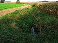
Starzelbach south of Olching
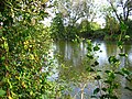
Amper at the mouth of the Starzelbach


Individual evidence
- ↑ a b List of creek and river areas in Bavaria - Isar river area, page 53 of the Bavarian State Office for the Environment, as of 2016 (PDF; 2.5 MB)