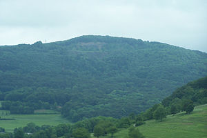
Umpfen (Rhön)
| Umpping | ||
|---|---|---|
|
Der Umpfen (2009) |
||
| height | 700.6 m above sea level NHN | |
| location | near Kaltennordheim , Schmalkalden-Meiningen district , Thuringia , Germany | |
| Mountains | Rhön ( Vordere Rhön ) | |
| Coordinates | 50 ° 38 '39 " N , 10 ° 10' 1" E | |
|
|
||
| Type | Extinct volcano | |
| rock | basalt | |
The Umpfen at Kaltennordheim in the district of Schmalkalden-Meiningen is 700.6 m above sea level. NHN high mountain in the Rhön in Thuringia ( Germany ).
Geographical location
Umpfen is located within the Vorderen Rhön in the Schmalkalden-Meiningen district north of Kaltennordheim, west of Kaltenlengsfeld and southeast of Fischbach . To the west, the mountain is passed approximately in a south-north direction by the Felda (tributary of the Werra ).
history
On the western summit plateau of Umpfen there are extensive remains of Celtic ramparts that are between 2,000 and 2,500 years old.
On its west side there used to be a basalt quarry, in which Soviet prisoners of war had to do forced labor during the Second World War.
Mountain description
From Kaltenlengsfeld there is a road to Umpfen (branching off at the village community center). Here you have a nice view over the village. You get to the Rhönbrise ski and hiking hut , which includes a restaurant and bed dormitory for hikers. From up here you can enjoy a beautiful view of the Rhön Mountains, z. B. to Gebaberg (Hohe Geba), to Wasserkuppe , to Milseburg and also to the Thuringian Forest to the Großer Inselsberg , to the tower of the Schneekopf and to the Dolmar .
There is a transmission mast above the Rhönbrise . The circular path leads past him around the summit to the former quarry. From the lower edge there is a wonderful view over the upper Feldatal to Fischbach / Rhön , Diedorf , Empfertshausen , Andenhausen , Zella / Rhön and Föhlritz below the Gläserberg . Following the path in the direction of the Rhönbrise again, the path to Kaltennordheim branches off to the right , which is a second possibility of ascent.
Further in the direction of the Rhönbrise you also get to the Dachstein lookout point , from where you can enjoy a view of Kaltennordheim and Kaltensundheim with the Alten Mark .
Basalt mining
The first reports of basalt mining, still entirely by hand, for private and municipal use, are from 1910. In 1914, the Leimbach & Co. company built a basalt mine on the Feldabahn ( 50 ° 38 ′ 49 ″ N , 10 ° 9 ′ 32 ″ E ) with crusher , sieves, silo system and loading platform, to which the basalt was transported by cable car from the quarry at Umpfen. In the course of Aryanization, the company owners had to hand over the plant to Bayrische Hartsteinwerke AG in 1935, which was owned by the Fichtel & Sachs AG family who owned it. After the Second World War this was expropriated by the Soviet military administration in Germany and from 1951 it was “the property of the people”. In 1953 it was affiliated to the VEB Basaltwerk Masbach and thus belonged to the VEB Naturstein- und Mineralwerke Thuringia based in Steinach .
Before the Second World War, the rock was first broken out of the wall by hand and later by blasting and then transported to the crusher via an angle station by cable car. There was no field railway and the cable car cars were loaded by hand directly at the quarry. After the Second World War, a primary crusher was planned on the bottom of the quarry and construction began, from which the rock was to be transported to the basalt works by cable car without an angular station. For reasons unknown, it was never completed. In 1978 the quarry and the factory were closed. The buildings were blown up. In 2004, debris overgrown by bushes could still be seen.
literature
- Geyer, Jahne, Storch: Geological sights of the Wartburg district and the independent city of Eisenach . In: District Office Wartburgkreis, Lower Nature Conservation Authority (Hrsg.): Nature conservation in the Wartburgkreis . Booklet 8. Printing and publishing house Frisch, Eisenach and Bad Salzungen 1999, ISBN 3-9806811-1-4 , p. 169-170 .
- Hiking map on a scale of 1: 50,000 Rhön HOLIDAY IS beautiful in Thuringia , published by Tourismusgemeinschaft “Thüringer Rhön” e. V., Schloßhof 4, 36452 Kaltennordheim, 036966/81220
See also
Web links
Individual evidence
- ↑ a b Map services of the Federal Agency for Nature Conservation ( information )
- ↑ Official topographic maps of Thuringia 1: 10,000. Wartburgkreis, district of Gotha, district-free city of Eisenach . In: Thuringian Land Survey Office (Hrsg.): CD-ROM series Top10 . CD 2. Erfurt 1999.
- ↑ a b c Alfred Saam: The basalt works in Oberriedenberg with its stone quarries Steinküppel, Gebirgsstein and Kellerstein , 1992 book in the University and State Library in Fulda
- ↑ Location calculated and measured from Feldatalbahn at www.vergessene-bahnen.de
- ↑ Hans Dieter Nüdling: Rhon Basalt , Parzeller, Fulda, 2006, ISBN 978-3-7900-0381-9 , page 80
- ↑ The Umpfen on www.rhoen.info, accessed on July 12, 2015


