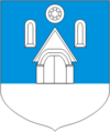
Valjala (rural community)
| Valjala | |||
|
|||
| State : |
|
||
| Circle : |
|
||
| Coordinates : | 58 ° 24 ' N , 22 ° 48' E | ||
| Area : | 180.02 km² | ||
| Residents : | 1,397 (2006) | ||
| Population density : | 8 inhabitants per km² | ||
| Time zone : | EET (UTC + 2) | ||
| Community type: | former rural community | ||

|
|||
Valjala (German: Wolde ) is a former rural community in the Estonian Saare district with an area of 180.02 km². It had 1397 inhabitants (2006). In 2017 all municipalities on Saaremaa merged to form the new rural municipality Saaremaa .
Valjala was in the southeast of Saaremaa Island . In addition to the eponymous main town ( Valjala alevik ) belonged to the rural community of the villages Ariste , Jõelepa , Jööri , Jursi , Kalju , Kallemäe , Kalli , Kogula , Koksi , Kõnnu , Koriska , Kuiste , Kungla , Lööne , Männiku , Nurme , Oessaare , Põlluküla , Rahu , Rannaküla , Röösa , Sakla , Siiksaare , Tõnija , Turja , Undimäe , Väkra , Väljaküla , Vanalõve , Veeriku , Vilidu and Võrsna .
The stone church of Valjala was probably built around 1227, making it one of the oldest churches in Estonia .

